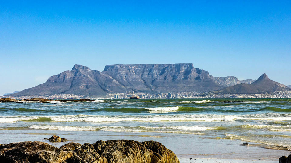
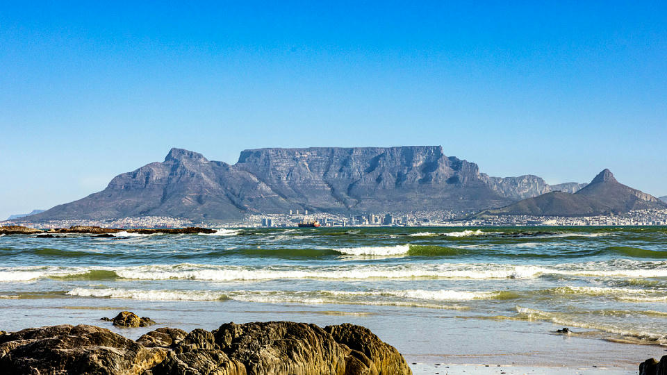
Table Mountain viewed from the Atlantic shoreline, with its flat-topped summit rising above Cape Town under clear blue skies. The layered cliffs and broad profile dominate the skyline, while foreground waves and coastal rocks add depth and scale to the scene.
South Africa
South Africa occupies the southern tip of the African continent and is defined by a wide range of climatic zones, landforms, and ecosystems. Its geography spans coastal plains, interior plateaus, mountain ranges, and semi-arid regions, creating strong spatial and visual diversity across the country.
The landscape transitions from rugged Atlantic and Indian Ocean coastlines to elevated grasslands and escarpments inland. Settlement patterns and access vary significantly by region, with large protected areas preserving extensive natural environments.
Seasonal change affects vegetation, light quality, and wildlife movement, influencing photographic conditions throughout the year.
Explore South Africa by Region
Choose a region to discover its landscapes, photographic character, and destinations.
Explore Regions in South Africa






Eastern Cape
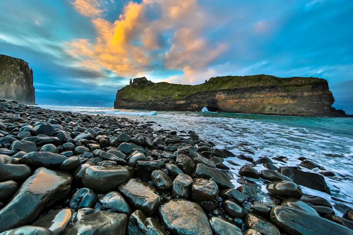
The Eastern Cape is structured around a series of contrasting landscape systems extending between the Indian Ocean coastline and the interior plateau. The region contains some of South Africa's most remote coastal environments alongside mountain catchments, fertile river valleys, indigenous forests, and semi-arid inland plains. Across the province, rivers such as the Mzimvubu, Great Fish, Sundays, and Gamtoos have shaped the terrain over millions of years. These river systems connect mountains, valleys, forests, estuaries, and coastal environments, creating a landscape characterised by strong transitions between different ecological zones and landforms. The visual structure of the region is defined by variety and contrast. Rugged coastlines, forested valleys, open grasslands, desert plains, mountain ridges, and winding river systems create a diverse range of compositions. Seasonal weather, changi
Free State
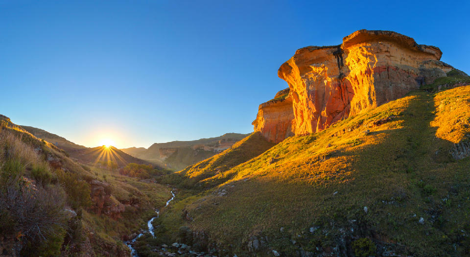
Free State is organised around a network of elevated interior plains, river systems, grassland plateaus, and mountain foothills. The western and central regions are dominated by open agricultural landscapes and broad horizons, while the eastern province rises into increasingly rugged terrain characterised by sandstone cliffs, escarpments, and mountain valleys. Major river systems, including the Orange and Vaal Rivers, play a defining role in shaping the province. River valleys, dams, wetlands, and deeply eroded gorges create natural corridors across the landscape, while erosion has exposed distinctive sandstone formations throughout the eastern highlands. The visual character of the province is defined by scale and openness. Rolling grasslands, distant mountain ranges, seasonal wildflowers, agricultural mosaics, and dramatic weather systems combine to create landscapes that change significantly throughout the year. Summer thunderstorms, winter frost, and low-angle light contribute strongly to the atmosphere of the region.
Gauteng
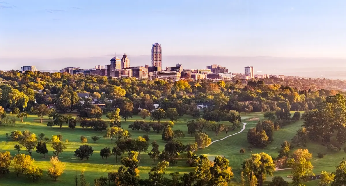
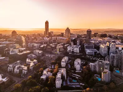
The landscape is formed by the elevated Highveld plateau, where rolling grasslands and quartzite ridges stretch across the interior of South Africa. Ancient geological formations, including the fossil-bearing dolomite systems of the Cradle of Humankind, preserve evidence of some of the earliest human ancestors ever discovered. To the south and west, Johannesburg developed along the gold-bearing Witwatersrand ridges, creating one of Africa's most recognisable urban skylines. To the north, Pretoria occupies a series of sheltered valleys and ridges, with jacaranda-lined suburbs and historic government buildings forming the visual identity of the city. Photographically, the region works through contrast. Modern skylines rise above grassland plains, historic architecture sits alongside contemporary development, and ancient geological formations provide a connection to some of humanity's earliest origins. Seasonal thunderstorms, Highveld sunsets, and spring jacaranda blooms create the region's most distinctive photographic conditions.
KwaZulu-Natal
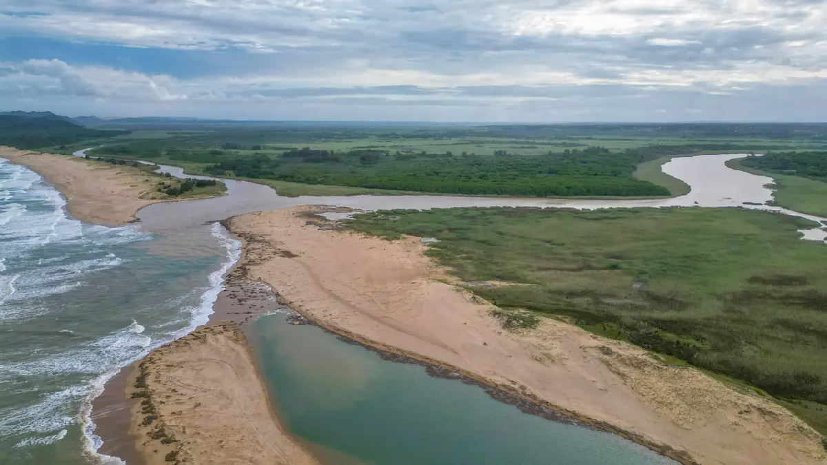
KwaZulu-Natal is structured around a series of major landscape systems connected by rivers flowing eastwards from the Drakensberg Escarpment towards the Indian Ocean. The province combines South Africa's highest mountain range with fertile agricultural valleys, extensive wetlands, wildlife reserves, indigenous forests, and a subtropical coastline, creating exceptional geographic diversity within a single region. Each landscape possesses a distinct visual identity. The Drakensberg is characterised by towering cliffs, sandstone buttresses, waterfalls, and alpine grasslands, while the Midlands features rolling hills, forests, rivers, and mist-covered farmland. Further east, coastal lakes, estuaries, beaches, dune systems, and wetlands dominate the landscape before giving way to the wilderness reserves of Hluhluwe-Imfolozi and the tropical shoreline surrounding Kosi Bay. The visual structure of the region is defined by strong contrasts in elevation, climate, and ecosystems. Mountain ridges, winding rivers, open savannah, indigenous forests, wetlands, coastal dunes, and expansive beaches create layered compositions throughout the province. Light varies dramatically between the cool mountain interior and the humid coastline, while mist, seasonal rainfall, thunderstorms, and changing coastal conditions continually reshape colour, atmosphere, and photographic opportunities.
Limpopo
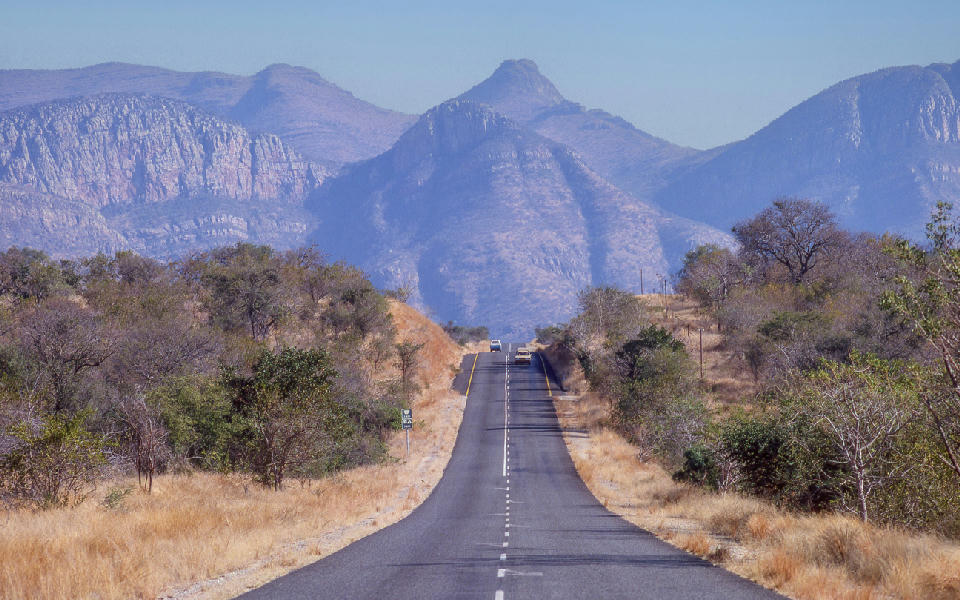
Limpopo is structured around a series of distinct landscape systems linked by major river valleys and broad savanna environments. The province combines the northern wilderness of Kruger National Park with the Soutpansberg Mountains, Makgabeng Plateau, Waterberg fringe landscapes, and the culturally significant border regions surrounding the Limpopo River. Each landscape unit functions as a distinct geographic environment with strong relationships between geology, vegetation, water systems, and settlement patterns. Mountain ranges create elevated viewpoints and ecological diversity, while extensive plains and river valleys provide continuity across the wider landscape. The visual structure of the province is defined by alternating bands of bushveld, river corridors, mountain ridges, rocky outcrops, and open savanna. Baobab trees, seasonal rivers, dramatic skies, and changing vegetation create continual variation while maintaining the region's identity as one of South Africa's largest wilderness and conservation landscapes.
Mpumalanga
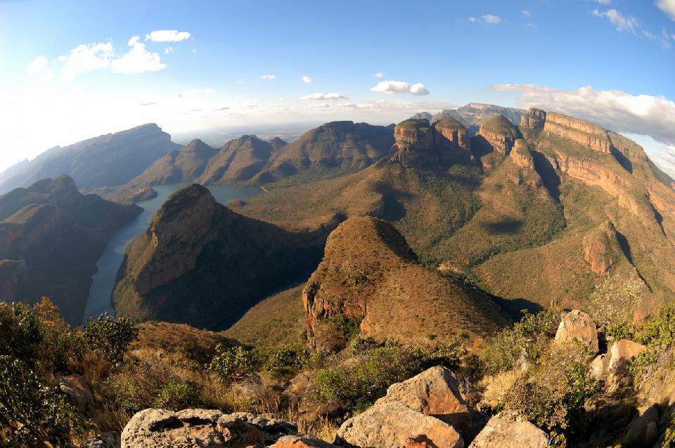
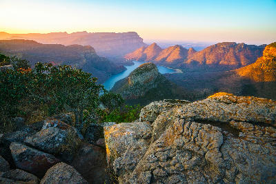
Mpumalanga is structured around a series of major landscape systems extending from the Highveld plateau to the Lowveld savannah. The escarpment forms the dominant geographic feature, creating dramatic elevation changes that shape river systems, canyons, forests, waterfalls, and mountain scenery throughout the province. These environments gradually transition eastward into the wildlife-rich plains of the Lowveld. Each section of the region possesses a distinct visual identity while remaining connected through the broader escarpment system. The Panorama Route is defined by deep canyons, waterfalls, cliffs, and mountain viewpoints, while the Blyde River Canyon contains some of Africa's most spectacular geological landscapes. Further east, Kruger National Park introduces vast savannah plains, river systems, and wildlife habitats, creating one of the continent's premier conservation landscapes. The visual structure of the region is defined by elevation, water, geology, and ecosystem diversity. Escarpments, canyons, waterfalls, forests, grasslands, rivers, and savannah landscapes create layered compositions across the province. Mist, seasonal rainfall, dramatic cloud formations, and changing light conditions continually influence colour, texture, and atmosphere throughout the landscape.
North West
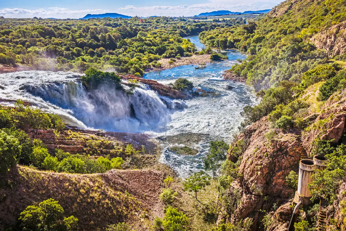
North West is organised around a series of distinct landscape systems that extend across the province. The Pilanesberg region forms one of the most significant geological features in South Africa, while the Magaliesberg creates a long mountain barrier along the province's eastern edge. Between these systems lie extensive bushveld plains, river valleys, and wildlife landscapes. The province contains a mixture of protected conservation areas, agricultural regions, and natural wilderness environments. Rivers, dams, mountain ridges, and volcanic formations provide structure across the landscape, while large areas of open savanna create a strong sense of scale and openness. The visual character of the province is defined by bushveld vegetation, mountain silhouettes, volcanic landforms, seasonal grasslands, and expansive skies. Summer thunderstorms, winter clarity, and changing seasonal conditions continually alter the appearance of the landscape while emphasising its geological and ecological diversity.
Northern Cape
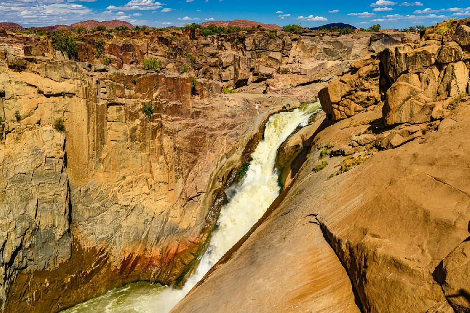
The Northern Cape is structured around several distinct landscape systems spread across a vast geographic area. Namaqualand occupies the western portion of the province with its granite hills, seasonal wildflowers, and arid coastal influences. Further inland, the Kalahari introduces red dunes, dry river systems, and desert grasslands, while the southern regions contain the escarpments, valleys, and semi-desert environments of the Great Karoo. Major geological features provide much of the province's visual identity. The Orange River creates fertile corridors through otherwise arid terrain, while mountain ranges, canyon systems, rocky outcrops, and desert plains produce dramatic contrasts across the landscape. Seasonal rainfall patterns, changing vegetation, and exceptional visibility contribute to an environment where light and atmosphere play a significant role throughout the year. Photographically, the Northern Cape is defined by scale, geology, and isolation. Vast open landscapes create opportunities for minimalist compositions and long-distance views, while mountains, dunes, canyons, rivers, and seasonal wildflower displays provide powerful focal points. Clear skies, low levels of light pollution, and rapidly changing weather conditions further contribute to the region's reputation as one of South Africa's premier landscape and night-photography destinations.
Western Cape
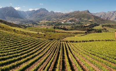
The Western Cape is structured around a series of mountain ranges running parallel to the coastline, separated by fertile valleys and semi-arid basins. Rivers cut through these ranges, forming passes and agricultural corridors that shape settlement and land use patterns. Coastal environments vary from sheltered bays and sandy beaches to exposed cliffs and rocky promontories. Inland regions transition toward drier plains and rugged uplands, creating strong contrasts between cultivated landscapes and more remote terrain. Light conditions are shaped by maritime influence, seasonal rainfall patterns, and mountain-induced weather systems. Wind, coastal mist, and shifting cloud cover affect visibility and tonal separation across both shoreline and inland environments.
Overview
South Africa’s terrain is structured around a central plateau bordered by the Great Escarpment, with mountain ranges such as the Drakensberg creating pronounced elevation shifts. These features shape drainage systems, vegetation zones, and long-distance sightlines across the interior.
Coastal regions present contrasting environments, from rocky headlands and cliffs to sandy beaches, lagoons, and estuaries. Inland, savanna, desert, and grassland ecosystems dominate, supporting diverse wildlife populations within national parks and private reserves.
Light conditions vary widely due to latitude, altitude, and weather systems, with clear skies common in many regions. Road access is generally good, though distances between locations can be substantial, particularly in remote areas.
Key Photography Subjects
- Mountain ranges, escarpments, and elevated plateaus
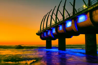
- Coastal landscapes, cliffs, and shorelines
- Savanna, desert, and grassland ecosystems
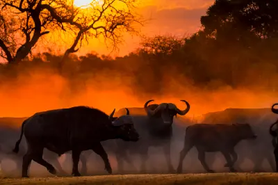
- Wildlife and natural habitats
- River systems, wetlands, and inland water bodies
- Agricultural landscapes and rural land use patterns
- Seasonal light, atmosphere, and weather patterns
Gallery
Workshops in South Africa
No upcoming workshops scheduled for South Africa at this time.
Check back soon or explore other destinations.