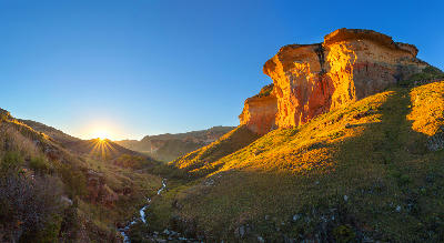
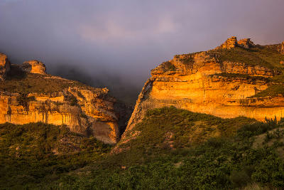
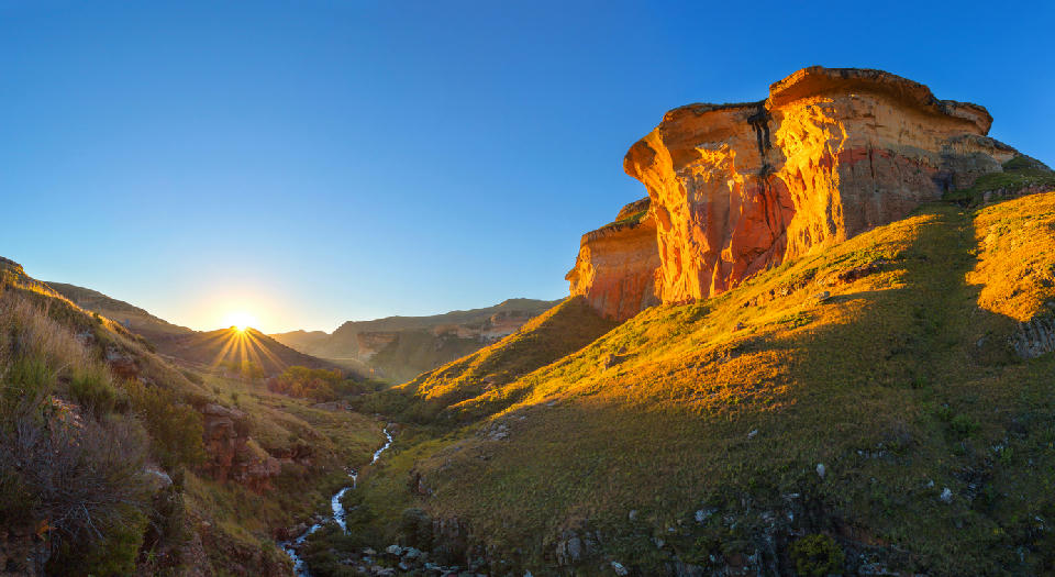
Sunrise illuminating the massive sandstone cliffs of Golden Gate Highlands National Park, with a small stream winding through a grassy mountain valley in the Free State, South Africa.

    Golden Gate Highlands National Park is famous for its towering sandstone cliffs, which glow deep gold and orange in the warm light of sunrise and sunset.

    Free State

    The Free State occupies the elevated interior of central South Africa, forming a landscape of open grasslands, rolling plains, sandstone highlands, river valleys, and mountain frontiers. The province stretches from the broad agricultural landscapes of the Highveld to the rugged escarpments and foothills bordering Lesotho.

    The landscape is structured around extensive grassland plateaus, major river systems, isolated sandstone formations, and the eastern mountain regions that rise toward the Maloti-Drakensberg range. These varied environments create one of South Africa's most expansive and visually open provinces.

    Altitude, geology, and climate combine to produce a landscape defined by wide horizons, seasonal grasslands, dramatic skies, and changing light. From mountain passes and river gorges to agricultural plains and highland wilderness, the province contains a diverse range of inland landscapes.

    Geographic discovery

    Explore Free State by Area

    Choose a part of the Free State to discover its landscapes, photographic character, and locations.

    Open interactive Explore

    Explore Areas in Free State

    Open in Explore
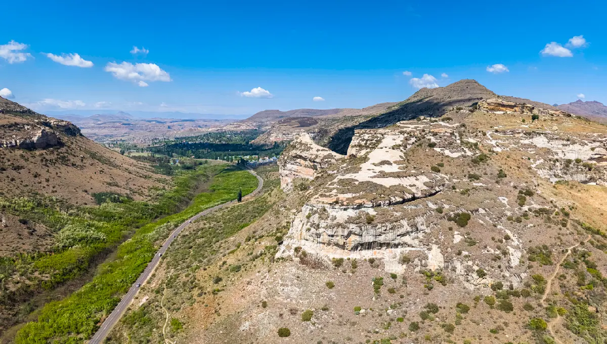
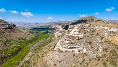
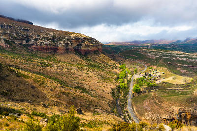
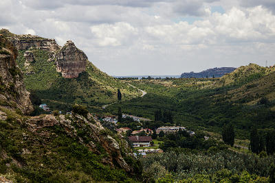
    Aerial view of sandstone cliffs and a winding valley road leading towards Clarens in South Africa's Eastern Highlands.

    Clarens & Eastern Highlands

    The Clarens & Eastern Highlands region is organised around a network of elevated valleys, sandstone formations, mountain foothills, and grassland plateaus extending across the eastern Free State. The terrain forms a transition zone between the interior plains and the higher mountain environments of Lesotho, creating a landscape of increasing relief and complexity towards the eastern border. Erosion has exposed extensive sandstone formations throughout the region, producing cliffs, ridges, isolated buttes, and distinctive geological landmarks. River systems cut through these formations to create fertile valleys, wetlands, and broad agricultural basins that contrast with the surrounding highlands. The visual structure of the landscape is defined by rolling grasslands, sandstone escarpments, winding river valleys, and distant mountain backdrops. Seasonal rainfall, thunderstorms, winter frost, and changing vegetation colours continually alter the appearance of the region while reinforcing its strong sense of scale and elevation.

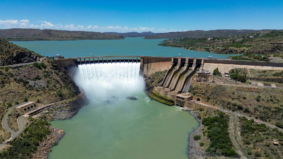
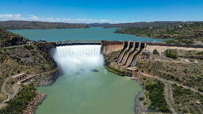
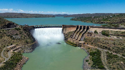
    Aerial view of Gariep Dam with water flowing through the spillway into the Orange River, South Africa

    Gariep & Orange River

    The Gariep & Orange River region is organised around the Orange River basin and the extensive water system created by Gariep Dam. The reservoir occupies a large section of the upper river valley, creating an intricate landscape of bays, peninsulas, islands, and shoreline environments extending across the provincial boundary between the Free State and Eastern Cape. Beyond the reservoir, the Orange River continues through a series of valleys and gorges that form one of the most significant river corridors in southern Africa. Semi-arid vegetation, open plains, rocky hills, and elevated viewpoints surround the water system, creating strong contrasts between land and water throughout the region. The visual character of the landscape is defined by scale, openness, and reflection. Vast water surfaces, distant horizons, changing weather systems, and low-angle light create constantly changing conditions across the reservoir and river basin. Seasonal water levels, storm activity, and atmospheric conditions contribute significantly to the appearance of the landscape.

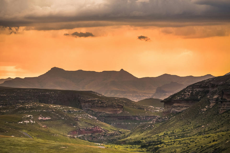
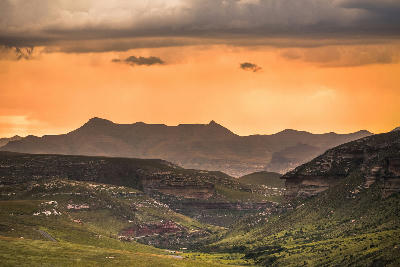
    Sunset storm clouds over the mountain valleys and sandstone highlands of the Golden Gate and Maluti Foothills region in South Africa.

    Golden Gate & Maluti Foothills

    The Golden Gate & Maluti Foothills region is organised around a series of elevated valleys and sandstone escarpments extending along the eastern edge of the Free State. The terrain forms a natural gateway between the South African interior and the higher mountain systems of Lesotho, creating a landscape of increasing elevation and geological complexity. The region is dominated by Clarens Formation sandstone, which has been sculpted into cliffs, ridges, isolated rock formations, and prominent landmarks through long-term erosion. Mountain streams, seasonal rivers, and grassland ecosystems occupy the valleys between these formations, creating strong contrasts between exposed rock and open highland terrain. The visual character of the landscape is defined by massive sandstone walls, rolling grasslands, winding mountain roads, and expansive views toward the Maloti Mountains. Seasonal weather systems, mist, thunderstorms, winter frost, and low-angle sunlight continually transform the appearance of the landscape, producing exceptional colour, texture, and atmosphere throughout the year.

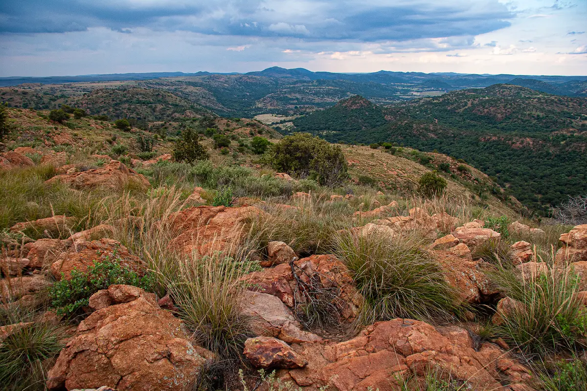
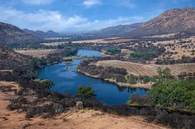
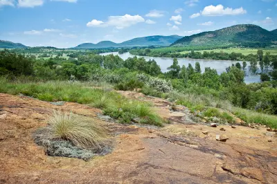
    Elevated panorama of rocky ridges, wooded valleys and rolling hills within the Vredefort Dome in South Africa.

    Vredefort Dome & Vaal River

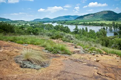
    The Vredefort Dome & Vaal River region is organised around the remnants of a massive meteorite impact that occurred more than two billion years ago. Subsequent uplift, erosion, and river incision exposed ancient rock formations and created the circular pattern of ridges and valleys that define the landscape today. The Vaal River forms the principal natural corridor through the region, carving through uplifted terrain and creating cliffs, rapids, islands, and broad river valleys. These waterways contrast strongly with the surrounding hills and geological formations, adding movement and visual diversity to the landscape. The visual character of the region is defined by exposed rock, rolling ridgelines, river scenery, and elevated viewpoints overlooking the impact basin. Seasonal vegetation, changing weather, and low-angle light continually alter the appearance of the terrain while emphasising the geological structure of the landscape.

    Photographic journey

    Free State Photography Route

    Free State Photographic Circuit · 11 stops

    Aerial view of the Vaal River meandering through the Vredefort Dome landscape with hills, farmland and riverine vegetation in North West and Free State, South Africa.01

    Vaal River

    The Vaal River winds through the Vredefort Dome, carving a scenic corridor of rocky hills, sandstone cliffs and tranquil waters through one of South Africa's most significant geological landscapes. Combining river scenery with dramatic terrain, it forms the visual heart of the Dome region.

    Elevated view across the Vaal River toward the wooded ridges and rocky landscapes of the Vredefort Dome in South Africa.03

    Vredefort Dome

    Vredefort Dome is the world's largest and oldest confirmed meteorite impact structure, created by a massive asteroid strike more than two billion years ago. Today the landscape is defined by rugged hills, folded rock formations, river valleys and geological features that reveal one of the most significant events in Earth's history.

    Sunset storm clouds over the mountain valleys and sandstone highlands of the Golden Gate and Maluti Foothills region in South Africa.05

    Golden Gate & Maluti Foothills

    The Golden Gate & Maluti Foothills region is organised around a series of elevated valleys and sandstone escarpments extending along the eastern edge of the Free State. The terrain forms a natural gateway between the South African interior and the higher mountain systems of Lesotho, creating a landscape of increasing elevation and geological complexity. The region is dominated by Clarens Formation sandstone, which has been sculpted into cliffs, ridges, isolated rock formations, and prominent landmarks through long-term erosion. Mountain streams, seasonal rivers, and grassland ecosystems occupy the valleys between these formations, creating strong contrasts between exposed rock and open highland terrain. The visual character of the landscape is defined by massive sandstone walls, rolling grasslands, winding mountain roads, and expansive views toward the Maloti Mountains. Seasonal weather systems, mist, thunderstorms, winter frost, and low-angle sunlight continually transform the appearance of the landscape, producing exceptional colour, texture, and atmosphere throughout the year.

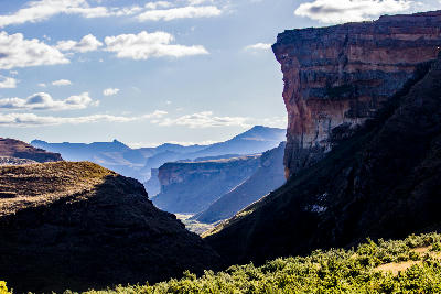
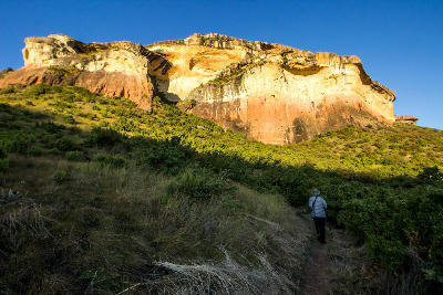
    Side view of Brandwag Buttress overlooking a deep valley in Golden Gate Highlands National Park, Free State, South Africa.07

    Brandwag Buttress

    Brandwag Buttress is the most iconic rock formation in Golden Gate Highlands National Park, rising dramatically above the surrounding grasslands and valleys. Its towering sandstone walls and distinctive shape have made it one of the most photographed natural landmarks in the Free State.

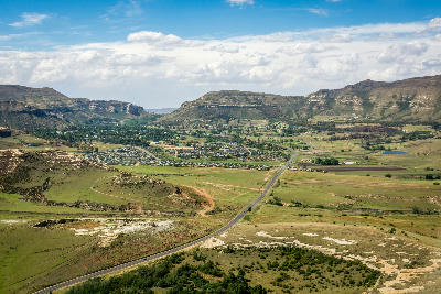
    Aerial view of sandstone cliffs and a winding valley road leading towards Clarens in South Africa's Eastern Highlands.09

    Clarens & Eastern Highlands

    The Clarens & Eastern Highlands region is organised around a network of elevated valleys, sandstone formations, mountain foothills, and grassland plateaus extending across the eastern Free State. The terrain forms a transition zone between the interior plains and the higher mountain environments of Lesotho, creating a landscape of increasing relief and complexity towards the eastern border. Erosion has exposed extensive sandstone formations throughout the region, producing cliffs, ridges, isolated buttes, and distinctive geological landmarks. River systems cut through these formations to create fertile valleys, wetlands, and broad agricultural basins that contrast with the surrounding highlands. The visual structure of the landscape is defined by rolling grasslands, sandstone escarpments, winding river valleys, and distant mountain backdrops. Seasonal rainfall, thunderstorms, winter frost, and changing vegetation colours continually alter the appearance of the region while reinforcing its strong sense of scale and elevation.

    Aerial view of Gariep Dam with water flowing through the spillway into the Orange River, South Africa11

    Gariep & Orange River

    The Gariep & Orange River region is organised around the Orange River basin and the extensive water system created by Gariep Dam. The reservoir occupies a large section of the upper river valley, creating an intricate landscape of bays, peninsulas, islands, and shoreline environments extending across the provincial boundary between the Free State and Eastern Cape. Beyond the reservoir, the Orange River continues through a series of valleys and gorges that form one of the most significant river corridors in southern Africa. Semi-arid vegetation, open plains, rocky hills, and elevated viewpoints surround the water system, creating strong contrasts between land and water throughout the region. The visual character of the landscape is defined by scale, openness, and reflection. Vast water surfaces, distant horizons, changing weather systems, and low-angle light create constantly changing conditions across the reservoir and river basin. Seasonal water levels, storm activity, and atmospheric conditions contribute significantly to the appearance of the landscape.

    Explore the Full Free State Photographic Circuit11 stops across the Free State

    Overview

    Free State is organised around a network of elevated interior plains, river systems, grassland plateaus, and mountain foothills. The western and central regions are dominated by open agricultural landscapes and broad horizons, while the eastern province rises into increasingly rugged terrain characterised by sandstone cliffs, escarpments, and mountain valleys.

    Major river systems, including the Orange and Vaal Rivers, play a defining role in shaping the province. River valleys, dams, wetlands, and deeply eroded gorges create natural corridors across the landscape, while erosion has exposed distinctive sandstone formations throughout the eastern highlands.

    The visual character of the province is defined by scale and openness. Rolling grasslands, distant mountain ranges, seasonal wildflowers, agricultural mosaics, and dramatic weather systems combine to create landscapes that change significantly throughout the year. Summer thunderstorms, winter frost, and low-angle light contribute strongly to the atmosphere of the region.
    Key Photography Subjects

    • Open grassland plains and wide horizons
    • Sandstone cliffs, escarpments, and rock formations
    • Mountain foothills and highland landscapes
    • River valleys, dams, and wetland systems
    • Agricultural landscapes and seasonal patterns
    • Dramatic skies, storms, and changing weather
    • Sunrise and sunset light across the interior plateau

    Gallery

    Workshops in Free State

    No upcoming workshops scheduled for Free State at this time.

    Check back soon or explore other destinations.