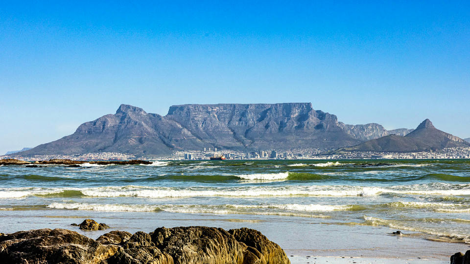
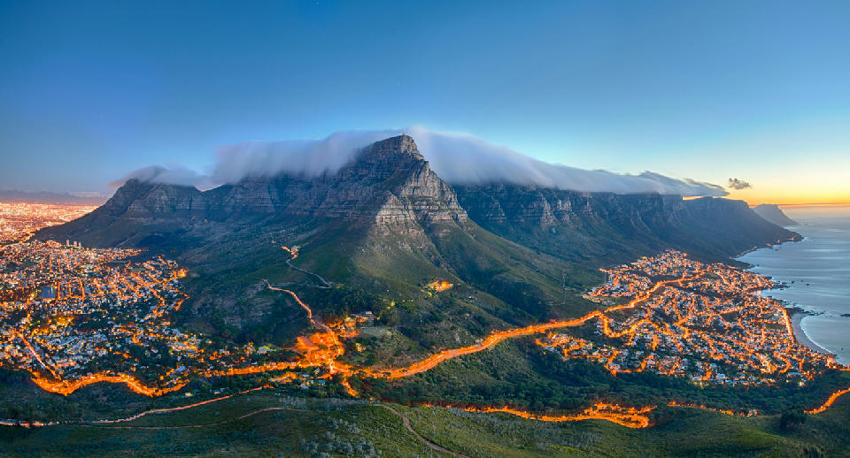
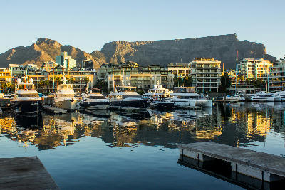
View of Table Mountain rising above the city of Cape Town, with its flat summit forming one of the most recognizable natural landmarks along South Africa’s Atlantic coastline.
Western Cape
The Western Cape is a coastal province in the south-west of South Africa defined by mountain ranges, agricultural valleys, and extensive Atlantic and Indian Ocean shorelines. The region includes Table Mountain above Cape Town and the coastal cliffs of Cape Point, where dramatic topography meets open ocean. Its structure combines rugged uplands, cultivated interiors, and varied coastal environments within a compact geographic area.
The landscape transitions between folded mountain chains, vineyard-lined valleys, semi-arid interior plains, and rocky headlands. Elevation shifts are pronounced along mountain fronts, while coastal flats and inland basins provide broader open terrain.
Seasonal variation influences vegetation colour, ocean conditions, and atmospheric clarity, contributing to shifts in light quality and contrast throughout the year.
Explore Western Cape by Region
Choose a region to discover its landscapes, photographic character, and destinations.
Explore Regions in Western Cape





Cape Peninsula
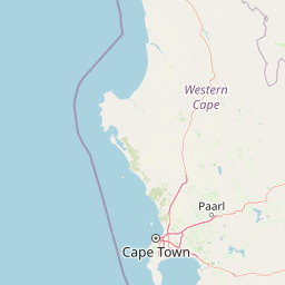
The Cape Peninsula functions as a linear mountain system surrounded on three sides by ocean. A continuous sandstone backbone defines its topographic form, with subsidiary ridges extending toward the coastline and dividing small basins and valleys. Coastal margins alternate between sandy bays and exposed cliffs, creating strong contrasts between horizontal ocean planes and vertical rock faces. Interior slopes descend toward urban and suburban settlements positioned within limited flatter terrain. The visual structure of the peninsula is governed by abrupt elevation change, repeated ridge-to-sea transitions, and open Atlantic horizons framing the southern extent of the landmass.
Cape Winelands
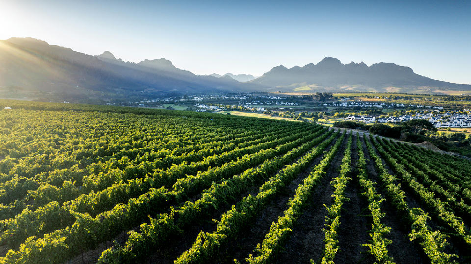
The Cape Winelands is structured around a series of fertile valleys separated by mountain barriers running through the inland Western Cape. These ranges create distinct agricultural basins where vineyards, orchards, and rural settlements occupy the flatter terrain between steep slopes. Each valley functions as a contained geographic unit with a strong visual relationship between cultivated land and surrounding mountains. Granite domes, sandstone ridges, and forested slopes form prominent backdrops to vineyard plains. The visual structure of the region is defined by alternating bands of agriculture and mountain relief, producing layered compositions across valleys, foothills, and elevated ridgelines.
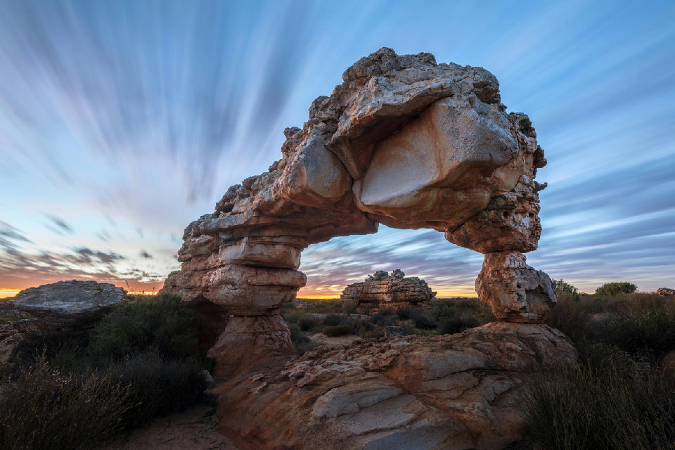
Cederberg
The Cederberg Mountains form a rugged wilderness region of sandstone peaks, deep valleys, rocky plateaus, and protected natural landscapes. Much of the area lies within nature reserves and conservation areas, preserving the wild character that makes the region one of South Africa’s premier mountain photography destinations. Photographically, the Cederberg is defined by shape, texture, and scale. Towering rock formations create striking focal points throughout the landscape, while mountain passes, valleys, and elevated viewpoints reveal sweeping views across the surrounding wilderness. Locations such as Wolfberg Arch, Maltese Cross, Stadsaal Caves, and the Sevilla Rock Art Trail showcase the remarkable diversity of the region. Light plays a major role across the mountains. Sunrise and sunset bring warm tones to the sandstone cliffs, while winter storms can transform the landscape with dramatic skies and changing weather. Clear air, low levels of development, and vast open spaces also make the Cederberg an exceptional destination for astrophotography and night-sky landscapes.
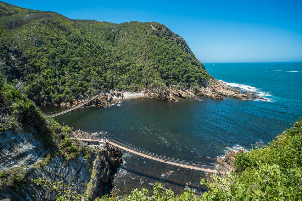
Garden Route
The Garden Route occupies a unique position along South Africa's southern coastline, where the Indian Ocean meets a landscape of forests, mountains, wetlands, rivers, and coastal plains. The interaction between ocean, climate, and topography has created one of the most diverse and visually varied regions in the country. Photographically, the Garden Route offers exceptional diversity. Coastal cliffs, rocky shorelines, estuaries, forests, mountain passes, lakes, beaches, and marine environments all occur within a relatively short distance of one another. The region is particularly well known for landscapes where water and mountains interact, creating layered compositions that combine ocean, forest, and elevated terrain within a single scene. Light and weather are defining elements throughout the year. Coastal mist, passing storms, dramatic cloud formations, and changing ocean conditions constantly reshape the appearance of the landscape. Sunrise and sunset often produce exceptional conditions along the coast, while forests and mountain valleys offer opportunities throughout the day.
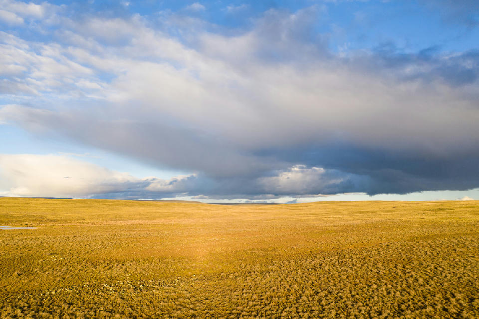
Great Karoo
The Great Karoo covers a vast area of South Africa's interior, where broad plains, dry river systems, scattered mountain ranges, and isolated settlements combine to create one of the country's most recognisable landscapes. Much of the region remains sparsely populated, allowing the natural scale of the terrain to dominate the scenery. Photographically, the Karoo is defined by simplicity and atmosphere. Open landscapes provide uninterrupted views across great distances, while farm roads, windmills, mountain ridges, and historic settlements create focal points within the wider scene. The lack of visual clutter allows photographers to work with light, weather, and scale in a way that is difficult to replicate elsewhere. Conditions change dramatically throughout the day. Sunrise and sunset bring warm colour across the plains, while afternoon storms can transform the landscape with towering cloud formations and dramatic light. The region is also one of South Africa's premier destinations for night photography, thanks to its dark skies, low population density, and vast open horizons.
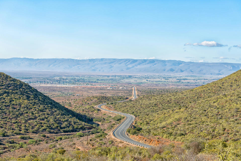
Klein Karoo
The Klein Karoo forms a long inland basin between major mountain systems across the Western Cape. Broad semi-arid valleys extend between the Langeberg and Swartberg ranges, while the Outeniqua Mountains define much of the southern boundary, creating a landscape of enclosed plains, rocky foothills and prominent mountain corridors. Across the interior, dry farmland, ostrich country and small settlements occupy flatter valley floors, while resistant mountain ridges rise sharply around them. Swartberg Pass, Tradouw Pass and Huisrivier Pass expose the geological structure of these ranges, while areas around Calitzdorp and Ladismith introduce rugged red-rock landscapes and isolated mountain forms. The visual structure of the region is defined by the contrast between expansive valley floors and enclosing mountain walls. Long roads, layered ridgelines and sparse vegetation reinforce the scale of the interior, while low-angle sunlight, storm clouds and seasonal changes in vegetation continually alter the colour and atmosphere of the landscape.
Overberg
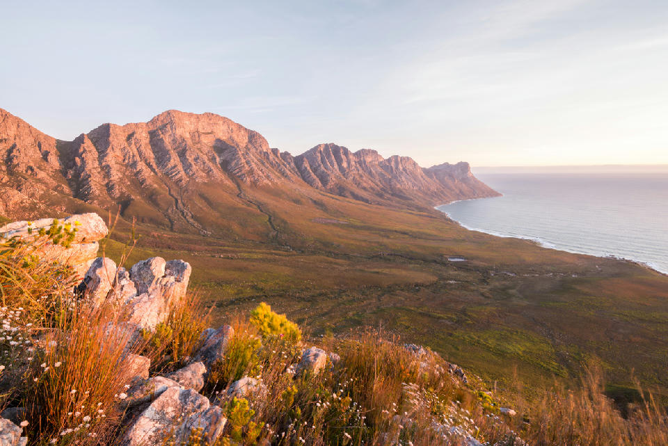
The Overberg works through the interaction between coastline, mountains, vegetation, weather, and open space. Ocean systems from the South Atlantic and Southern Ocean shape visibility, atmosphere, and light across the region, while mountain ridges and valleys create strong landscape structure inland. Along the Whale Coast, rocky cliffs, kelp-lined bays, and elevated viewpoints overlook Walker Bay and the southern Atlantic coastline. Marine weather creates rapidly changing visibility conditions, while seasonal whale activity adds scale and movement to coastal compositions. Further inland, cool-climate valleys such as Hemel-en-Aarde combine vineyards, rolling hills, and mountain backdrops into layered agricultural landscapes. The interaction between cultivated terrain and surrounding mountain ridges creates structured compositions with strong seasonal colour variation. Toward Cape Agulhas and De Hoop, the landscape opens into windswept coastlines, dunes, limestone formations, wetlands, and broad ocean-facing plains. These areas work through openness, atmospheric weather, and long sightlines across exposed coastal terrain.
West Coast
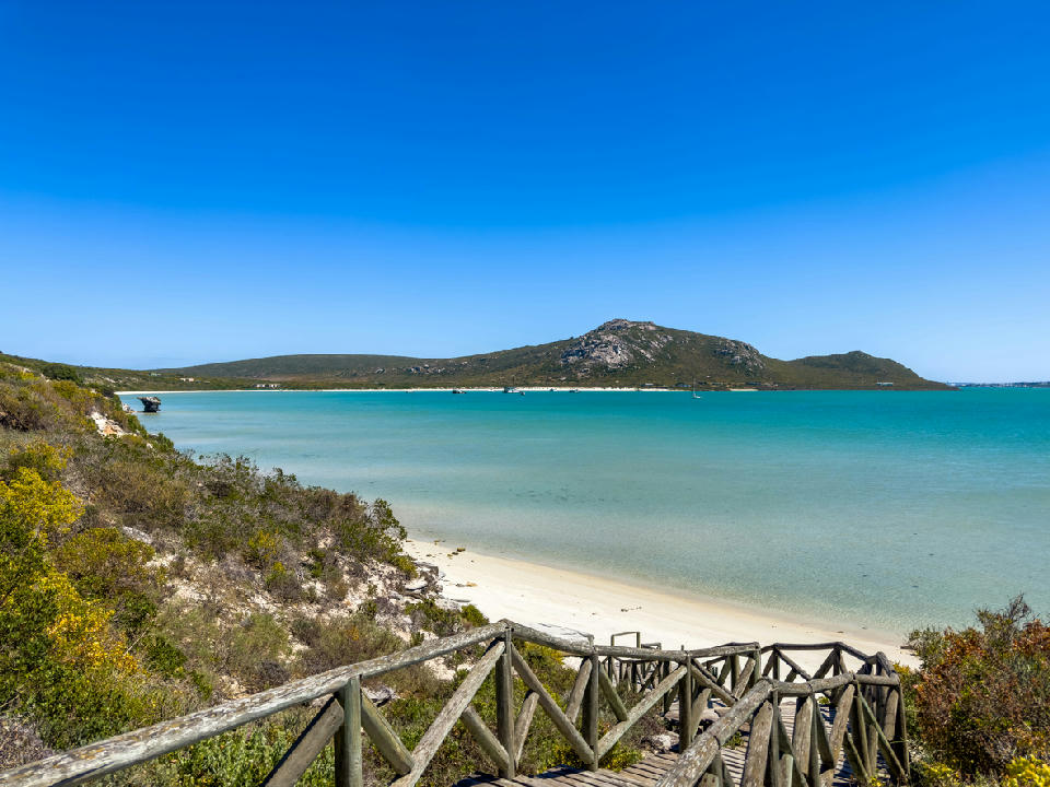
The West Coast is structured around a series of bays, lagoons, wetlands, beaches, and rocky shorelines extending along South Africa's Atlantic coast. The interaction between coastal geology, marine systems, and seasonal rainfall creates a landscape of exceptional environmental diversity. The region contains some of South Africa's most important coastal ecosystems. Langebaan Lagoon forms the environmental centrepiece of the coastline, while wetlands such as Verlorenvlei support significant birdlife and seasonal ecological activity. Fishing settlements, dune systems, and offshore seabird colonies add further diversity throughout the region. The visual structure of the West Coast is defined by open horizons, expansive shorelines, and changing coastal conditions. Light plays an important role, with ocean mist, seasonal wildflowers, and Atlantic weather systems shaping colour, texture, and atmosphere throughout the landscape.
Overview
The Western Cape is structured around a series of mountain ranges running parallel to the coastline, separated by fertile valleys and semi-arid basins. Rivers cut through these ranges, forming passes and agricultural corridors that shape settlement and land use patterns.
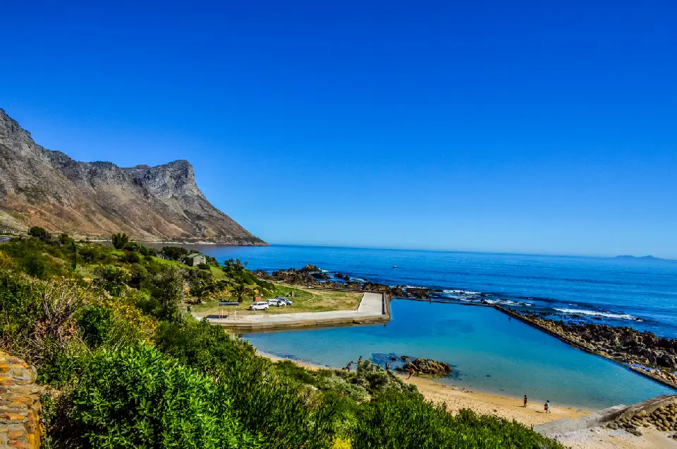
Coastal environments vary from sheltered bays and sandy beaches to exposed cliffs and rocky promontories. Inland regions transition toward drier plains and rugged uplands, creating strong contrasts between cultivated landscapes and more remote terrain.
Light conditions are shaped by maritime influence, seasonal rainfall patterns, and mountain-induced weather systems. Wind, coastal mist, and shifting cloud cover affect visibility and tonal separation across both shoreline and inland environments.
Key Photography Subjects
- Mountain ranges rising above coastal plains
- Vineyards and agricultural valleys
- Atlantic and Indian Ocean shorelines
- Rocky headlands and exposed sea cliffs
- Semi-arid interior landscapes
- Historic towns and coastal settlements
- Seasonal light, atmosphere, and weather effects
Gallery
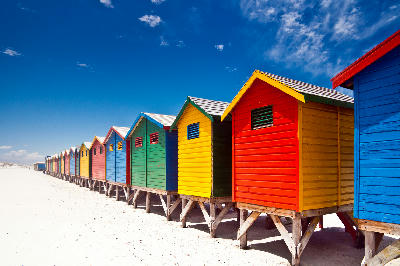
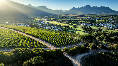
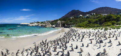
Workshops in Western Cape
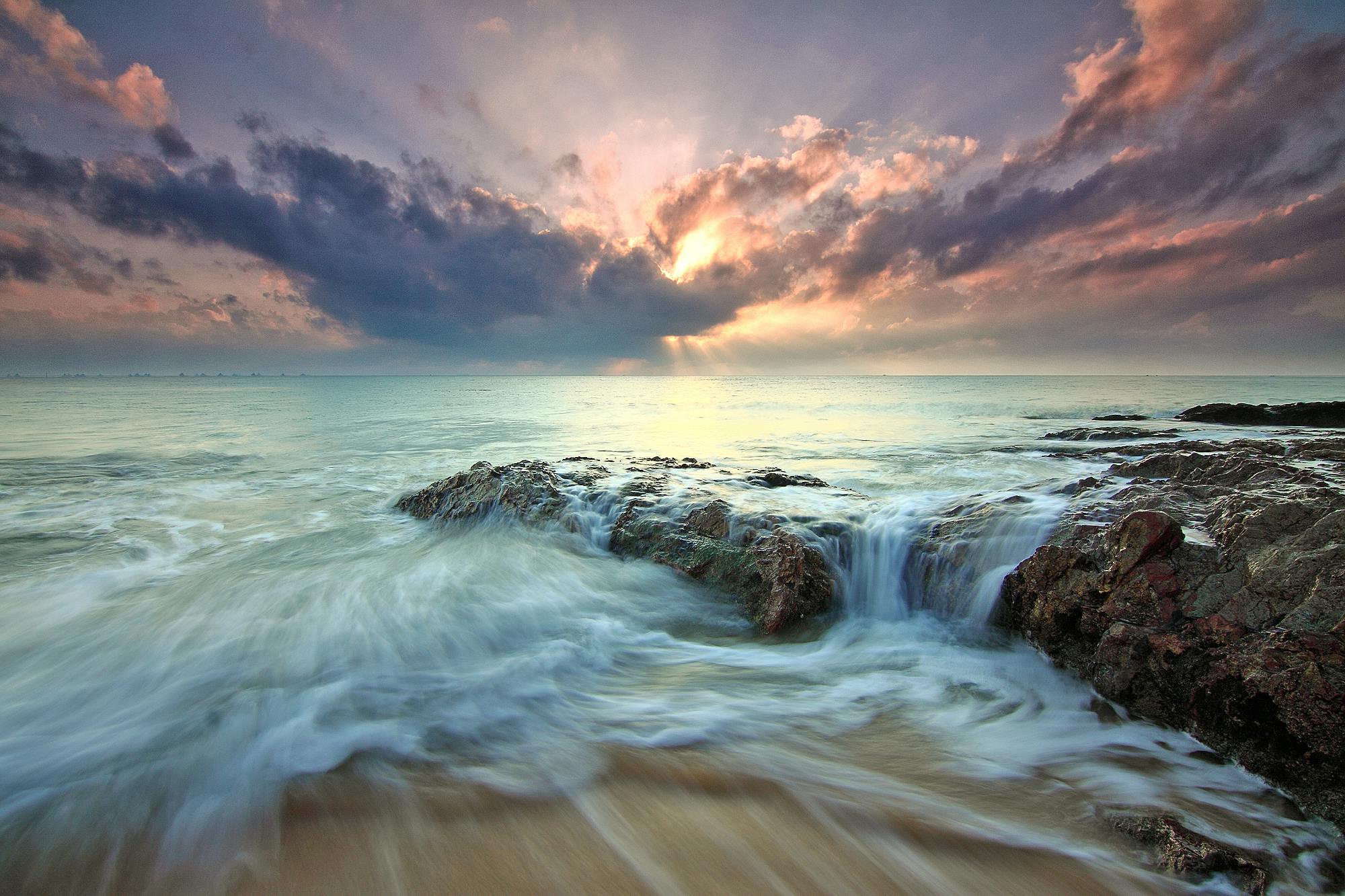
Arniston & De Kelders Seascape Masterclass
≈ USD 814
Pringle Bay Long Exposure & Seascapes Workshop – 3 Days
≈ USD 490