01
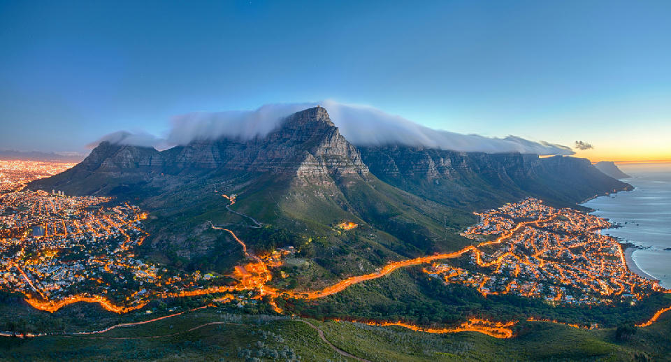
Table Mountain and the Twelve Apostles at sunset with the famous “tablecloth” cloud spilling over the summit, overlooking Cape Town and Camps Bay, South Africa.
Cape Peninsula
The Cape Peninsula is a mountainous promontory extending southward into the Atlantic Ocean from mainland South Africa. The landscape is defined by a central sandstone ridge system bordered by steep coastal slopes, rocky headlands, and narrow shoreline flats. The peninsula includes Table Mountain and the cliffs of Cape Point, where elevated plateaus descend directly toward open ocean.
Terrain transitions from high plateau surfaces to sharply incised valleys and exposed coastal escarpments. Lowland areas are limited and occur primarily along sheltered bays, while mountain ridgelines form the dominant structural spine.
Surface character is shaped by marine exposure, wind-driven erosion, and seasonal vegetation change across fynbos-covered slopes and rocky outcrops.
Geographic discovery
Explore Cape Peninsula by Area
Choose a part of the Cape Peninsula to discover its landscapes, photographic character, and locations.
Explore Areas in Cape Peninsula


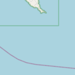




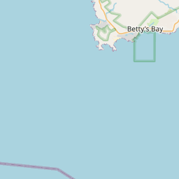





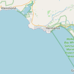



Cape Point Reserve
Cape Town
Atlantic Seaboard
City Bowl & Table Mountain
False Bay Coast
Noordhoek to Scarborough Coast
Simon's Town & Boulders Coast
Atlantic Seaboard
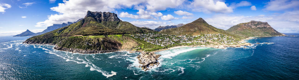
The Atlantic Seaboard is structured as a linear coastal system where mountain and ocean define a narrow and continuous landscape. The Twelve Apostles mountain range forms a steep inland boundary, while the Atlantic coastline creates a sequence of bays and exposed headlands. Coastal areas alternate between sandy beaches and rocky outcrops, while urban development occupies limited space between the mountain slopes and the shoreline. The corridor extends along a series of connected coastal segments rather than forming a broad continuous plain. The visual structure of the region is defined by the contrast between steep mountain backdrops, open ocean horizons, and the narrow coastal strip, producing layered compositions along the coastline.
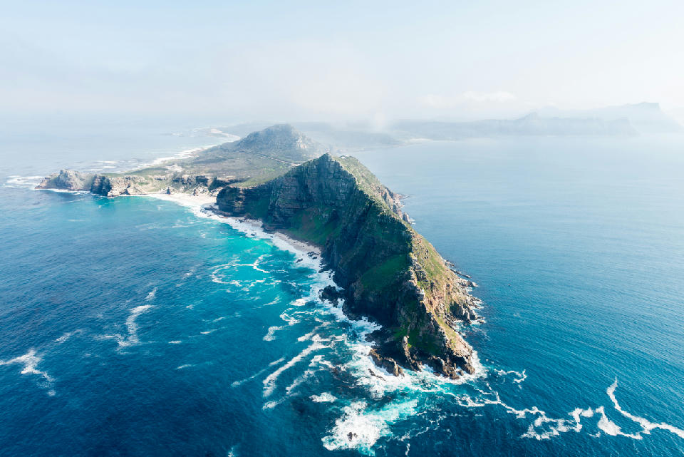
Cape Point Reserve
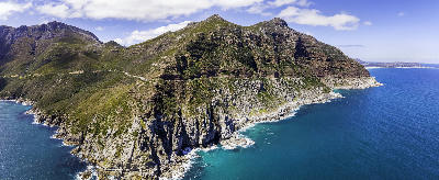
Cape Point Reserve is structured as a coastal headland system forming the southern extremity of the Cape Peninsula. Elevated plateaus terminate in steep cliffs that drop directly into the ocean, creating strong vertical relief along the coastline. Rocky promontories extend into open water, while isolated bays and beaches occur in more sheltered sections of the shoreline. The terrain remains largely undeveloped, with natural vegetation covering much of the landscape. The visual structure of the region is defined by the contrast between elevated landforms, sheer coastal cliffs, and open ocean horizons, producing expansive compositions across land, sea, and sky.
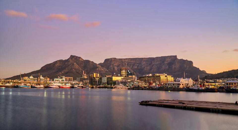
Cape Town
Cape Town is structured around a central mountain system that defines the city’s spatial layout. Table Mountain and its associated ridgelines form a natural barrier between coastal zones and interior plains, shaping both settlement and land use patterns. Coastal areas include bays, beaches, and exposed headlands along both the Atlantic and False Bay shorelines. Urban development is concentrated along lower elevations, while higher terrain remains dominated by natural vegetation and protected landscapes. The visual structure of the city is defined by the contrast between mountain backdrops, ocean horizons, and urban forms, producing layered compositions across built and natural environments.
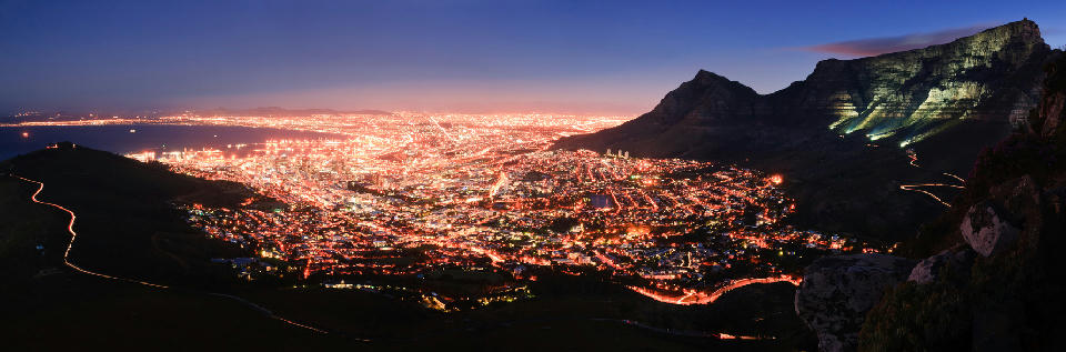
City Bowl & Table Mountain
The City Bowl is structured as a natural basin formed by surrounding mountain ridgelines, including Table Mountain, Lion’s Head, and Devil’s Peak. These formations create a contained urban space with strong visual boundaries defined by elevation and terrain. Table Mountain dominates the region as a plateau system with steep escarpments and sloping flanks descending into the city. The surrounding slopes and ridgelines connect the mountain to adjacent coastal and urban zones. The visual structure of the area is defined by the contrast between the flat-topped mountain, surrounding peaks, and the urban basin below, producing layered compositions across terrain, built form, and ocean-facing edges.
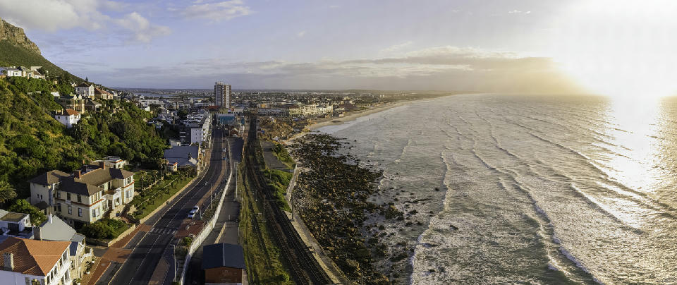
False Bay Coast
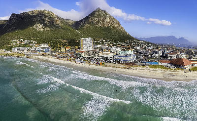
The False Bay Coast is structured as a continuous shoreline along a large bay system. The coastline is defined by long sandy beach formations interrupted by smaller rocky sections and harbour areas. Urban and suburban development occupies much of the coastal strip, while inland terrain rises gradually toward mountain slopes. The bay’s sheltered conditions create calmer water patterns compared to the Atlantic coastline. The visual structure of the region is defined by the contrast between wide open beaches, expansive ocean horizons, and low-lying coastal terrain, producing broad and horizontal compositions across the landscape.
Noordhoek to Scarborough Coast
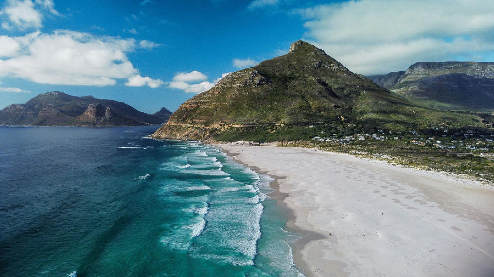
The Noordhoek to Scarborough coastline is structured as a broad, open coastal system along the western Cape Peninsula. Unlike the more confined Atlantic Seaboard, this section features wider shoreline expanses and less abrupt elevation change between ocean and inland terrain. Beach systems extend across long continuous stretches, interrupted by rocky headlands and small settlement clusters. Inland areas transition into rural and semi-natural landscapes, with lower density development and open space. The visual structure of the region is defined by the contrast between wide sandy beaches, open ocean horizons, and low-lying coastal terrain, producing expansive compositions across shoreline and coastal plains.
Simon's Town & Boulders Coast
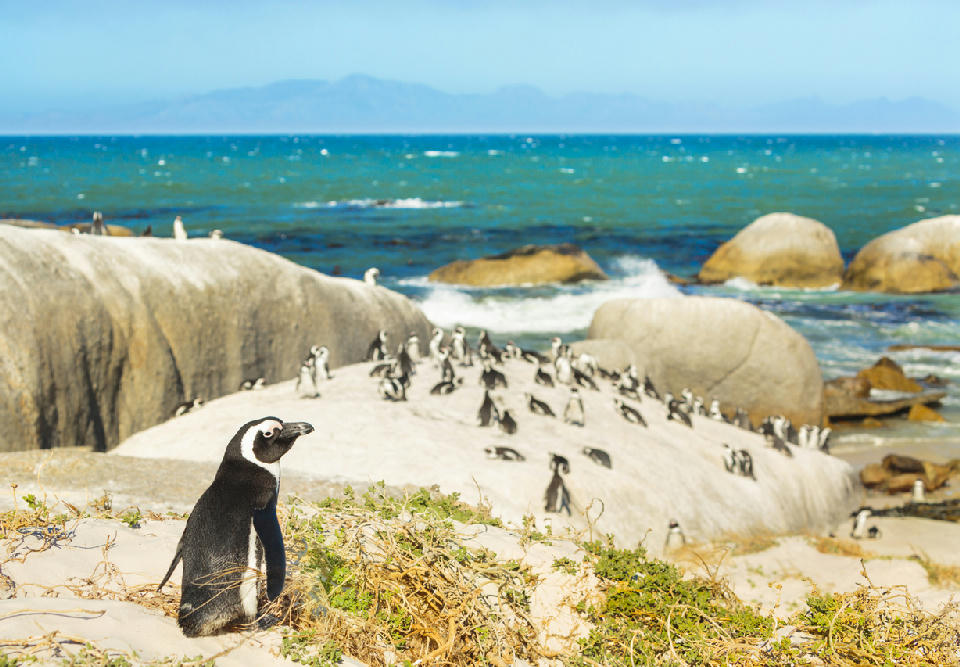
The Simon’s Town and Boulders coastline is structured as a series of small bays and headlands along the False Bay margin. Granite rock formations shape the shoreline, creating enclosed coves and sheltered beach environments. Coastal settlements are positioned within these bays, while surrounding slopes transition into natural vegetation and low mountain terrain. The coastline remains more protected compared to the Atlantic side of the peninsula. The visual structure of the region is defined by the interaction between smooth granite formations, calm bay waters, and coastal settlements, producing layered compositions across shoreline, water, and surrounding terrain.
Photographic journey
Cape Peninsula Photography Route
Cape Town Route · 43 stops
09
Green Point Lighthouse
18
Noordhoek Beach
26
Buffels Bay
35
Silvermine Nature Reserve
43
Bloubergstrand
Overview
The Cape Peninsula functions as a linear mountain system surrounded on three sides by ocean. A continuous sandstone backbone defines its topographic form, with subsidiary ridges extending toward the coastline and dividing small basins and valleys.
Coastal margins alternate between sandy bays and exposed cliffs, creating strong contrasts between horizontal ocean planes and vertical rock faces. Interior slopes descend toward urban and suburban settlements positioned within limited flatter terrain.
The visual structure of the peninsula is governed by abrupt elevation change, repeated ridge-to-sea transitions, and open Atlantic horizons framing the southern extent of the landmass.
Key Photography Subjects
- Sandstone ridgelines descending toward ocean
- Sheer coastal cliffs facing open Atlantic
- Elevated plateaus overlooking sheltered bays
- Rocky headlands and promontories
- Fynbos-covered mountain slopes
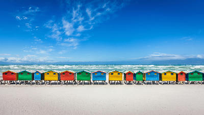
- Coastal settlements beneath mountain backdrops
- Seasonal light, wind, and atmospheric variation
Gallery
Workshops in Cape Peninsula
No upcoming workshops scheduled for Cape Peninsula at this time.
Check back soon or explore other destinations.