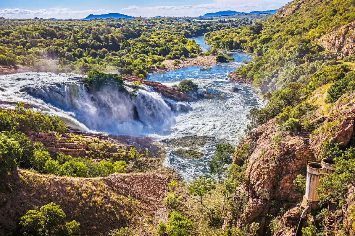
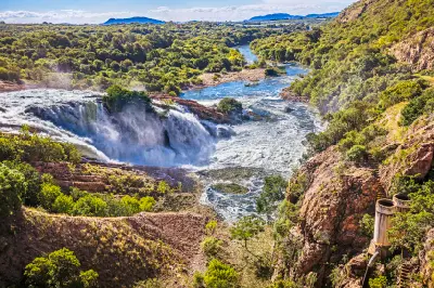
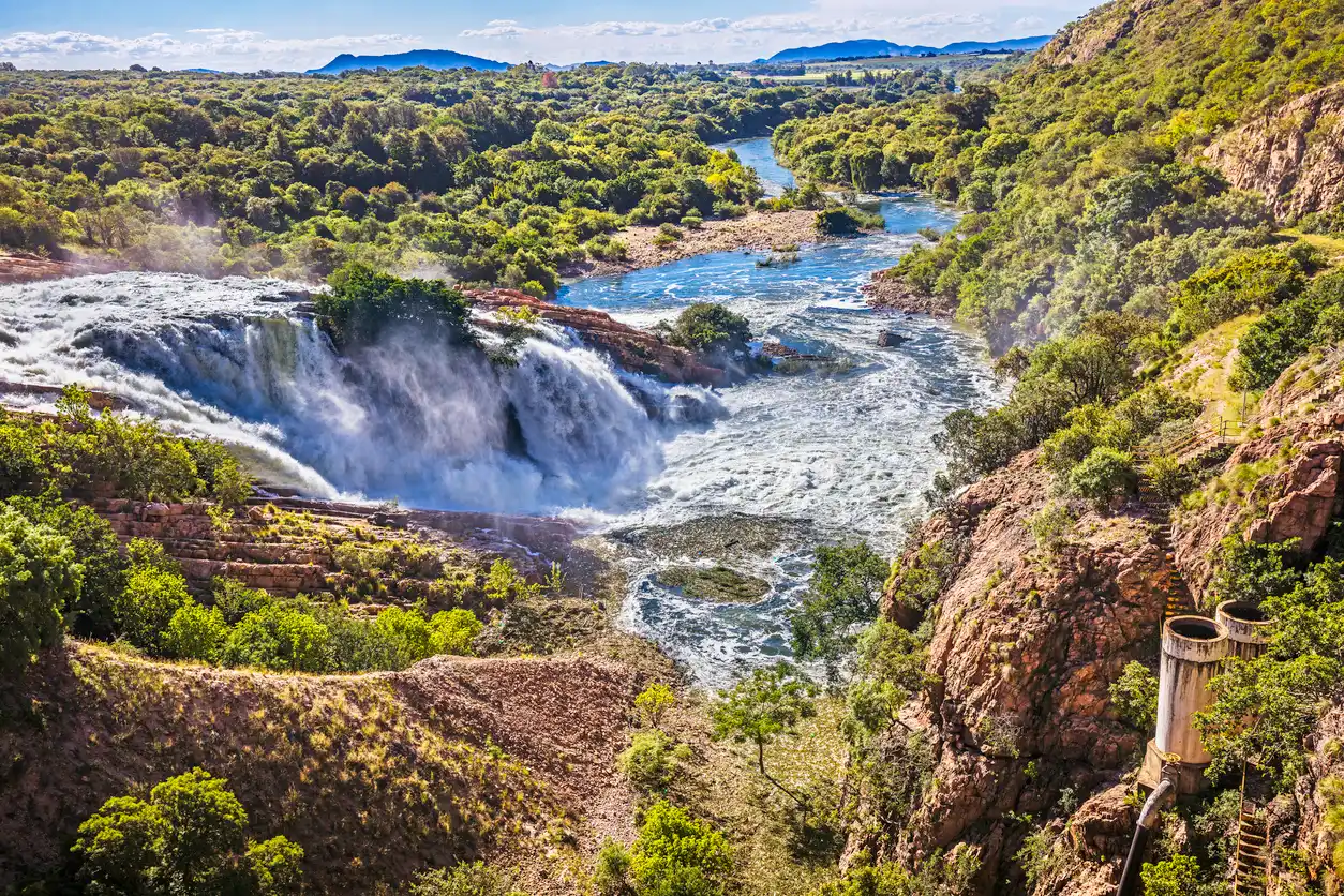
View of the Hartbeespoort Dam spillway and Crocodile River flowing through a rocky gorge below the Magaliesberg, with waterfalls, forested hillsides and surrounding bushveld landscapes.

    The Hartbeespoort Dam spillway channels water into the Crocodile River below, creating a dramatic cascade framed by wooded valleys and the rugged slopes of the Magaliesberg foothills.

    North West

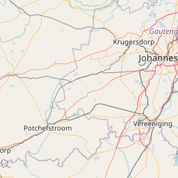
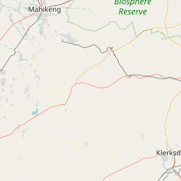
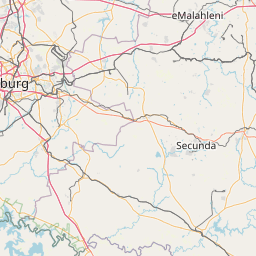
    North West occupies the transition zone between South Africa's central interior and the arid landscapes of the western plateau. The province is characterised by bushveld plains, ancient mountain ranges, river valleys, volcanic landforms, and extensive wilderness areas that create a landscape distinct from both the Highveld and the Kalahari.

    The landscape is structured around the Pilanesberg volcanic complex, the Magaliesberg mountain range, the Vaal River system, and broad bushveld environments extending across much of the province. These varied landforms create a combination of open savanna, rugged ridges, elevated viewpoints, and wildlife-rich ecosystems.

    Geology plays a defining role throughout the province. Ancient mountain formations, eroded volcanic landscapes, river systems, and extensive plains combine to create a region characterised by strong natural contrasts, wide horizons, and a diverse range of environments.

    Geographic discovery

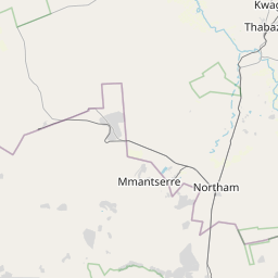
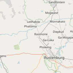
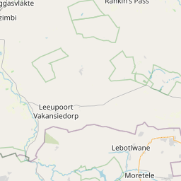
    Explore North West by Area

    Choose a part of North West to discover its landscapes, photographic character, and locations.

    Open interactive Explore

    Explore Areas in North West

    Open in Explore
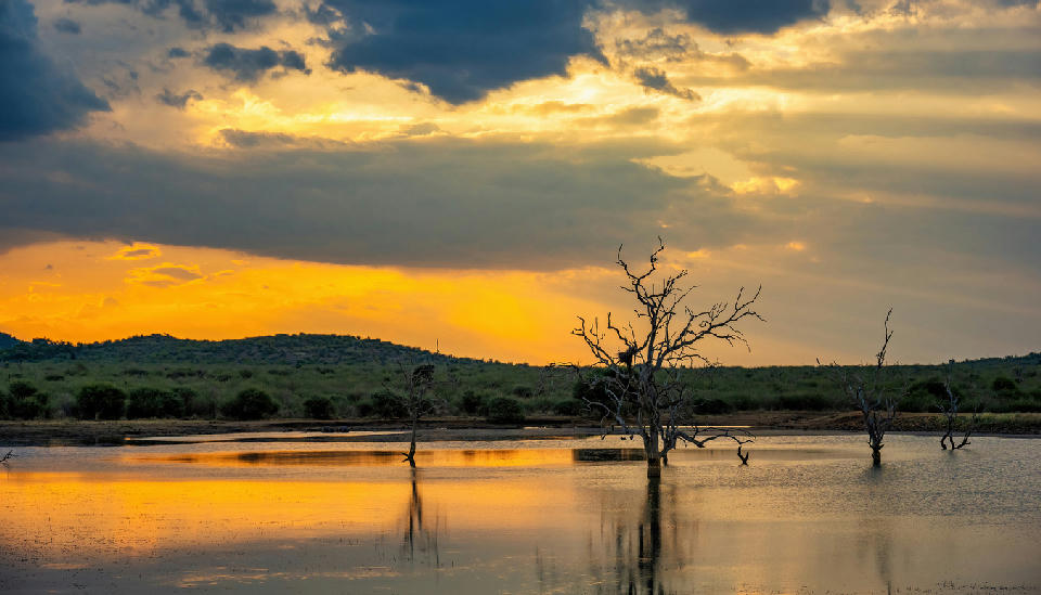
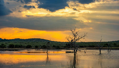
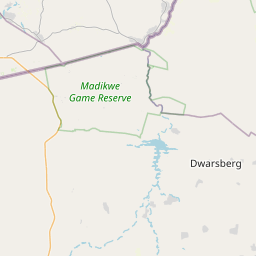
    Golden sunset reflected in a waterhole with dead trees standing in the water in Madikwe Game Reserve, North West Province, South Africa.

    Madikwe & Western Bushveld

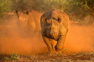
    The landscape is formed by gently undulating bushveld plains broken by sandstone ridges, seasonal drainage systems, and scattered acacia woodland. Ancient geological processes created a landscape of low relief, where broad horizons and open valleys dominate rather than dramatic mountain scenery. Seasonal rivers and waterholes provide important ecological corridors through the region and create focal points within the wider wilderness. The region forms part of the greater western bushveld ecosystem extending into Botswana and the Kalahari Basin. Open savanna, thornveld, and mixed woodland habitats support a remarkable diversity of wildlife while maintaining the expansive character that distinguishes the western interior of southern Africa. Photographically, the area works through wildlife, atmosphere, and scale. Vast skies, distant horizons, and open plains create powerful minimalist compositions, while seasonal storms, dust, mist, and dramatic safari light frequently transform the landscape. The interaction between wildlife and wilderness remains the defining visual characteristic of the region.

    View of water cascading from Hartbeespoort Dam into the Crocodile River below, surrounded by rocky cliffs, dense vegetation and the Magaliesberg foothills.

    Magaliesberg & Hartbeespoort

    The region is anchored by the Magaliesberg mountain range, a billion-year-old geological formation extending across much of southern North West. Long ridgelines, rocky cliffs, narrow passes, and wooded valleys dominate the terrain, creating a landscape markedly different from the flatter bushveld regions elsewhere in the province. Hartbeespoort Dam occupies the centre of the landscape where the Crocodile River emerges from the mountains. The reservoir introduces a major water element into the region, creating broad reflective surfaces surrounded by ridges, hills, and elevated viewpoints. The interaction between mountain topography and open water gives the area a distinctive visual character. Photographically, the region works through elevation, scale, and contrast. Mountain ridges provide dramatic leading lines and panoramic viewpoints, while the reservoir, river systems, and valleys create opportunities for reflections and layered compositions. Seasonal thunderstorms, winter clarity, and changing light conditions frequently transform the appearance of the landscape.

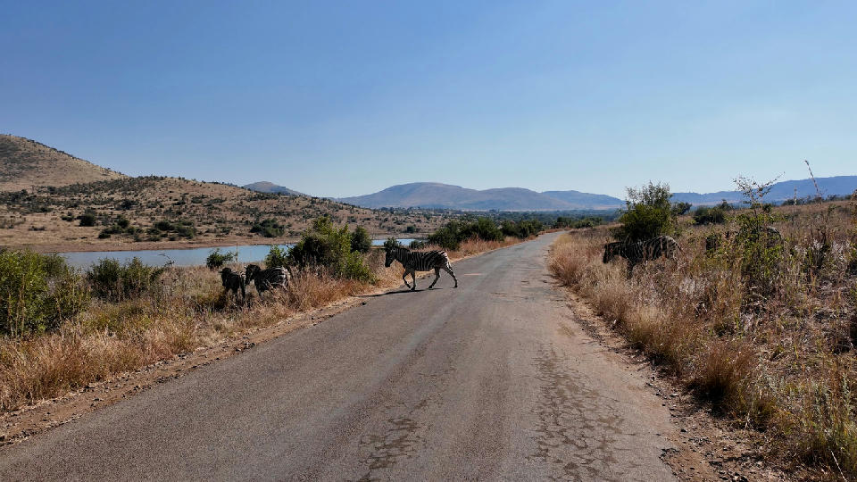
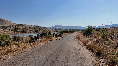
    Zebras crossing a road beside a waterbody in Pilanesberg National Park, South Africa.

    Pilanesberg & Bushveld

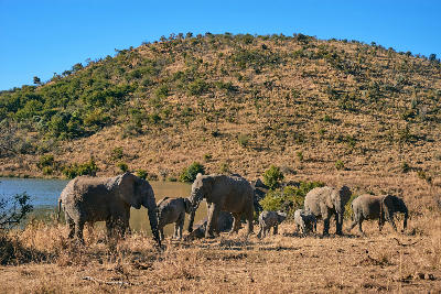
    The landscape is shaped by the remnants of a massive volcanic system that collapsed more than a billion years ago. Erosion exposed the circular ring formations that now define Pilanesberg's topography, creating concentric mountain ridges surrounding broad valleys and plains. Unlike the linear mountain systems of the Magaliesberg or Drakensberg, Pilanesberg presents a rare circular landscape visible from elevated viewpoints throughout the reserve. Open savanna, thornveld, seasonal drainage lines, rocky hills, and scattered wetlands create a varied environment that supports a remarkable concentration of wildlife. Waterholes, river valleys, and grassland plains provide focal points within the broader landscape while the volcanic ridges create depth and scale across wider views. Photographically, the region works through wildlife, geology, and atmosphere. The volcanic structure creates strong landscape compositions, while changing weather, summer storms, winter clarity, and golden safari light continually transform the appearance of the bushveld. The interaction between wildlife and landscape remains one of the defining visual characteristics of the region.

    Photographic journey

    North West Photography Route

    North West Bushveld Circuit · 9 stops

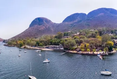
    Golden sunset over Hartbeespoort Dam viewed from the summit of the Hartbeespoort Aerial Cableway, with mountain ridges, lakeshore settlements and viewing terraces in the foreground.01

    Hartbeespoort Aerial Cableway

    The Hartbeespoort Aerial Cableway provides some of the finest elevated views in the North West Province, carrying visitors from the foothills of the Magaliesberg to panoramic viewpoints overlooking Hartbeespoort Dam, the surrounding mountains and the distant Highveld. It is the premier viewpoint destination in the region.

    View of water cascading from Hartbeespoort Dam into the Crocodile River below, surrounded by rocky cliffs, dense vegetation and the Magaliesberg foothills.03

    Magaliesberg & Hartbeespoort

    The region is anchored by the Magaliesberg mountain range, a billion-year-old geological formation extending across much of southern North West. Long ridgelines, rocky cliffs, narrow passes, and wooded valleys dominate the terrain, creating a landscape markedly different from the flatter bushveld regions elsewhere in the province. Hartbeespoort Dam occupies the centre of the landscape where the Crocodile River emerges from the mountains. The reservoir introduces a major water element into the region, creating broad reflective surfaces surrounded by ridges, hills, and elevated viewpoints. The interaction between mountain topography and open water gives the area a distinctive visual character. Photographically, the region works through elevation, scale, and contrast. Mountain ridges provide dramatic leading lines and panoramic viewpoints, while the reservoir, river systems, and valleys create opportunities for reflections and layered compositions. Seasonal thunderstorms, winter clarity, and changing light conditions frequently transform the appearance of the landscape.

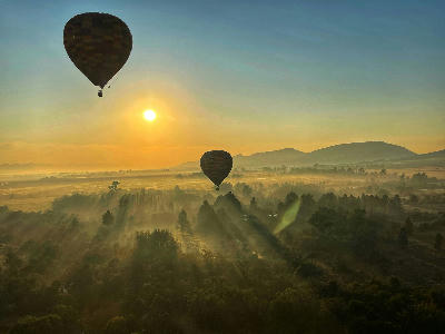
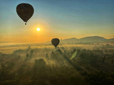
    Hot-air balloons floating above the misty Magaliesberg valley at sunrise near Hartbeespoort, South Africa.04

    Magaliesberg

    The Magaliesberg is one of the oldest mountain ranges on Earth, stretching across the northern interior of South Africa in a series of rugged quartzite ridges, deep valleys and dramatic cliffs. Rising above the surrounding Highveld and bushveld landscapes, it forms the scenic backbone of the Hartbeespoort region and one of the country's most important mountain landscapes.

    Zebras crossing a road beside a waterbody in Pilanesberg National Park, South Africa.06

    Pilanesberg & Bushveld

    The landscape is shaped by the remnants of a massive volcanic system that collapsed more than a billion years ago. Erosion exposed the circular ring formations that now define Pilanesberg's topography, creating concentric mountain ridges surrounding broad valleys and plains. Unlike the linear mountain systems of the Magaliesberg or Drakensberg, Pilanesberg presents a rare circular landscape visible from elevated viewpoints throughout the reserve. Open savanna, thornveld, seasonal drainage lines, rocky hills, and scattered wetlands create a varied environment that supports a remarkable concentration of wildlife. Waterholes, river valleys, and grassland plains provide focal points within the broader landscape while the volcanic ridges create depth and scale across wider views. Photographically, the region works through wildlife, geology, and atmosphere. The volcanic structure creates strong landscape compositions, while changing weather, summer storms, winter clarity, and golden safari light continually transform the appearance of the bushveld. The interaction between wildlife and landscape remains one of the defining visual characteristics of the region.

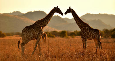
    Two giraffes facing each other in golden grassland at sunset in Pilanesberg National Park, South Africa.07

    Pilanesberg National Park

    Pilanesberg National Park protects one of South Africa's most distinctive safari landscapes, centred on the remnants of an ancient volcanic crater surrounded by rolling hills, bushveld plains and seasonal wetlands. Located within a rare alkaline ring complex, the park combines exceptional wildlife viewing with scenery found nowhere else in the country.

    Golden sunset reflected in a waterhole with dead trees standing in the water in Madikwe Game Reserve, North West Province, South Africa.09

    Madikwe & Western Bushveld

    The landscape is formed by gently undulating bushveld plains broken by sandstone ridges, seasonal drainage systems, and scattered acacia woodland. Ancient geological processes created a landscape of low relief, where broad horizons and open valleys dominate rather than dramatic mountain scenery. Seasonal rivers and waterholes provide important ecological corridors through the region and create focal points within the wider wilderness. The region forms part of the greater western bushveld ecosystem extending into Botswana and the Kalahari Basin. Open savanna, thornveld, and mixed woodland habitats support a remarkable diversity of wildlife while maintaining the expansive character that distinguishes the western interior of southern Africa. Photographically, the area works through wildlife, atmosphere, and scale. Vast skies, distant horizons, and open plains create powerful minimalist compositions, while seasonal storms, dust, mist, and dramatic safari light frequently transform the landscape. The interaction between wildlife and wilderness remains the defining visual characteristic of the region.

    Explore the Full North West Route9 stops across North West

    Overview

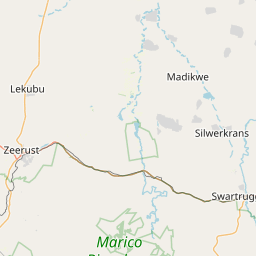
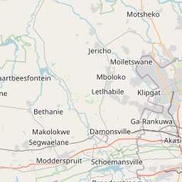
    North West is organised around a series of distinct landscape systems that extend across the province. The Pilanesberg region forms one of the most significant geological features in South Africa, while the Magaliesberg creates a long mountain barrier along the province's eastern edge. Between these systems lie extensive bushveld plains, river valleys, and wildlife landscapes.

    The province contains a mixture of protected conservation areas, agricultural regions, and natural wilderness environments. Rivers, dams, mountain ridges, and volcanic formations provide structure across the landscape, while large areas of open savanna create a strong sense of scale and openness.

    The visual character of the province is defined by bushveld vegetation, mountain silhouettes, volcanic landforms, seasonal grasslands, and expansive skies. Summer thunderstorms, winter clarity, and changing seasonal conditions continually alter the appearance of the landscape while emphasising its geological and ecological diversity.
    Key Photography Subjects

    • Bushveld plains and open savanna landscapes
    • Ancient mountain ranges and ridgelines
    • Volcanic formations and geological features
    • Wildlife habitats and conservation areas
    • River valleys, dams, and water systems
    • Storm light, dramatic skies, and seasonal weather
    • Sunrise and sunset across expansive horizons

    Gallery

    Workshops in North West

    No upcoming workshops scheduled for North West at this time.

    Check back soon or explore other destinations.