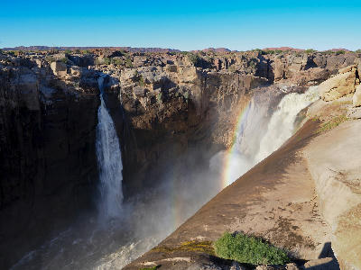
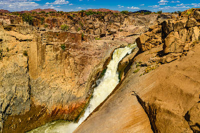
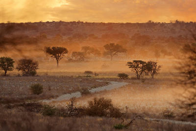
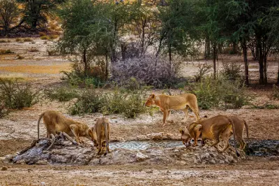
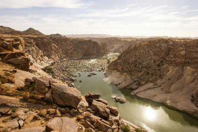
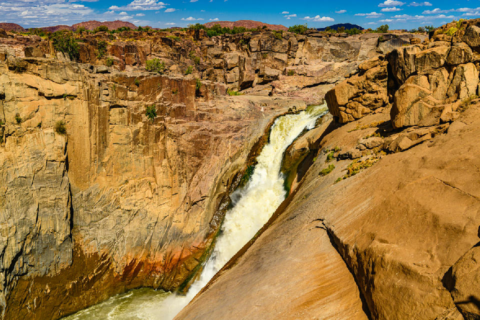
Augrabies Falls cascading into a deep rocky granite canyon in Augrabies Falls National Park, Northern Cape, South Africa.

    Augrabies Falls plunging into the granite gorge of the Orange River, the iconic centrepiece of Augrabies Falls National Park in the Northern Cape, South Africa.

    Northern Cape

    The Northern Cape is South Africa's largest province and one of the most expansive landscape regions in southern Africa. The region is defined by vast desert environments, dramatic mountain ranges, deep river valleys, semi-arid plains, and immense open spaces stretching across much of the country's interior.

    From the red dunes of the Kalahari and the granite mountains of Namaqualand to the immense canyon systems of the south and the remote plains of the Upper Karoo, the region contains some of South Africa's most diverse and least-developed natural landscapes. Large distances, low population density, and limited urban development create a strong sense of scale and isolation across much of the province.

    Unlike many other regions of South Africa where forests, coastlines, or agricultural landscapes dominate, the Northern Cape is defined by geology, climate, and space. Ancient rock formations, seasonal wildflower displays, desert ecosystems, and vast horizons create a landscape where natural processes remain the primary influence on both scenery and photographic opportunities.

    Geographic discovery

    Explore Northern Cape by Area

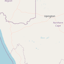
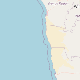
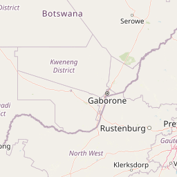
    Choose a part of the Northern Cape to discover its landscapes, photographic character, and locations.

    Open interactive Explore

    Explore Areas in Northern Cape

    Open in Explore
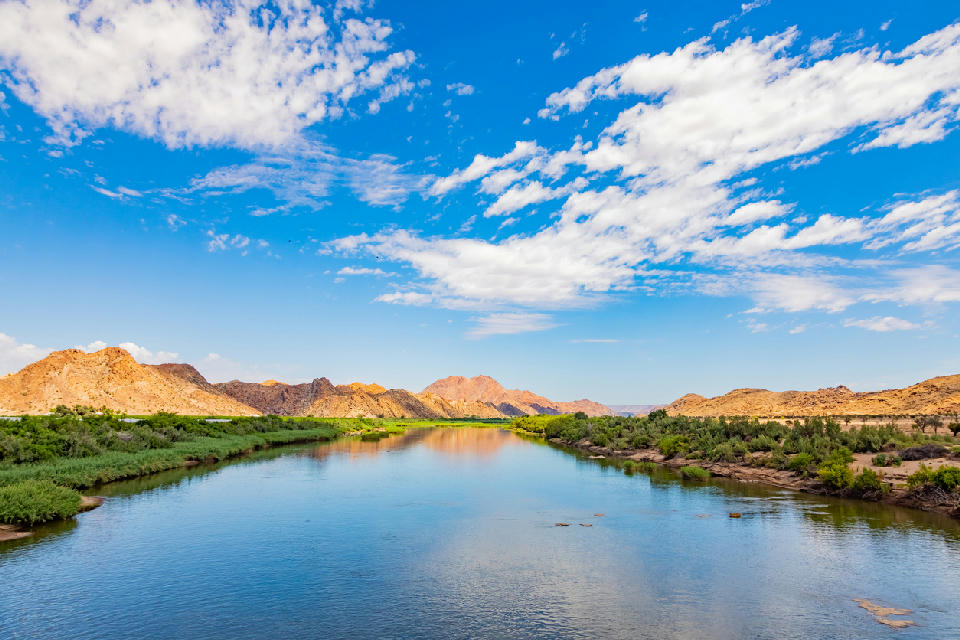
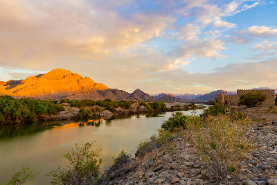
    Orange River flowing between rocky canyon walls in Augrabies National Park, Northern Cape, South Africa.

    Augrabies & Green Kalahari

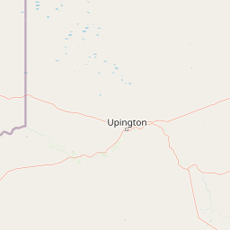
    The Augrabies & Green Kalahari region is structured around the Orange River as it cuts through resistant granite bedrock before continuing westwards toward the Atlantic Ocean. This process has created dramatic waterfalls, deep canyons, rocky escarpments, and extensive river terraces that dominate the landscape. Beyond the gorge, the Orange River supports a broad agricultural corridor extending through an otherwise arid environment. Vineyards, orchards, and irrigated farmland occupy the river valley, while rocky hills, desert plains, and scattered mountain outcrops define the surrounding terrain. The contrast between fertile river landscapes and dry interior environments is one of the defining characteristics of the region. The visual structure of the region is shaped by the interaction between water, geology, and desert terrain. Waterfalls, river channels, canyon walls, agricultural landscapes, and elevated viewpoints combine to create a diverse landscape where movement, scale, texture, and seasonal change play an important role throughout the year.

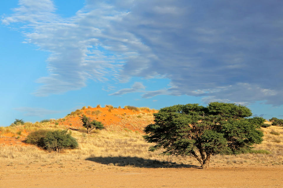
    Red Kalahari sand dunes and camel thorn trees in the Kgalagadi Dune System, Northern Cape, South Africa.

    Kgalagadi Wilderness System

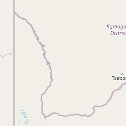
    The Kgalagadi Wilderness System is structured around a network of fossil river valleys running between extensive dune systems that stretch across the southern Kalahari. These ancient drainage systems divide the landscape into broad wilderness corridors, creating a landscape dominated by space, scale, and uninterrupted natural terrain. Across the region, red dunes, open grasslands, dry riverbeds, and scattered camelthorn trees form the defining visual elements. The Auob and Nossob valleys support higher concentrations of wildlife, while the surrounding dune fields create elevated viewpoints and repeating patterns that extend across the horizon. The result is a landscape where terrain and ecology remain closely connected. The visual structure of the region is defined by simplicity and repetition. Long dune ridges, winding riverbeds, isolated trees, and distant horizons create strong geometric compositions, while changing weather systems, airborne dust, and low-angle desert light continually reshape the appearance of the wilderness.

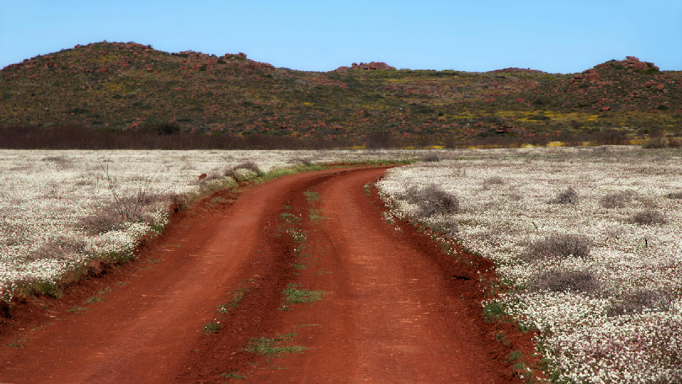
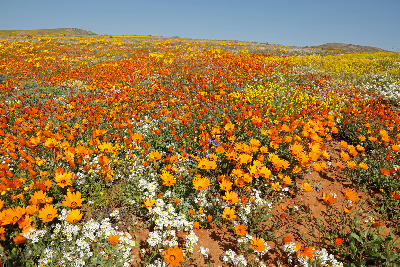
    Red gravel road winding through white spring wildflower fields beneath granite hills in Namaqualand, South Africa.

    Namaqualand & Wildflower Landscapes

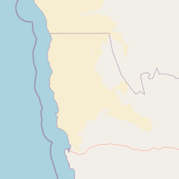
    The region is structured around a network of flowering plains, granite mountain systems, elevated valleys, and semi-arid basins extending across western Namaqualand. Areas such as Namaqua National Park, the Kamiesberg, Goegap Nature Reserve, and surrounding rural landscapes contribute different visual elements to the broader flower region. Rolling uplands, rocky outcrops, and distant mountain ranges provide structure and scale beneath the seasonal displays. Geology and climate combine to shape the character of the landscape. Ancient granite formations dominate much of the terrain, while winter rainfall patterns influence the intensity and distribution of annual flower blooms. During peak flowering periods, extensive fields of daisies and endemic flowering plants create striking contrasts against otherwise rugged desert landscapes, producing one of the most visually distinctive seasonal environments in Africa. Photographically, the region is defined by colour, contrast, and seasonal spectacle. Wildflower carpets create vibrant foregrounds across expansive landscapes, while granite mountains, rolling ridges, and open skies provide depth and visual balance. Early morning and late afternoon light enhance colour and texture throughout the flowering season, while changing weather conditions create continually evolving opportunities for both intimate flower studies and large-scale landscape compositions.

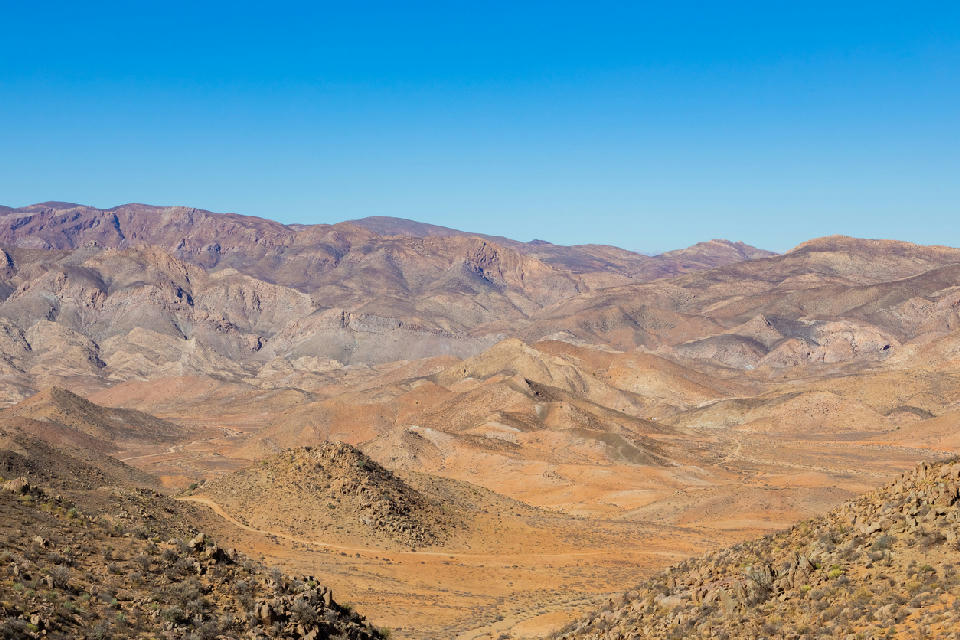
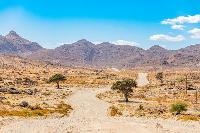
    Panoramic view across the rugged desert mountains and valleys of Richtersveld National Park, Northern Cape, South Africa.

    Richtersveld Desert Mountains

    The Richtersveld is structured around a network of mountain ranges separated by deeply incised valleys and dry river systems. These rugged landforms create a landscape of exceptional relief, with steep ridgelines, isolated peaks, and winding mountain passes extending across one of South Africa's largest wilderness areas. Across the region, mountain barriers divide a series of distinct desert basins and valleys. The Orange River forms a contrasting green corridor along the northern boundary, while rocky plains, drainage systems, and succulent-rich slopes occupy the terrain between major mountain systems. Ancient geological formations dominate the scenery, creating some of the oldest and most visually striking landscapes in southern Africa. The visual structure of the region is defined by alternating ridgelines, valleys, escarpments, and elevated viewpoints. Long sightlines, dramatic changes in elevation, and constantly shifting light produce layered desert compositions where geology, scale, and isolation become the defining characteristics of the

    Photographic journey

    Northern Cape Photography Route

    Northern Cape Route · 21 stops

    Gravel road leading toward the Green River estuary and coastal wetlands at Groenriviersmond in Namaqua National Park, Northern Cape, South Africa.01

    Green River Mouth & Coastal Wetlands

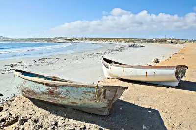
    Green River Mouth is a remote coastal wetland where the Groen River reaches the Atlantic Ocean within Namaqualand. Known for its estuary landscapes, birdlife, coastal dunes, and open shoreline scenery, it provides a striking contrast to the flower fields more commonly associated with the region.

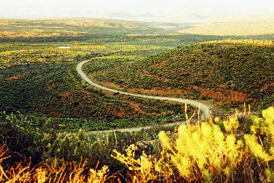
    Winding road through the scrub-covered hills and valleys of the Kamiesberg region in Namaqualand, Northern Cape, South Africa.05

    Kamiesberg

    The Kamiesberg is a mountain range in the heart of Namaqualand known for its granite peaks, remote valleys, and spectacular seasonal flower displays. The higher elevations create a distinctive landscape that differs noticeably from the surrounding semi-desert plains.

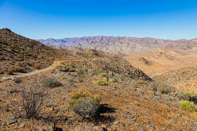
    Mountain road descending through the rugged valleys and arid mountain landscapes of Helskloof Pass in the Richtersveld region of South Africa.09

    Helskloof Pass

    Richtersberg is one of the defining mountain features of the Richtersveld, rising above a landscape of rocky ridges, desert valleys and remote wilderness. Its distinctive profile makes it a focal point for landscape photography throughout the region.

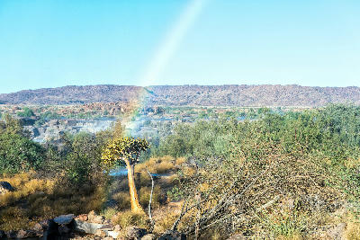
    Quiver tree standing among riverine vegetation with a rainbow created by spray from Augrabies Falls in the background, Northern Cape, South Africa.13

    Augrabies Falls National Park

    Augrabies Falls National Park protects one of South Africa's most dramatic desert river landscapes, where the Orange River cuts through granite bedrock to create deep gorges, rocky plateaus, waterfalls, rapids, and expansive semi-arid wilderness. The park offers a broader experience beyond the famous waterfall itself, combining geology, wildlife, river scenery, and panoramic viewpoints.

    Augrabies Falls cascading into a granite gorge with a rainbow forming in the spray, Northern Cape, South Africa.17

    Augrabies Falls

    Augrabies Falls is one of South Africa's most spectacular waterfalls, where the Orange River plunges through a dramatic granite gorge in the heart of the Northern Cape. The falls form the centrepiece of Augrabies Falls National Park and are renowned for their power, scale, and rugged desert surroundings.

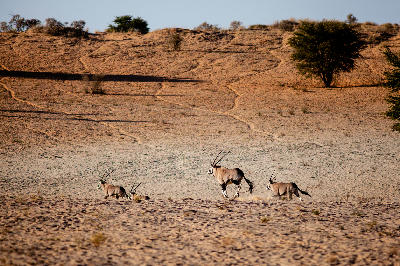
    A group of gemsbok running across sandy Kalahari terrain with low dunes and scattered acacia trees near Nossob.21

    Nossob

    Nossob centres on the remote eastern portion of Kgalagadi, where the Nossob River valley stretches through vast desert plains, isolated waterholes and sparse Kalahari vegetation. Known for its strong wilderness character and predator sightings, the area offers one of the most remote experiences within the park.

    Explore the Full Northern Cape Route21 stops across the Northern Cape

    Overview

    The Northern Cape is structured around several distinct landscape systems spread across a vast geographic area. Namaqualand occupies the western portion of the province with its granite hills, seasonal wildflowers, and arid coastal influences. Further inland, the Kalahari introduces red dunes, dry river systems, and desert grasslands, while the southern regions contain the escarpments, valleys, and semi-desert environments of the Great Karoo.

    Major geological features provide much of the province's visual identity. The Orange River creates fertile corridors through otherwise arid terrain, while mountain ranges, canyon systems, rocky outcrops, and desert plains produce dramatic contrasts across the landscape. Seasonal rainfall patterns, changing vegetation, and exceptional visibility contribute to an environment where light and atmosphere play a significant role throughout the year.

    Photographically, the Northern Cape is defined by scale, geology, and isolation. Vast open landscapes create opportunities for minimalist compositions and long-distance views, while mountains, dunes, canyons, rivers, and seasonal wildflower displays provide powerful focal points. Clear skies, low levels of light pollution, and rapidly changing weather conditions further contribute to the region's reputation as one of South Africa's premier landscape and night-photography destinations.
    Key Photography Subjects

    • Vast desert and semi-desert landscapes
    • Granite mountains, rock formations, and escarpments
    • Seasonal Namaqualand wildflower displays
    • Red Kalahari dunes and arid river systems
    • Canyon landscapes and dramatic geological features
    • Orange River valleys and oasis environments
    • Dark skies, atmospheric light, and remote wilderness scenery

    Gallery

    Workshops in Northern Cape

    No upcoming workshops scheduled for Northern Cape at this time.

    Check back soon or explore other destinations.