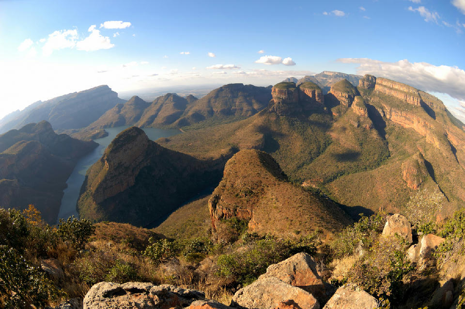
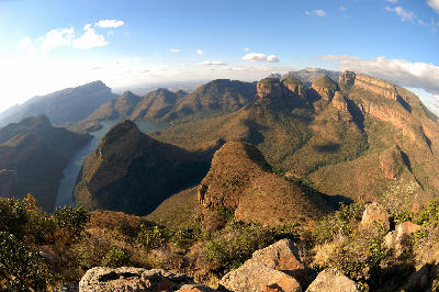
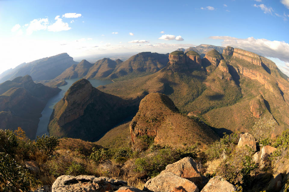
Three Rondavels rock formations overlooking the Blyde River Canyon and winding river below in Mpumalanga, South Africa.

    The Three Rondavels rise above the Blyde River Canyon, forming one of the most iconic landscapes along South Africa's Panorama Route.

    Mpumalanga

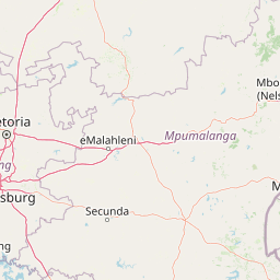
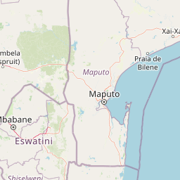
    Mpumalanga is a landscape of escarpments, canyons, waterfalls, grasslands, forests, and wildlife reserves occupying South Africa's northeastern interior. The region includes the Panorama Route, Blyde River Canyon, Kruger National Park, Highveld grasslands, and extensive mountain escarpments that descend dramatically towards the Lowveld and Mozambique.

    The terrain is structured around the Great Escarpment, where high plateaus give way to deep river canyons, forested valleys, waterfalls, and rugged mountain landscapes. Further east, the land transitions into the warm Lowveld, creating vast savannah ecosystems that support some of Africa's most important wildlife populations within Kruger National Park and surrounding conservation areas.

    Seasonal variation influences river flow, vegetation, wildlife activity, atmospheric clarity, and landscape colour throughout the year. Summer thunderstorms, winter clarity, mist-covered escarpments, and changing grassland conditions create constantly evolving scenery across one of South Africa's most geographically diverse regions.

    Geographic discovery

    Explore Mpumalanga by Area

    Choose a part of Mpumalanga to discover its landscapes, photographic character, and locations.

    Open interactive Explore

    Explore Areas in Mpumalanga

    Open in Explore
    View of the Three Rondavels and Blyde Dam in Blyde River Canyon, Mpumalanga, South Africa, seen from the Three Rondavels viewpoint.

    Blyde River Canyon & Panorama Route

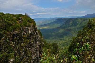
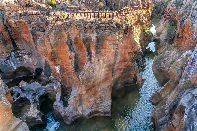
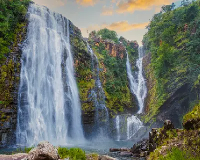
    The Blyde River Canyon & Panorama Route is structured around a series of escarpment viewpoints, river gorges, waterfalls, and elevated mountain ridges extending along the eastern Drakensberg escarpment. Deep valleys separate elevated plateaus while river systems carve dramatic canyons through resistant rock formations. Each valley functions as a distinct geographic unit with strong visual relationships between cliffs, forests, waterfalls, rivers, and distant mountain horizons. Forested ravines occupy sheltered slopes while exposed viewpoints provide extensive views across the Lowveld far below. The visual structure of the region is defined by alternating bands of canyon walls, river valleys, mountain ridges, waterfalls, and forested escarpment terrain. Changes in elevation, weather, and seasonal vegetation create continual variation across the landscape throughout the year.

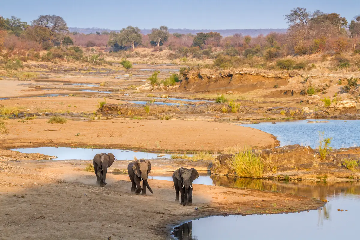
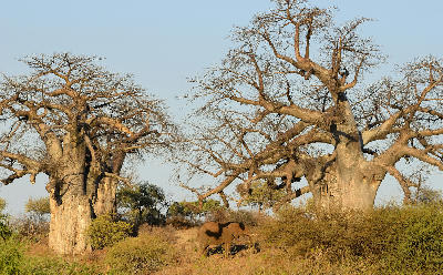
    Three African elephants walking beside a shallow river channel in the dry savanna landscapes of Kruger National Park, South Africa.

    Kruger Central & North

    Kruger Central & North is structured around a network of major river systems flowing eastward across broad savanna and woodland landscapes. The Olifants, Letaba, Shingwedzi and Luvuvhu Rivers form the dominant geographic corridors, linking extensive wilderness areas across the northern half of the park. Each river system supports distinct ecological environments with strong relationships between water, vegetation, geology, and wildlife movement. River valleys provide focal points within vast woodland and savanna landscapes, while surrounding plains, seasonal drainage systems, and scattered rocky outcrops create variety across the broader terrain. The visual structure of the region is defined by alternating bands of riverine woodland, mopane veld, open grassland, rocky outcrops, and distant horizons. Wildlife concentrations, seasonal vegetation changes, dust, storms, and shifting light conditions continually alter the appearance of the landscape while preserving its character as one of Africa's largest protected wilderness systems.

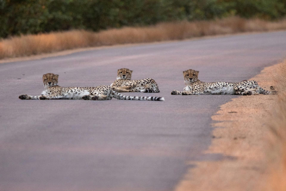
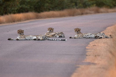
    Three cheetahs resting on a road near Crocodile Bridge in Kruger National Park South, South Africa.

    Kruger National Park South

    Kruger National Park South is structured around a network of perennial rivers flowing eastward through open savanna and woodland landscapes. The Sabie and Crocodile Rivers form the dominant geographic systems, while smaller tributaries, waterholes, and seasonal drainage lines connect surrounding habitats. Each river system functions as a distinct ecological corridor with strong relationships between water, vegetation, and wildlife movement. Riverbanks support dense woodland while surrounding plains transition into open grassland, creating a mosaic of habitats across the broader landscape. The visual structure of the region is defined by alternating bands of riverine forest, open savanna, granite outcrops, and bushveld woodland. Wildlife concentrations, seasonal vegetation changes, and shifting light conditions continually alter the appearance of the landscape while maintaining its character as one of Africa's premier safari environments.

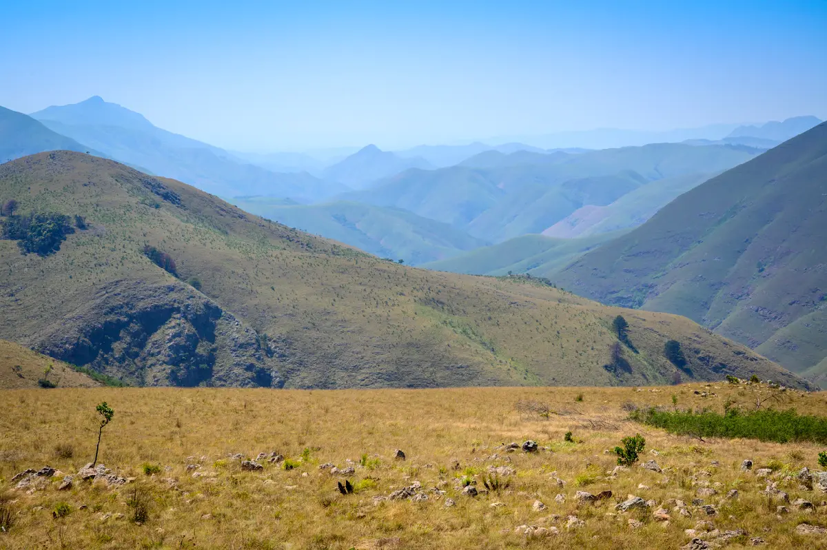
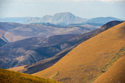
    Panoramic view of the Makhonjwa Mountains near Barberton in Mpumalanga, South Africa.

    Makhonjwa Mountains & Barberton

    The Makhonjwa Mountains & Barberton are structured around a series of ancient folded mountain ranges separated by river valleys and mountain passes. Unlike the canyon landscapes of the Panorama Route or the wildlife plains of the Lowveld, the region is characterised by rugged mountain terrain and globally significant geological formations. Each valley functions as a distinct geographic unit with strong visual relationships between ridgelines, exposed rock formations, rivers, and surrounding mountain slopes. Mountain passes connect these systems while providing elevated viewpoints across the wider landscape. The visual structure of the region is defined by alternating bands of mountain ridges, geological outcrops, river valleys, and escarpment slopes. Changes in elevation, weather, and seasonal vegetation create continual variation across the landscape while exposing some of the oldest surviving sections of Earth's crust.

    Photographic journey

    Mpumalanga Photography Route

    Mpumalanga & Kruger Panorama · 30 stops

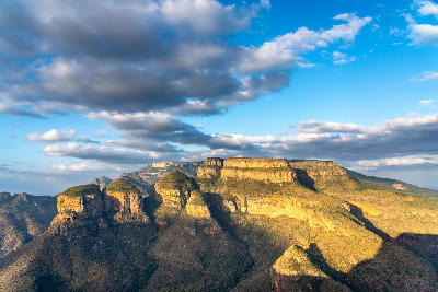
    Golden light illuminating the Three Rondavels rock formations above Blyde River Canyon in Mpumalanga, South Africa, beneath dramatic cloud-filled skies.01

    Three Rondavels

    Three Rondavels is the most iconic viewpoint in the Blyde River Canyon, overlooking three massive rock formations that rise above the canyon floor and Blyde Dam below. Named for their resemblance to traditional African rondavel huts, the formations create one of South Africa's most recognisable landscapes. The combination of towering cliffs, deep canyon scenery and expansive views makes this one of the flagship photography locations on the Panorama Route.

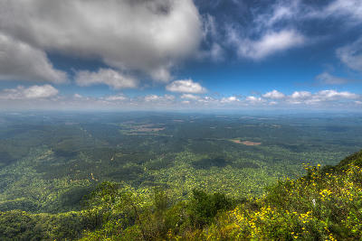
    Panoramic view from Wonder View across the Lowveld and escarpment landscapes of Mpumalanga, South Africa.07

    Wonder View

    Wonder View is the highest publicly accessible viewpoint on the Panorama Route, offering expansive views from the Mpumalanga Escarpment across the Lowveld below. Perched near the edge of the escarpment, the viewpoint provides a vast sense of scale, with rolling hills, distant plains and layered ridges stretching towards the horizon. Its elevation and accessibility make it one of the region's most impressive panoramic lookouts.

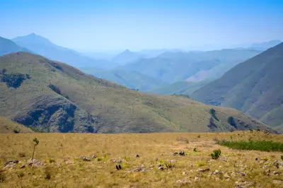
    Panoramic view of the Makhonjwa Mountains near Barberton in Mpumalanga, South Africa.13

    Makhonjwa Mountains & Barberton

    The Makhonjwa Mountains & Barberton are structured around a series of ancient folded mountain ranges separated by river valleys and mountain passes. Unlike the canyon landscapes of the Panorama Route or the wildlife plains of the Lowveld, the region is characterised by rugged mountain terrain and globally significant geological formations. Each valley functions as a distinct geographic unit with strong visual relationships between ridgelines, exposed rock formations, rivers, and surrounding mountain slopes. Mountain passes connect these systems while providing elevated viewpoints across the wider landscape. The visual structure of the region is defined by alternating bands of mountain ridges, geological outcrops, river valleys, and escarpment slopes. Changes in elevation, weather, and seasonal vegetation create continual variation across the landscape while exposing some of the oldest surviving sections of Earth's crust.

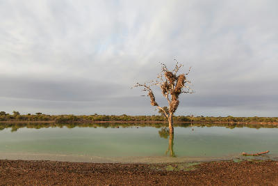
    Dead tree standing in Sunset Dam near Lower Sabie in Kruger National Park with calm water and dramatic evening clouds.18

    Sunset Dam

    Sunset Dam is one of the most famous wildlife-viewing locations in southern Kruger National Park. Situated just a few kilometres east of Lower Sabie, the dam attracts a constant flow of wildlife and birdlife throughout the year. Its easy roadside access, reliable water and open views make it one of the park's most rewarding locations for photography.

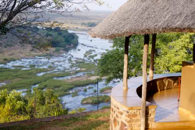
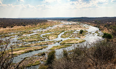
    View from Olifants Rest Camp across the Olifants River in Kruger National Park, South Africa.24

    Olifants Rest Camp

    Olifants Rest Camp occupies one of the most spectacular positions in Kruger National Park, perched high above the Olifants River with sweeping views across the river valley below. The camp is renowned for its elevated setting, dramatic landscapes and combination of wildlife and scenery, making it one of the most visually distinctive rest camps in the park.

    The Luvuvhu River flowing through dense riverine vegetation near Crooks Corner in Kruger National Park.30

    Crooks Corner

    Crooks Corner is one of the most remote and historically significant destinations in Kruger National Park. Located in the far north of the park, it marks the meeting point of South Africa, Zimbabwe and Mozambique near the confluence of the Luvuvhu and Limpopo Rivers. The combination of river landscapes, fever tree forests and frontier history gives the location a unique identity unlike anywhere else in Kruger.

    Explore the Full Mpumalanga Route30 stops across Mpumalanga

    Overview

    Mpumalanga is structured around a series of major landscape systems extending from the Highveld plateau to the Lowveld savannah. The escarpment forms the dominant geographic feature, creating dramatic elevation changes that shape river systems, canyons, forests, waterfalls, and mountain scenery throughout the province. These environments gradually transition eastward into the wildlife-rich plains of the Lowveld.

    Each section of the region possesses a distinct visual identity while remaining connected through the broader escarpment system. The Panorama Route is defined by deep canyons, waterfalls, cliffs, and mountain viewpoints, while the Blyde River Canyon contains some of Africa's most spectacular geological landscapes. Further east, Kruger National Park introduces vast savannah plains, river systems, and wildlife habitats, creating one of the continent's premier conservation landscapes.

    The visual structure of the region is defined by elevation, water, geology, and ecosystem diversity. Escarpments, canyons, waterfalls, forests, grasslands, rivers, and savannah landscapes create layered compositions across the province. Mist, seasonal rainfall, dramatic cloud formations, and changing light conditions continually influence colour, texture, and atmosphere throughout the landscape.
    Key Photography Subjects

    • Escarpments, cliffs, and dramatic mountain viewpoints
    • Deep river canyons and geological formations
    • Waterfalls, rivers, and forested valleys
    • Highveld grasslands and rolling upland landscapes
    • Savannah ecosystems and African wildlife
    • Sunrise, mist, and atmospheric escarpment scenery
    • Seasonal light, weather systems, and landscape contrasts

    Gallery

    Workshops in Mpumalanga

    No upcoming workshops scheduled for Mpumalanga at this time.

    Check back soon or explore other destinations.