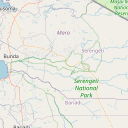
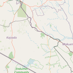
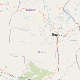
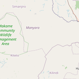
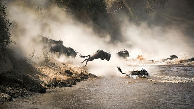
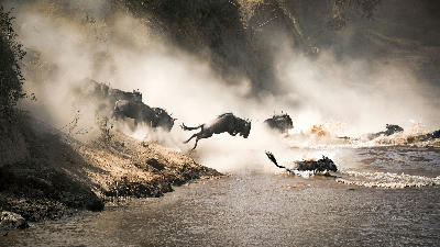
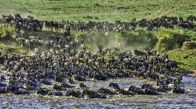
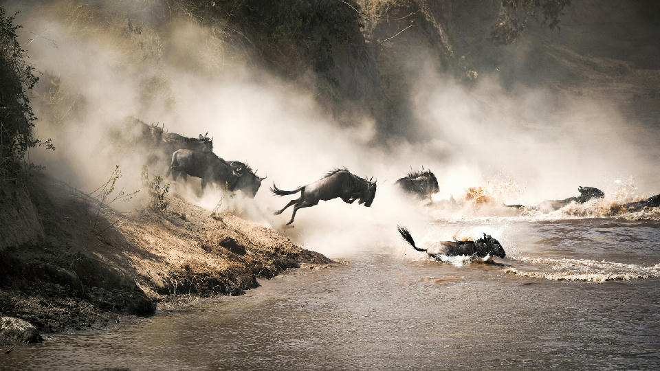
Wildebeest crossing the Mara River during the Great Migration between Serengeti National Park in Tanzania and the Maasai Mara in Kenya.

    Wildebeest plunge into the Mara River during the Great Migration between Serengeti National Park, Tanzania, and the Maasai Mara, Kenya, one of Africa's greatest wildlife spectacles.

    Northern Safari Circuit

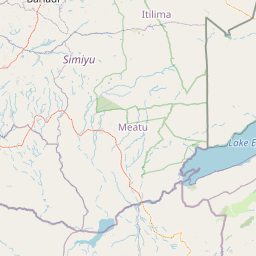
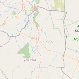
    The Northern Safari Circuit is Tanzania's most celebrated wildlife region, where vast savannas, volcanic highlands, ancient calderas, Rift Valley escarpments and seasonal lakes combine to create one of the world's greatest safari landscapes. Encompassing the Serengeti Ecosystem, Ngorongoro Highlands, Tarangire, Lake Manyara and the foothills of Mount Kilimanjaro, the region contains an extraordinary concentration of wildlife, geological diversity and iconic African scenery that has become synonymous with East African safari photography.

    The landscape is shaped by the East African Rift System, whose volcanic activity created towering mountains, expansive plains, alkaline lakes and the remarkable Ngorongoro volcanic complex. Ancient lava flows, fertile volcanic soils and seasonal river systems support vast grasslands, acacia woodlands and wetlands that sustain one of the richest concentrations of wildlife anywhere on Earth. From the open plains of the Serengeti to the towering baobabs of Tarangire and the forested crater rims of Ngorongoro, each landscape forms part of an interconnected ecosystem extending across northern Tanzania.

    Seasonal variation continually reshapes the region throughout the year. Rainfall influences vegetation, river systems and wildlife movements, while the Great Migration drives one of the world's greatest natural spectacles across the Serengeti Ecosystem. Dry-season conditions provide exceptional wildlife concentrations and clear atmospheric visibility, while the green season transforms the landscape with lush grasslands, dramatic thunderstorms, migratory birds and vibrant natural colour.

    Geographic discovery

    Explore Northern Safari Circuit by Area

    Choose a part of Northern Safari Circuit to discover its landscapes, photographic character, and locations.

    Open interactive Explore

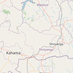
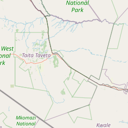
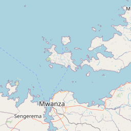
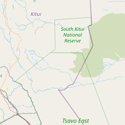
    Explore Areas in Northern Safari Circuit

    Open in Explore
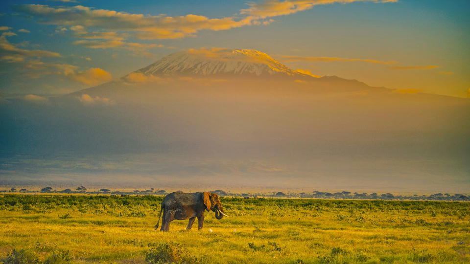
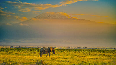
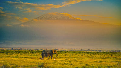
    African elephant grazing beneath snow-capped Mount Kilimanjaro in Amboseli National Park, Kenya.

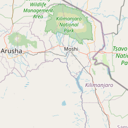
    Kilimanjaro National Park

    Kilimanjaro National Park is structured around Mount Kilimanjaro's three volcanic cones and the dramatic changes in landscape that occur with increasing elevation. The lower mountain is cloaked in dense montane rainforest rich in wildlife and endemic plants, above which lies an extensive heath and moorland zone characterised by giant groundsels and lobelias. Higher still, the alpine desert consists of lava fields, volcanic ridges and barren slopes leading to the glaciers, ice fields and volcanic crater surrounding Uhuru Peak. Features such as the Shira Plateau, Barranco Wall and The Saddle each represent distinctive stages within this remarkable ascent. Each elevation zone possesses its own photographic identity. The rainforest offers towering trees, moss-covered trails and abundant birdlife, while the heathlands are dominated by surreal high-altitude vegetation found nowhere else in East Africa. The alpine desert reveals dramatic volcanic formations, lava towers and sweeping mountain vistas, before giving way to glaciers, crater rims and the snow-covered summit that has become one of Africa's most recognisable landscapes. Few mountains in the world display such dramatic environmental transitions over such a relatively short horizontal distance. The visual character of Kilimanjaro National Park is defined by immense scale, dramatic elevation and constantly changing mountain weather. Clouds frequently wrap around the lower slopes while the summit rises into clear blue skies above, creating striking contrasts between tropical forest and permanent ice. Clear mornings provide exceptional long-distance views across the surrounding plains, while sunrise and sunset illuminate the glaciers, volcanic cliffs and high-altitude landscapes with rich golden and pink alpenglow.

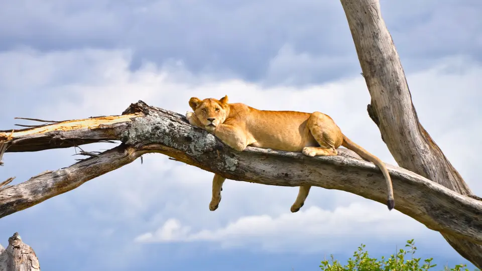
    Lioness resting on a large fallen tree against dramatic skies in Lake Manyara National Park, Tanzania.

    Lake Manyara National Park

    Lake Manyara National Park is structured around the dramatic meeting of the Great Rift Valley escarpment and Lake Manyara itself. Towering cliffs rise abruptly above the western boundary before descending through dense groundwater forests into acacia woodland, open grasslands, seasonal marshes and the alkaline lake. This remarkable transition between mountain and lake creates one of Tanzania's most varied protected landscapes, despite the park's relatively modest size. Each habitat contributes a distinctive photographic character. The groundwater forest offers towering fig and mahogany trees beneath a dense canopy where elephants, baboons and blue monkeys are commonly encountered. Open woodland supports giraffes, buffalo and the park's famous tree-climbing lions, while marshes and lake margins provide habitat for hippos, pelicans, storks and seasonal flamingo flocks. Beyond the lake, sweeping views across the Rift Valley floor provide spectacular landscape compositions that contrast beautifully with the intimate wildlife encounters found within the forest. The visual identity of Lake Manyara National Park is defined by dramatic contrast. Sheer escarpments overlook shimmering alkaline waters, lush evergreen forest gives way to open savanna and seasonal wetlands stretch toward distant volcanic highlands. Morning mist beneath the escarpment, reflections across the lake and warm evening light filtering through ancient trees combine to create one of northern Tanzania's most photogenic national parks.

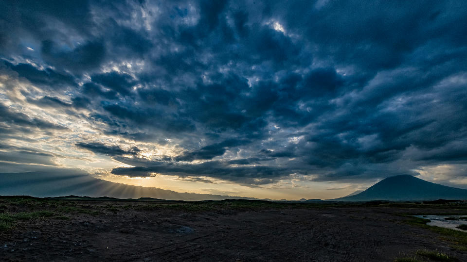
    Dark storm clouds illuminated by sunrise over Ol Doinyo Lengai volcano and the Great Rift Valley near Lake Natron in northern Tanzania.

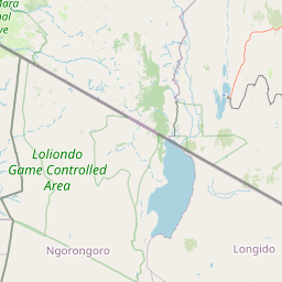
    Lake Natron & Rift Valley

    Lake Natron & Rift Valley are structured around the eastern branch of the Great Rift Valley, where tectonic movement created dramatic fault escarpments, volcanic mountains, lava plains and alkaline lakes stretching across northern Tanzania. Lake Natron forms the geological centrepiece of the region beneath the active volcano Ol Doinyo Lengai, while surrounding volcanic landscapes including Empakaai Crater and neighbouring Rift Valley escarpments illustrate the immense geological forces that continue to shape East Africa today. Each landscape contributes a distinct photographic identity. Lake Natron is renowned for its vivid mineral-rich waters, flamingo breeding colonies and vast reflective lakebed, while Ol Doinyo Lengai dominates the skyline as the world's only active carbonatite volcano. Volcanic ash plains, lava fields, deeply eroded escarpments and crater rims create dramatic geological compositions, while seasonal grasslands soften the surrounding landscape during the rainy season. Together these contrasting environments form one of Africa's most visually distinctive volcanic regions. The visual character of Lake Natron & Rift Valley is defined by immense geological scale, where towering escarpments overlook expansive volcanic plains and shimmering alkaline lakes beneath enormous African skies. Mineral-rich shorelines, volcanic peaks, lava flows and seasonal cloud formations continually reshape the scenery, creating exceptional opportunities for landscape photography unlike anywhere else in Tanzania.

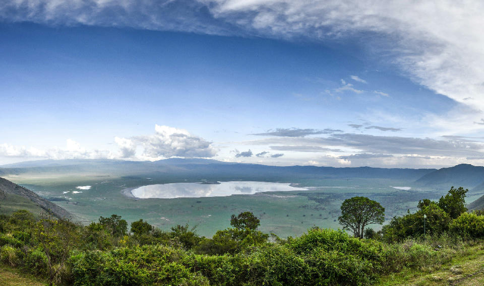
    Panoramic landscape of Ngorongoro Crater and Lake Magadi surrounded by the volcanic highlands of Tanzania's Ngorongoro Conservation Area.

    Ngorongoro Conservation Area

    The Ngorongoro Conservation Area is structured around a series of interconnected volcanic landscapes, each offering a distinctive photographic character. At its centre lies the Ngorongoro Crater, an immense volcanic caldera supporting one of Africa's highest concentrations of wildlife. To the northeast, Empakaai Crater contains a deep volcanic lake surrounded by forested crater walls, while nearby Olmoti Crater offers rolling montane grasslands, waterfalls and panoramic viewpoints. Further west, the short-grass plains of Ndutu provide the southern extension of the Serengeti Ecosystem and host the annual wildebeest calving season, while Olduvai Gorge preserves one of the world's most important records of early human history. Each landscape contributes to the conservation area's remarkable diversity. Dense montane forests cloak the higher elevations, volcanic grasslands support large grazing mammals and predators, crater lakes attract flamingos and other waterbirds, while broad open plains merge seamlessly into the neighbouring Serengeti. The coexistence of spectacular geology, abundant wildlife, living Maasai culture and internationally significant archaeological heritage makes the conservation area unlike any other protected landscape in Africa. The visual character of the Ngorongoro Conservation Area is defined by dramatic changes in elevation, sweeping crater panoramas and constantly changing mountain weather. Forested crater rims descend into wildlife-filled grasslands, volcanic peaks rise above distant horizons and seasonal cloud, mist and afternoon thunderstorms continually reshape the landscape. Sunrise and sunset illuminate the crater walls with warm golden light, producing some of Tanzania's finest landscape photography.

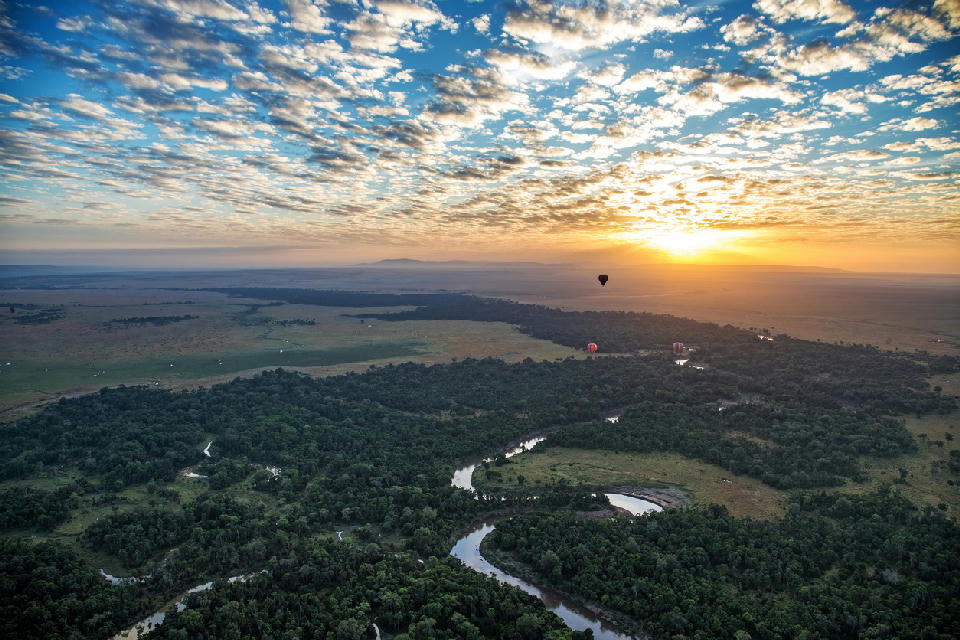
    Hot air balloons flying above the Mara River and northern Serengeti landscape at sunrise in Tanzania.

    Serengeti National Park

    The Serengeti Ecosystem is structured around several interconnected landscapes, each contributing a distinctive ecological and photographic character. The Central Serengeti around Seronera forms the year-round wildlife core, while the Western Corridor follows the Grumeti River toward Lake Victoria. The Northern Serengeti borders Kenya's Maasai Mara and is famous for dramatic Mara River crossings, while the Southern Serengeti and Ndutu Plains provide nutrient-rich short-grass plains where the migration gathers for calving. Granite kopjes, seasonal rivers and scattered acacia woodlands link these regions into a single functioning ecosystem. Each landscape offers a unique visual identity. Endless grasslands dominate the southern plains, granite kopjes rise dramatically above the central savanna, riverine forests follow the Grumeti and Mara Rivers, and rolling wooded hills become more common toward the western and northern boundaries. These changing habitats support exceptional biodiversity, from vast grazing herds to lions, cheetahs, leopards, elephants, giraffes, hyenas and hundreds of bird species. The visual character of the Serengeti is defined by immense open horizons, isolated acacia trees, rocky kopjes and constantly changing wildlife activity beneath expansive African skies. Morning mist, dust raised by migrating herds, dramatic thunderstorms and warm golden light create endlessly changing conditions that have made the Serengeti one of the most photographed wilderness landscapes on Earth.

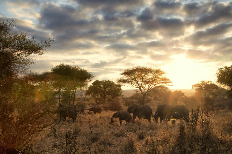
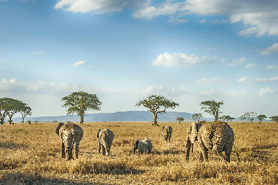
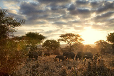
    Family of African bush elephants walking through the savanna at sunrise in Tarangire National Park, Tanzania.

    Tarangire National Park

    Tarangire National Park is structured around the Tarangire River, the ecological lifeline that shapes the park's wildlife movements and vegetation. Ancient baobab-covered ridges overlook broad acacia savannas, while seasonal floodplains, riverine woodland and the Silale Swamp create important habitats that support wildlife throughout the year. Granite kopjes, winding river valleys and scattered termite mounds add further diversity to a landscape that changes dramatically with the seasons. Each habitat contributes its own photographic character. Towering baobab trees dominate the skyline and provide some of the park's most recognisable compositions, while riverine woodland offers shade for elephants, giraffes and buffalo during the hottest months. Open grasslands support zebra, wildebeest and numerous antelope species, attracting lions, leopards and cheetahs, while seasonal wetlands become important feeding areas for elephants, waterbirds and migratory species. Together these habitats create one of northern Tanzania's richest wildlife environments. The visual character of Tarangire National Park is defined by monumental baobab trees rising above golden grasslands, winding river channels lined with acacia woodland and enormous elephant herds moving through dusty savannas beneath expansive African skies. Morning mist, dust illuminated by low-angle sunlight and dramatic afternoon thunderstorms continually transform the landscape, producing some of East Africa's most iconic safari photography.

    Photographic journey

    Northern Safari Circuit Photography Route

    Northern Safari Circuit · 25 stops

    Wildebeest crossing the Mara River during the Great Migration in the northern Serengeti, Tanzania.01

    Mara River

    The Mara River is the most famous wildlife crossing point within the Serengeti, where the annual Great Migration reaches its dramatic climax. During the migration season, vast herds of wildebeest and zebra attempt to cross the crocodile-filled river, creating one of the world's most spectacular natural events.

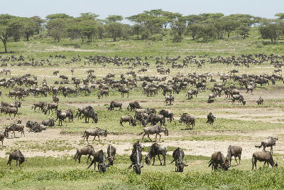
    Large herds of migrating wildebeest grazing across the Ndutu Plains during the Great Migration calving season in Tanzania.06

    Ndutu Plains

    Ndutu Plains is one of Africa's greatest wildlife photography destinations, renowned for the Great Migration calving season when hundreds of thousands of wildebeest gather across its vast grasslands. Located within the Ngorongoro Conservation Area, it offers exceptional predator action and some of Tanzania's most spectacular safari experiences.

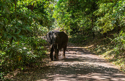
    African elephant walking along a forest road beneath the dense canopy of the Groundwater Forest in Lake Manyara National Park, Tanzania.11

    Groundwater Forest

    The Groundwater Forest is a lush evergreen woodland within Lake Manyara National Park, sustained year-round by underground springs flowing from the Great Rift Valley escarpment. Towering mahogany and fig trees create a cool, shaded environment that contrasts dramatically with the surrounding savanna and alkaline lake, making it one of the park's most distinctive ecosystems.

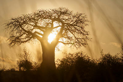
    Silhouette of an ancient baobab tree at sunrise in Baobab Valley, Tarangire National Park, Tanzania.15

    Baobab Valley

    Baobab Valley is one of Tarangire National Park's most distinctive landscapes, where enormous ancient baobab trees dominate the surrounding savanna. These iconic giants, often visited by elephants and other wildlife, create one of Tanzania's most recognisable photography locations and are a defining feature of the park.

    African elephant grazing beneath snow-capped Mount Kilimanjaro in Amboseli National Park, Kenya.20

    Kilimanjaro National Park

    Kilimanjaro National Park is structured around Mount Kilimanjaro's three volcanic cones and the dramatic changes in landscape that occur with increasing elevation. The lower mountain is cloaked in dense montane rainforest rich in wildlife and endemic plants, above which lies an extensive heath and moorland zone characterised by giant groundsels and lobelias. Higher still, the alpine desert consists of lava fields, volcanic ridges and barren slopes leading to the glaciers, ice fields and volcanic crater surrounding Uhuru Peak. Features such as the Shira Plateau, Barranco Wall and The Saddle each represent distinctive stages within this remarkable ascent. Each elevation zone possesses its own photographic identity. The rainforest offers towering trees, moss-covered trails and abundant birdlife, while the heathlands are dominated by surreal high-altitude vegetation found nowhere else in East Africa. The alpine desert reveals dramatic volcanic formations, lava towers and sweeping mountain vistas, before giving way to glaciers, crater rims and the snow-covered summit that has become one of Africa's most recognisable landscapes. Few mountains in the world display such dramatic environmental transitions over such a relatively short horizontal distance. The visual character of Kilimanjaro National Park is defined by immense scale, dramatic elevation and constantly changing mountain weather. Clouds frequently wrap around the lower slopes while the summit rises into clear blue skies above, creating striking contrasts between tropical forest and permanent ice. Clear mornings provide exceptional long-distance views across the surrounding plains, while sunrise and sunset illuminate the glaciers, volcanic cliffs and high-altitude landscapes with rich golden and pink alpenglow.

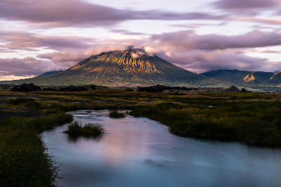
    Ol Doinyo Lengai volcano illuminated by early morning light above a reflective stream and Maasai plains near Lake Natron, Tanzania.25

    Ol Doinyo Lengai

    Ol Doinyo Lengai is an active stratovolcano rising above the eastern Rift Valley and is the only volcano in the world known to erupt carbonatite lava. Revered by the Maasai as the "Mountain of God," it dominates the landscape surrounding Lake Natron and offers one of Tanzania's most dramatic volcanic environments. Its steep slopes, volcanic ash fields and sweeping views across the Great Rift Valley make it a distinctive destination for adventurous hikers and landscape photographers.

    Explore the Full Northern Safari Circuit Route25 stops across Northern Safari Circuit

    Overview

    The Northern Safari Circuit is structured around a series of interconnected ecosystems that together form one of Africa's most important wildlife landscapes. The Serengeti Ecosystem occupies the western plains, linked directly to the Ngorongoro Conservation Area, while Tarangire National Park, Lake Manyara and the Great Rift Valley create additional wildlife habitats extending eastward toward Mount Kilimanjaro. Seasonal migration routes, river systems and volcanic soils connect these landscapes into a single ecological network supporting extraordinary biodiversity.

    Each landscape contributes a distinct photographic identity. The Serengeti is renowned for endless grasslands, predator-prey interactions and the Great Migration, while Ngorongoro is dominated by volcanic craters, forested highlands and wildlife-rich crater floors. Tarangire is characterised by giant baobab trees and immense elephant herds, Lake Manyara by dramatic Rift Valley escarpments and alkaline lakes, and the Kilimanjaro foothills by cultivated landscapes framed by Africa's highest mountain.

    The visual structure of the region is defined by broad savannas, volcanic mountains and dramatic escarpments rising above open plains. Acacia trees punctuate expansive horizons, seasonal rivers weave through wildlife-rich grasslands and volcanic peaks provide striking backdrops across much of northern Tanzania. Changing weather, wildlife migrations and exceptional equatorial light continually transform the appearance of the landscape throughout the year.
    Key Photography Subjects

    • The Great Migration across the Serengeti plains
    • Lions, elephants, cheetahs and abundant wildlife
    • Ngorongoro Crater and volcanic landscapes
    • Giant baobab trees and Tarangire elephant herds
    • Rift Valley escarpments and alkaline lakes
    • Mount Kilimanjaro rising above surrounding plains
    • Golden savanna light, dramatic storms and African sunsets

    Gallery

    Workshops in Northern Safari Circuit

    No upcoming workshops scheduled for Northern Safari Circuit at this time.

    Check back soon or explore other destinations.