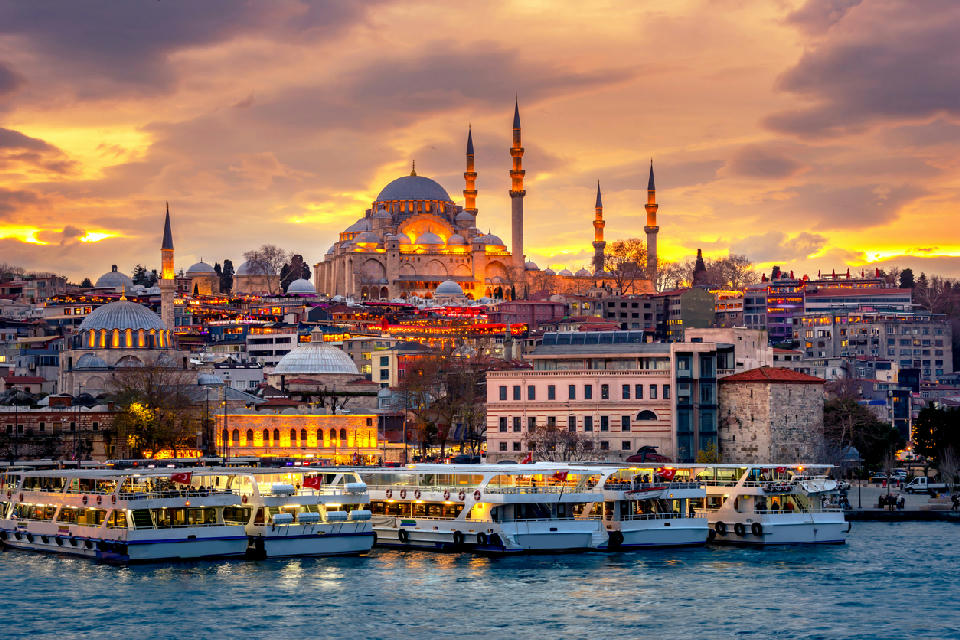
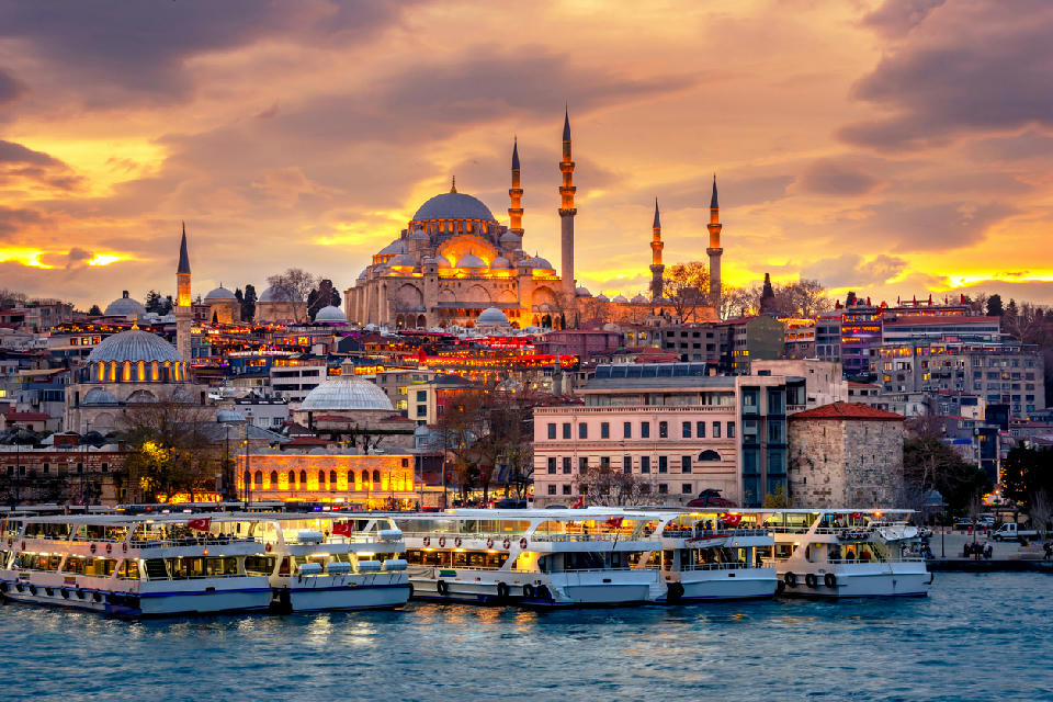
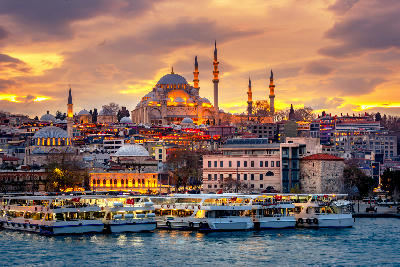
The Süleymaniye Mosque rises above Istanbul’s historic peninsula, with views extending across the Bosphorus toward Galata Bridge and Galata Tower.
Turkey
Turkey occupies a unique geographic position at the junction of southeastern Europe and western Asia, resulting in a highly varied landscape shaped by tectonic activity, erosion, and long human settlement. The country spans multiple climatic zones, from Mediterranean coasts to continental interiors and high mountain regions.
Its terrain includes long coastlines along the Aegean, Mediterranean, and Black Seas, broad plateaus in central Anatolia, deeply incised river valleys, and extensive mountain systems. Volcanic formations, sedimentary basins, and karst landscapes contribute to strong visual diversity across relatively short distances.
Seasonal variation affects light quality, vegetation, and atmospheric conditions. Coastal regions experience milder winters and dry summers, while interior and eastern regions undergo more pronounced seasonal extremes, influencing colour, contrast, and accessibility throughout the year.
Explore Turkey by Region
Choose a region to discover its landscapes, photographic character, and destinations.
Explore Regions in Turkey
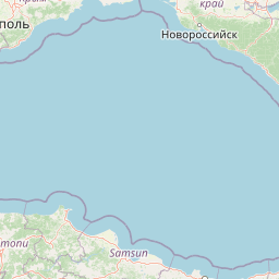
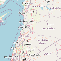
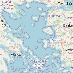
Black Sea Mountains
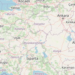
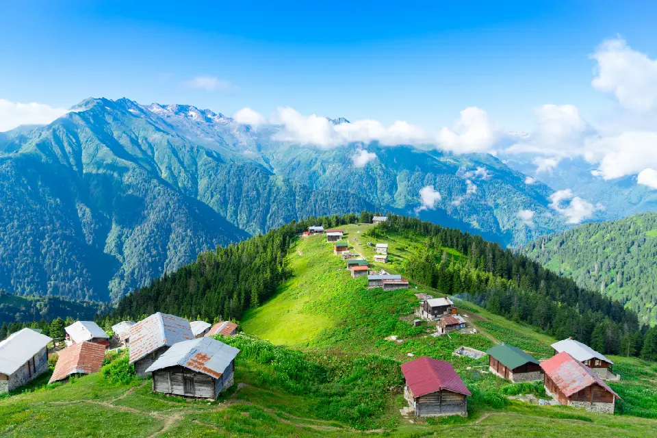
The region is structured around the eastern Black Sea mountain system, where steep ranges rise rapidly inland from Turkey’s northern coast. Deep river valleys cut through densely forested slopes before reaching alpine plateaus, rocky ridges, glacial basins, and high summits. The Kaçkar Mountains form the region’s highest and most rugged terrain, creating a landscape of pronounced vertical relief and frequently changing mountain weather. Human settlement follows the valleys and high pastures. Traditional villages, wooden houses, stone bridges, tea plantations, and seasonal yayla settlements occupy narrow pockets of usable land between forested slopes and mountain ridges. Ayder Plateau and Uzungöl represent two of the region’s best-known landscapes, while extensive areas beyond them retain a much more remote mountain character. Photographically, the Black Sea Mountains work through elevation, vegetation, atmosphere, and layered terrain. Forested valleys and tea-covered hillsides provide intricate patterns at lower elevations, while waterfalls, alpine meadows, glacial lakes, and rugged peaks dominate higher ground. Mist, low cloud, rain, snow, autumn colour, and shafts of changing light can dramatically alter visibility and mood, making atmospheric conditions an important part of the region’s visual identity.
Cappadocia & Central Anatolia
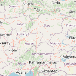
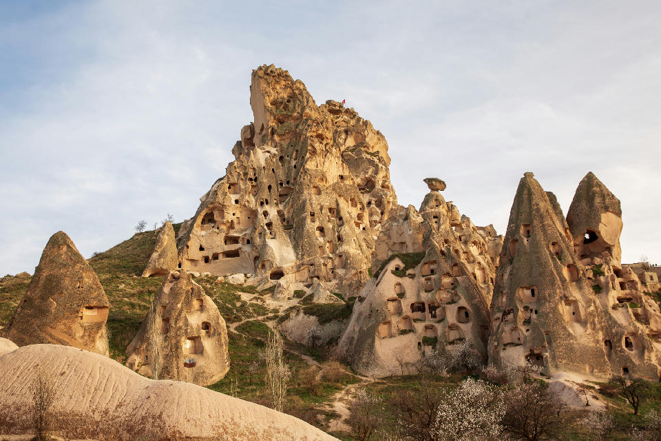
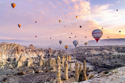
Cappadocia & Central Anatolia are structured around a vast volcanic plateau whose softer layers of tuff have been progressively sculpted into some of the world's most unusual geological formations. Around Göreme, Uçhisar, Paşabağ and Zelve, erosion has created dense concentrations of fairy chimneys, pinnacles and deeply carved valleys, while human occupation has added cave dwellings, rock-cut churches and monasteries. Farther southwest, Ihlara Valley cuts dramatically through the plateau, exposing steep canyon walls lined with historic settlements and religious sites. Each landscape contributes a distinctive photographic identity. Göreme provides the classic combination of fairy chimneys, cave architecture and hot-air balloons, while Uçhisar rises above the surrounding valleys as one of Cappadocia's dominant natural landmarks. Paşabağ and Zelve contain some of the region's most concentrated volcanic formations, while Love, Rose and Red valleys reveal layered cliffs, eroded ridges and constantly changing colours. Derinkuyu and Kaymaklı expose the extraordinary subterranean dimension of Cappadocia, with networks of chambers and passages extending deep below the landscape. Beyond Cappadocia's volcanic formations, the landscape opens dramatically toward Ihlara Valley and Lake Tuz. Ihlara combines a deeply incised river canyon with rock-cut churches, villages and Selime Monastery, while Lake Tuz introduces an entirely different visual environment of immense horizons, salt crusts, shallow reflective water and open steppe. Together these landscapes reveal the extraordinary geological and human diversity of Central Anatolia, ranging from intimate cave interiors and sculpted valleys to some of Turkey's most expansive minimalist landscapes.
Eastern Anatolia
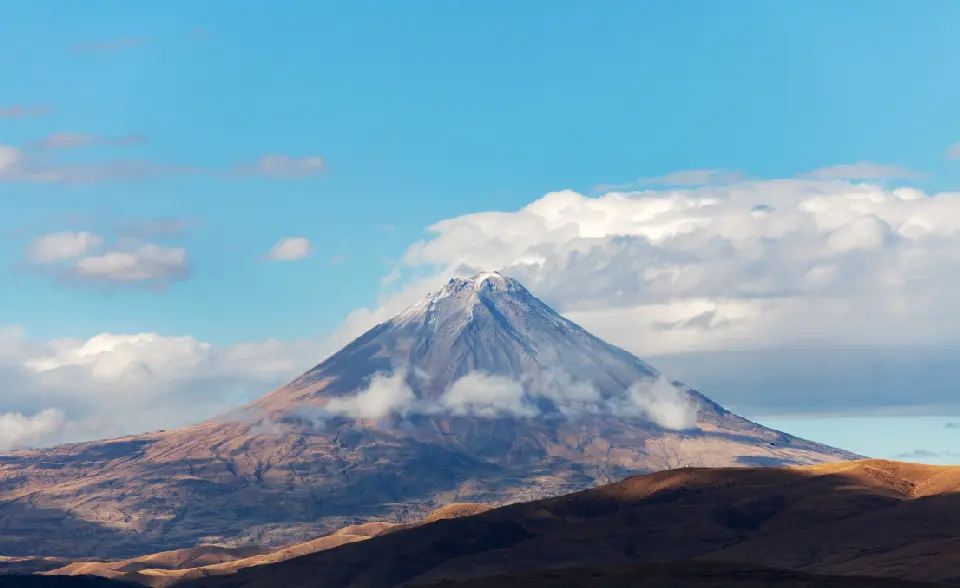
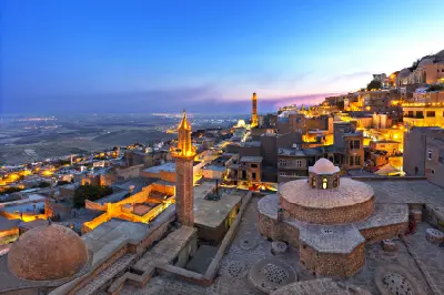
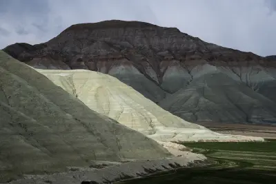
Eastern Anatolia occupies a vast elevated plateau formed by tectonic uplift and volcanic activity, with mountain ranges and isolated volcanoes rising above broad basins and high plains. Mount Ararat, Turkey’s highest summit, dominates the far east with its permanently snow-streaked volcanic cone, while the Lake Van basin is framed by volcanic massifs including Süphan and Nemrut. Rivers, wetlands, lava formations, and high-altitude grasslands add further variety to this immense interior landscape. Human settlement has developed around strategic valleys, trade routes, fertile basins, and lake shores for thousands of years. Urartian fortresses, Armenian churches and monasteries, Ottoman monuments, Kurdish villages, and historic towns remain scattered throughout the region. Around Doğubayazıt, the monumental İshak Pasha Palace stands against the barren mountains, while Akdamar Island preserves one of Lake Van’s most significant medieval landmarks. Photographically, Eastern Anatolia is defined by scale, isolation, and the relationship between monumental landscapes and historic structures. Snow-covered volcanoes rise above immense plains, Lake Van provides expansive water-and-mountain compositions, and isolated architecture creates strong focal points within otherwise open terrain. Sunrise and sunset emphasise volcanic relief and mountain layers, while winter snow, spring greenery, storm light, and clear high-altitude conditions continually transform the region.
Istanbul
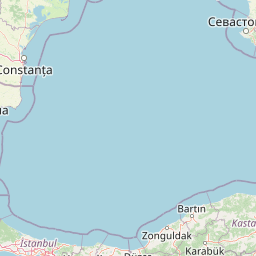
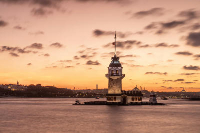
Istanbul’s landscape is structured around its waterways. The Bosphorus acts as a central axis, separating continents while visually linking shorelines through ferries, bridges, and layered cityscapes. Hills rise behind the waterfronts, producing elevated viewpoints that reveal dense rooflines, minarets, and shoreline geometry. Historic areas are concentrated along the Golden Horn and the Bosphorus entrance, where narrow streets, courtyards, and monumental architecture coexist within compact districts. Modern expansion extends outward across ridges and plateaus, creating a complex urban gradient from historic core to contemporary city. Seasonal change affects colour, vegetation, and light quality. Winter brings softer contrast and frequent haze, while summer introduces stronger light, deeper shadows, and increased clarity across water and skyline. These conditions shape how scale, repetition, and detail are read throughout the city.
Pamukkale & Ancient Wonders
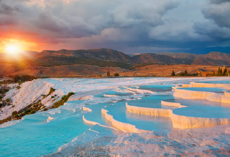
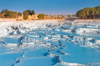
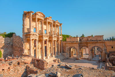
The landscape is anchored by Pamukkale’s travertine formations and the extensive ruins of Hierapolis occupying the plateau immediately above them. Thermal water has shaped the hillside over thousands of years, producing cascading white terraces, mineral deposits, and shallow pools, while the ancient city contains monumental gates, streets, baths, temples, a theatre, and one of Anatolia’s largest surviving necropolises. Beyond Pamukkale, the wider region contains important archaeological landscapes associated with successive Anatolian, Greek, Roman, and Byzantine civilizations. Ancient cities and monumental ruins occupy plains, hillsides, and elevated sites, creating a broader historical landscape in which architecture and archaeology remain closely connected to the geography of western Turkey. Photographically, the region works through texture, geometry, scale, and the contrast between natural and constructed forms. Travertine terraces create abstract patterns and reflections, while columns, theatres, temples, and weathered stone provide strong architectural subjects. Elevated viewpoints, low-angle sunlight, mist, clouds, and golden-hour light can reveal layers of mountains and plains behind the archaeological sites.
Turquoise Coast
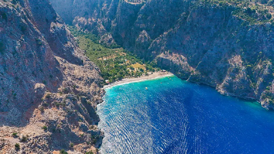
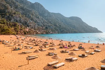
The Turquoise Coast is structured around the close relationship between the Taurus Mountains and the Mediterranean Sea. Limestone massifs and forested ridges frequently reach the shoreline, creating steep headlands, cliffs, offshore islands, enclosed bays, and elevated viewpoints. Between them lie broader beaches, lagoons, river deltas, and fertile coastal plains. Much of the western and central coast formed part of ancient Lycia, leaving an extensive archaeological landscape of rock-cut tombs, theatres, temples, fortifications, and ruined settlements. Historic routes connected these communities across difficult mountain terrain, while sheltered natural harbours supported maritime trade and coastal settlement. The visual character of the region is defined by the contrast between turquoise water, pale limestone, forested mountains, and open Mediterranean skies. Elevated terrain provides long coastal views across bays and islands, while beaches, lagoons, cliffs, archaeological sites, harbours, and traditional settlements create a varied sequence of landscapes along the coast.
Overview
Turkey’s geography is structured around the Anatolian Plateau, bordered by mountain ranges to the north and south and opening to multiple seas. Elevation shifts are often abrupt, with plains giving way to rugged mountains, river gorges, and elevated basins. Volcanic activity has produced distinctive landforms in several regions.
Light conditions vary by latitude, elevation, and season. Clear skies are common in summer across much of the country, while spring and autumn introduce atmospheric haze, cloud layers, and changing vegetation. Winter snow affects higher elevations and eastern regions, altering landscape structure and access.
Human settlement is deeply integrated into the landscape, with historic towns, agricultural terraces, and archaeological sites embedded within natural environments. This creates frequent overlaps between natural, cultural, and historical photographic subjects.
Key Photography Subjects
- Coastal landscapes along the Aegean, Mediterranean, and Black Seas
- Volcanic landforms, plateaus, and eroded valleys
- Mountain ranges, highlands, and alpine environments
- River valleys, basins, and interior plains
- Historic settlements, ruins, and cultural landscapes
- Agricultural land use and terraced terrain
- Seasonal light, arid textures, and atmospheric condition
Gallery
Workshops in Turkey
No upcoming workshops scheduled for Turkey at this time.
Check back soon or explore other destinations.