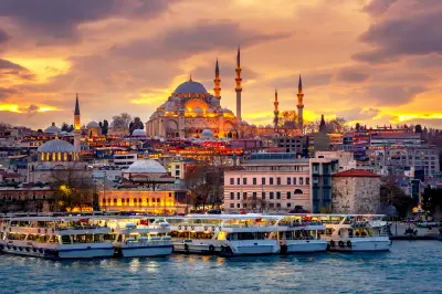
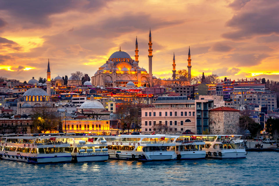
Istanbul waterfront and ferries at sunset with the Süleymaniye Mosque rising above the historic peninsula.

    Ferries line Istanbul’s waterfront beneath the Süleymaniye Mosque as sunset illuminates the historic peninsula.

    Istanbul

    Istanbul is a large metropolitan city positioned on the Bosphorus Strait, where the European and Asian landmasses meet. Its geography is defined by water corridors, rolling hills, and a dense urban fabric shaped by centuries of layered development.

    The city spans both sides of the Bosphorus, with the Golden Horn and Sea of Marmara forming additional natural boundaries that structure neighbourhoods and sightlines. Urban form varies from tightly packed historic districts to broader waterfront areas and elevated residential zones.

    Light conditions are strongly influenced by surrounding water, weather systems moving in from the Black Sea and Marmara, and seasonal variation, creating frequent changes in visibility, contrast, and atmospheric depth.

    Geographic discovery

    Explore Istanbul by Area

    Choose a part of Istanbul to discover its landscapes, photographic character, and locations.

    Open interactive Explore

    Explore Areas in Istanbul

    Open in Explore
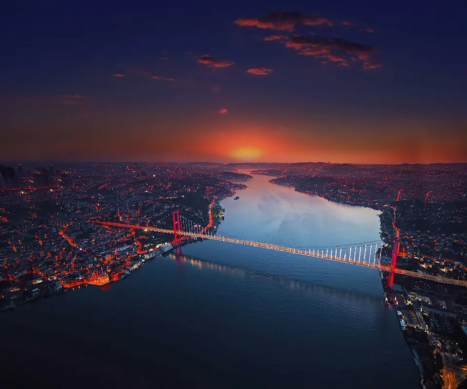
    Aerial view of the Bosphorus at dusk with the 15 July Martyrs Bridge connecting the European and Asian sides of Istanbul.

    Bosphorus

    The Bosphorus has shaped Istanbul's geography, history, and strategic importance for more than two millennia. Its narrow channel controls maritime passage between the Black Sea and Mediterranean world, while its opposing European and Asian shores provided natural defensive positions and sites for successive settlements, fortifications, ports, and imperial residences. During the Ottoman period, the shoreline became increasingly associated with palaces, gardens, mosques, villages, and timber waterfront mansions known as yalıs. Today these historic elements coexist with ferry terminals, modern neighbourhoods, major road bridges, fishing boats, cargo vessels, and intense maritime traffic, giving the waterway a distinctive combination of historic architecture and contemporary urban life. Photographically, the Bosphorus works through water, architecture, scale, and constantly changing atmospheric conditions. Long views compress mosques, waterfront buildings, wooded hills, ships, and bridges into layered compositions, while ferries provide changing perspectives directly from the water. Sunrise and sunset can silhouette Istanbul's hills and minarets, while mist, reflected light, and blue hour transform the strait as bridges and waterfront landmarks illuminate after dark.
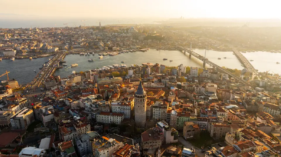
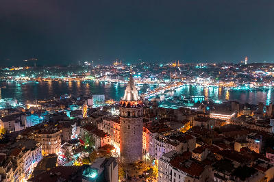
    Aerial view of Galata Tower, Galata Bridge and the Golden Horn at golden hour in Istanbul.

    Golden Horn

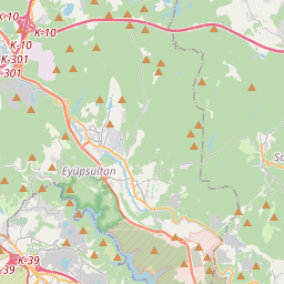
    The Golden Horn played a central role in the development of Byzantine Constantinople and later Ottoman Istanbul. Its deep, sheltered waters provided a natural harbour protected from the stronger currents of the Bosphorus, encouraging the growth of maritime trade, naval facilities, workshops, and settlements along both shores. The surrounding districts preserve an unusually concentrated record of Istanbul's history. Eminönü and the historic peninsula are dominated by monumental Ottoman architecture and commercial streets, while Fener and Balat retain colourful houses, steep lanes, churches, and traces of long-established Greek Orthodox and Jewish communities. Farther inland, Eyüp developed around one of the city's most important religious complexes and historic cemeteries. Photographically, the Golden Horn works through layers of water, architecture, movement, and skyline. Galata Bridge provides fishing, ferry, and street scenes, while elevated viewpoints reveal mosques, minarets, domes, bridges, and densely built hillsides extending across the city. Sunrise and late-afternoon light can illuminate the historic peninsula, while blue hour brings reflections, ferry lights, and illuminated landmarks across the harbour.

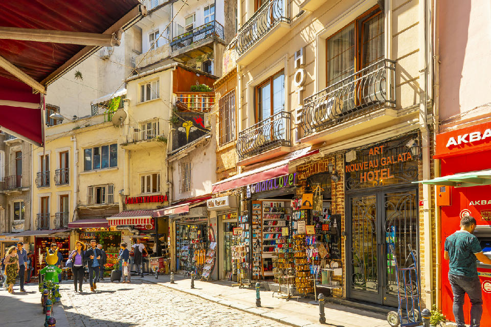
    Karaköy district, Istanbul

    Karaköy

    Karaköy is a waterfront district on the northern side of Istanbul’s Golden Horn, historically linked to port activity and trade. The area combines late Ottoman and early modern buildings with narrow streets and active ferry connections. Its position between the historic peninsula and Beyoğlu makes it a transitional urban zone with layered architectural character.

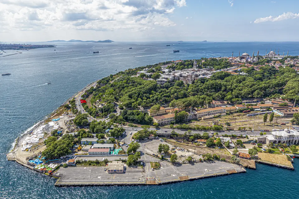
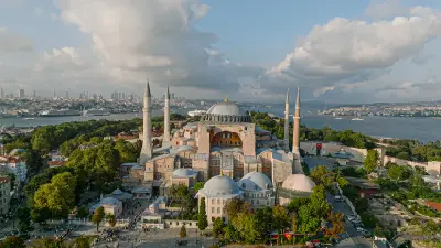
    Aerial view of Sultanahmet in Istanbul, with Topkapı Palace, Hagia Sophia, the Blue Mosque and the Sea of Marmara.

    Sultanahmet

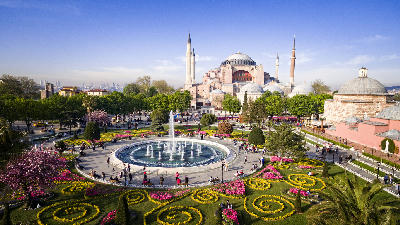
    Sultanahmet developed around the ceremonial and political centre of Constantinople, capital of the Eastern Roman and Byzantine empires. The Hippodrome formed the focus of public life, while imperial palaces, churches, cisterns, and civic buildings occupied the surrounding hills. Hagia Sophia, completed in the sixth century, remains the most monumental surviving expression of Byzantine architecture in the district. Following the Ottoman conquest of Constantinople in 1453, the area became an important centre of the Ottoman capital. Topkapı Palace served as the principal residence and administrative seat of the sultans for centuries, while major mosques and religious complexes reshaped the skyline. The seventeenth-century Blue Mosque created one of Istanbul's defining architectural compositions opposite Hagia Sophia. Photographically, Sultanahmet combines monumental architecture with unusually dense visual layering. Domes and minarets can be photographed from streets, courtyards, gardens, rooftops, and elevated viewpoints, while interiors reveal tilework, calligraphy, stonework, mosaics, and immense architectural spaces. Early morning offers quieter squares and softer light, while sunset and blue hour transform the skyline as illuminated domes and minarets rise above the historic peninsula.

    Photographic journey

    Istanbul Photography Route

    Istanbul Photographic Circuit · 22 stops

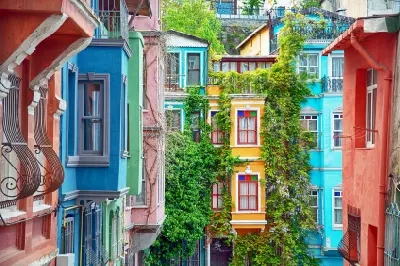
    Brightly painted historic houses with bay windows and climbing greenery in Balat, Istanbul.01

    Balat

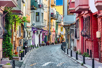
    Balat is a historic neighbourhood on the southern shore of Istanbul's Golden Horn, characterised by steep streets, tightly packed buildings and layers of Ottoman-era urban architecture. The district was historically home to substantial Greek Orthodox, Jewish and Armenian communities, reflected in its churches, synagogues and surviving residential buildings. Colourfully painted façades and traditional houses have become particularly associated with the neighbourhood, while its narrow streets retain a markedly different character from monumental central Istanbul.

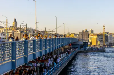
    People fishing from Galata Bridge in Istanbul with waterfront restaurants below and Galata Tower in the background.05

    Galata Bridge

    Galata Bridge spans the mouth of the Golden Horn, connecting Istanbul's historic peninsula with Karaköy and the districts surrounding Galata. The bridge occupies one of the city's busiest waterfront settings, surrounded by ferries, mosques, fishing boats and dense layers of historic architecture. Local fishermen lining its upper deck have become one of Istanbul's characteristic street scenes, while restaurants occupy the lower level close to the water. Its central position provides expansive views towards the surrounding skyline and waterways.

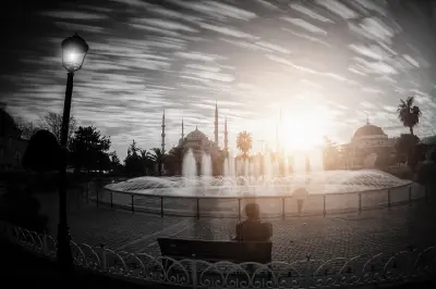
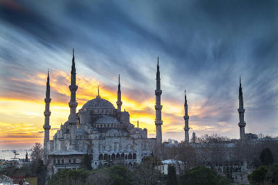
    Sultanahmet Square fountain at sunset with the Blue Mosque silhouetted in the background, Istanbul, Turkey.09

    Sultanahmet Square & Hippodrome

    Sultanahmet Square occupies the site of Constantinople's ancient Hippodrome, once a vast arena used for chariot racing, ceremonies and public gatherings during the Byzantine period. Although the original stadium has largely disappeared, several monuments from its central axis survive, including the Egyptian Obelisk of Theodosius, the Serpent Column and the Walled Obelisk. Today, the open square connects Hagia Sophia and the Blue Mosque and remains one of the principal public spaces within Istanbul's historic centre.

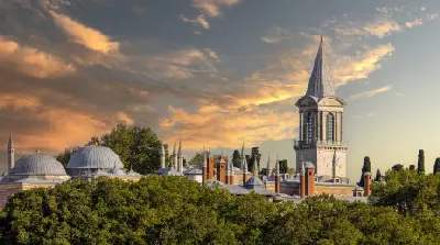
    Topkapı Palace in Istanbul at sunset, showing Ottoman domes and the Tower of Justice beneath dramatic golden clouds.14

    Topkapı Palace

    Topkapı Palace is an extensive Ottoman palace complex occupying a prominent position on Istanbul's historic peninsula above the Bosphorus and Golden Horn. Developed from the 15th century onwards, it served as the principal residence and administrative centre of the Ottoman sultans for several centuries. Successive courtyards contain ceremonial gates, pavilions, audience chambers, gardens and the imperial harem, decorated with elaborate tilework and architectural detail. Terraces along the palace grounds provide broad views across Istanbul's surrounding waterways.

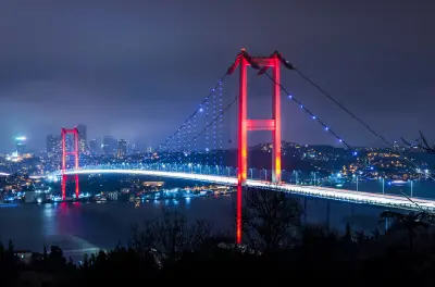
    15 July Martyrs Bridge illuminated in red and blue at night over the Bosphorus in Istanbul, Turkey.18

    Bosphorus Bridge

    The Bosphorus Bridge is a large suspension bridge spanning the Bosphorus Strait and connecting the European and Asian sides of Istanbul. Its long deck, vertical towers, and cable structure create a strong linear form across open water. The bridge is a dominant infrastructural feature within the city’s landscape.

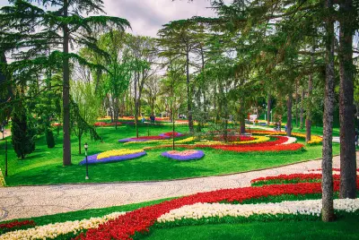
    Red, white, yellow and purple tulip beds among mature trees and lawns in Emirgan Park during Istanbul's spring Tulip Festival.22

    Emirgan Park

    Emirgan Park is a large landscaped park on the European side of the Bosphorus, extending across wooded hills above the waterfront. The grounds contain mature trees, ornamental ponds, formal gardens and historic Ottoman-era pavilions connected by winding paths. Emirgan is particularly associated with Istanbul's spring tulip displays, when extensive beds of tulips create bands of colour throughout the gardens. Outside the flowering season, woodland, lawns and elevated sections give the park a quieter landscape character.

    Explore the Full Istanbul Circuit22 stops across Istanbul

    Overview

    Istanbul’s landscape is structured around its waterways. The Bosphorus acts as a central axis, separating continents while visually linking shorelines through ferries, bridges, and layered cityscapes. Hills rise behind the waterfronts, producing elevated viewpoints that reveal dense rooflines, minarets, and shoreline geometry.

    Historic areas are concentrated along the Golden Horn and the Bosphorus entrance, where narrow streets, courtyards, and monumental architecture coexist within compact districts. Modern expansion extends outward across ridges and plateaus, creating a complex urban gradient from historic core to contemporary city.

    Seasonal change affects colour, vegetation, and light quality. Winter brings softer contrast and frequent haze, while summer introduces stronger light, deeper shadows, and increased clarity across water and skyline. These conditions shape how scale, repetition, and detail are read throughout the city.

    Key Photography Subjects

    • Bosphorus Strait and ferry crossings
    • Waterfront skylines and layered urban hills
    • Historic architecture, domes, and minarets
    • Bridges, shoreline infrastructure, and harbours
    • Dense urban fabric and roofline patterns
    • Waterways shaping neighbourhood boundaries
    • Seasonal light, haze, and weather over the city

    Gallery

    Workshops in Istanbul

    No upcoming workshops scheduled for Istanbul at this time.

    Check back soon or explore other destinations.