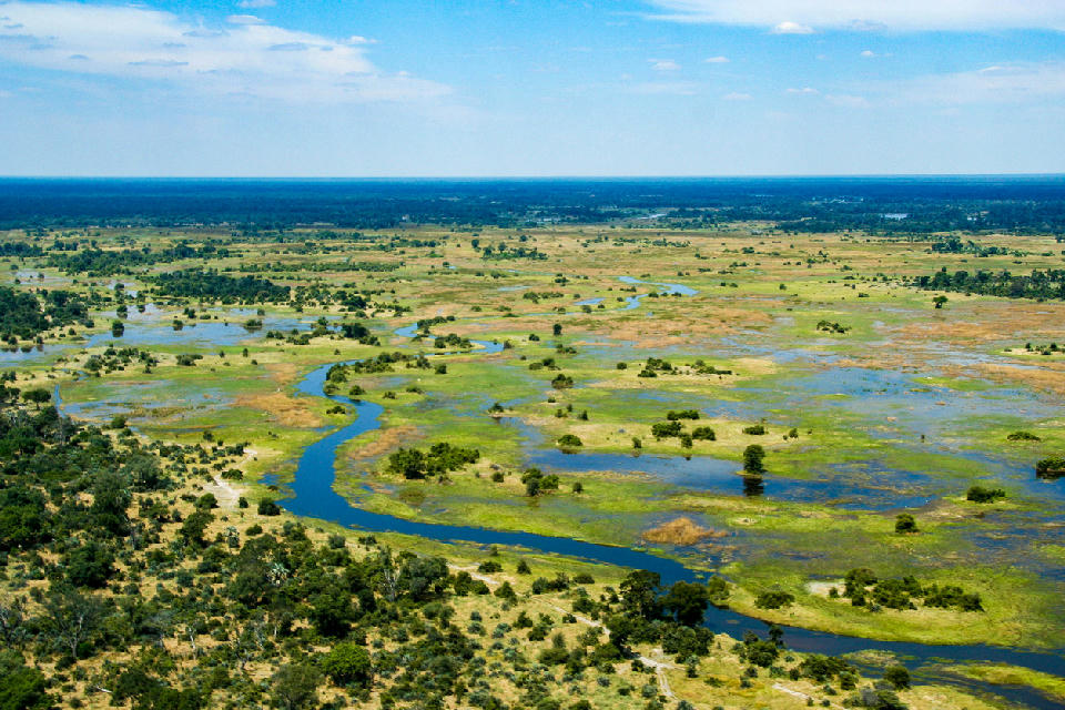
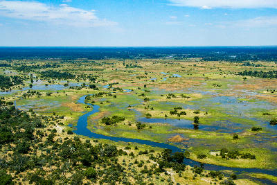
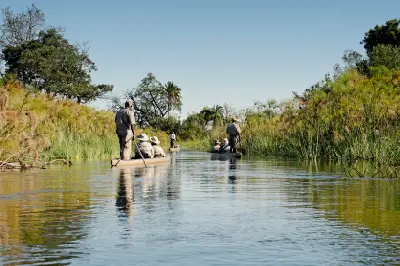
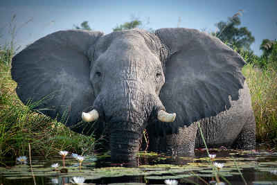
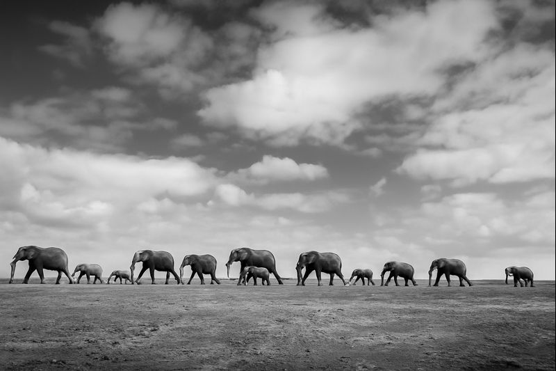
Aerial view of the Okavango Delta with winding river channels and expansive wetlands in Botswana.

    An aerial view of the Okavango Delta reveals winding channels, seasonal floodplains and lush wetlands that form Botswana's iconic inland oasis.

    Botswana

    Botswana is a vast wilderness landscape defined by desert basins, seasonal wetlands, ancient river systems and some of Africa's most important wildlife ecosystems. Covering much of the interior of southern Africa, the country is characterised by expansive open spaces, low human population density and a remarkable diversity of natural environments ranging from the floodplains of the Okavango Delta to the dune fields of the Kalahari Desert. Together these landscapes create one of the continent's premier destinations for wildlife, landscape and wilderness photography.

    The country's geography is shaped by the interaction between water and aridity. Seasonal floodwaters entering from Angola sustain the Okavango Delta deep within the Kalahari Basin, creating a unique inland wetland system surrounded by vast semi-arid landscapes. Elsewhere, ancient river channels, salt pans, grasslands, mopane woodlands and desert dunes form interconnected ecosystems that support exceptional concentrations of wildlife adapted to some of Africa's harshest environmental conditions.

    Seasonal variation transforms much of Botswana throughout the year. Flood cycles influence the extent of the Okavango Delta, rainfall patterns alter vegetation and wildlife distribution, and changing water availability continuously reshapes the appearance of the landscape. Winter generally brings dry conditions, clear visibility and concentrated wildlife activity, while summer introduces dramatic thunderstorms, green landscapes and migratory birdlife.

    Geographic discovery

    Explore Botswana by Area

    Choose a part of Botswana to discover its landscapes, photographic character, and locations.

    Open interactive Explore

    Explore Areas in Botswana

    Open in Explore
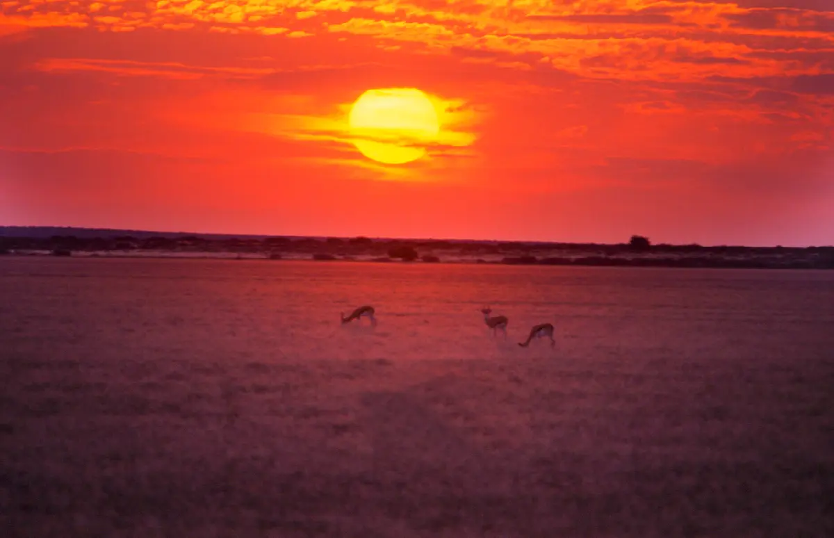
    Antelope grazing on the open plains of Piper Pan at sunset in the Central Kalahari Game Reserve, Botswana.

    Central Kalahari

    The Central Kalahari is structured around an immense interior basin where fossil river systems, ancient dune fields and seasonal grasslands extend across one of the largest protected areas in Africa. Deception Valley, Passarge Valley and numerous shallow pans preserve the remnants of ancient drainage systems that once carried water through the Kalahari, while today's landscape is shaped primarily by seasonal rainfall and long periods of aridity. Each landscape contributes a distinct character to the region. Deception Valley is renowned for its sweeping open plains and abundant wildlife following summer rains, while the wider Central Kalahari Game Reserve protects immense wilderness areas where rolling grasslands, isolated acacia trees and ancient fossil valleys dominate the scenery. Together these environments create one of Africa's purest expressions of open semi-arid wilderness. The visual structure of the region is defined by uninterrupted horizons, gently rolling terrain and isolated landscape features emerging from vast grass-covered plains. Solitary trees, fossil river channels, distant dunes and seasonal pans create simple yet powerful compositions, while dramatic skies, dust, thunderstorms and changing desert light continually transform the landscape throughout the year.

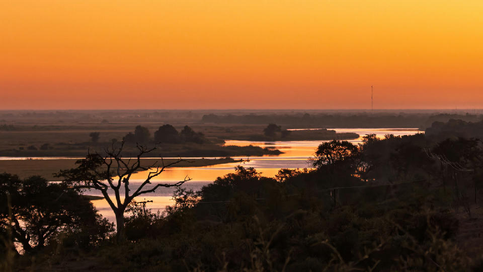
    Panoramic sunset over the Kwando River floodplain with winding waterways and silhouetted trees in the Linyanti region of Botswana.

    Chobe & Linyanti

    Chobe & Linyanti are structured around a series of interconnected river systems that form one of Africa's most important wildlife corridors. The Chobe River defines the eastern section of the region, while the Linyanti, Kwando and Savuti wetlands create an extensive network of floodplains, channels and seasonal marshes extending across northern Botswana. These permanent water sources sustain wildlife throughout the year and connect directly with the wider ecosystems of the Okavango Delta. Each landscape contributes a distinct character to the region. The Chobe Riverfront is renowned for enormous elephant herds gathering along its banks, while Linyanti combines secluded waterways, riverine woodland and exceptional predator populations. Savuti contrasts with both, offering open grasslands, ancient marshes and changing watercourses that have become famous for dramatic wildlife interactions. Together these environments create one of Botswana's richest and most varied safari landscapes. The visual structure of the region is defined by winding rivers, broad floodplains and dense woodland bordering permanent water. Elephants, buffalo and other wildlife gather along riverbanks, reedbeds reflect changing light across calm waterways and mature trees frame expansive floodplain vistas. Morning mist, golden sunsets and seasonal floodwaters continually reshape the appearance of the landscape throughout the year.

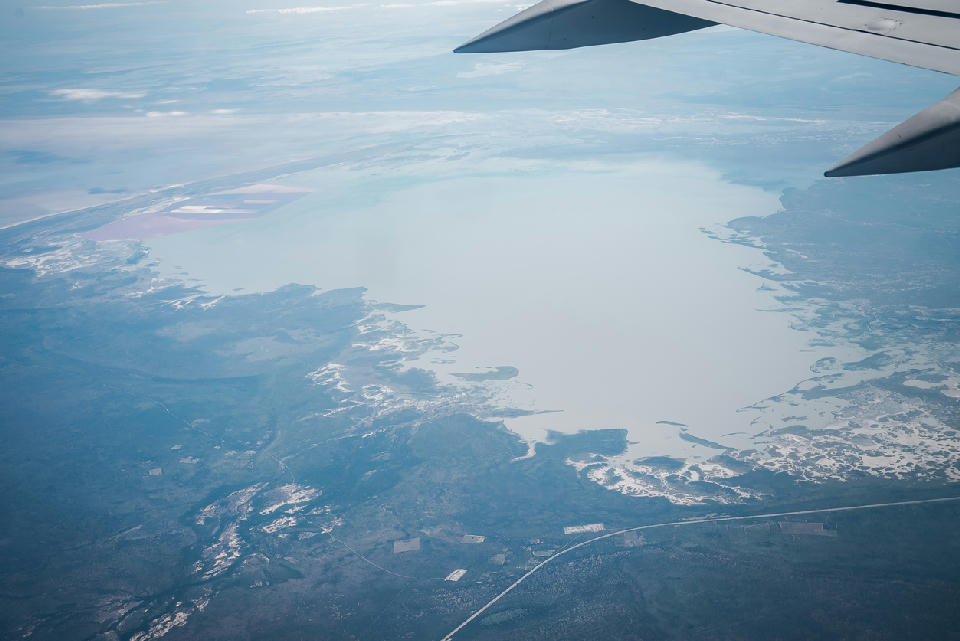
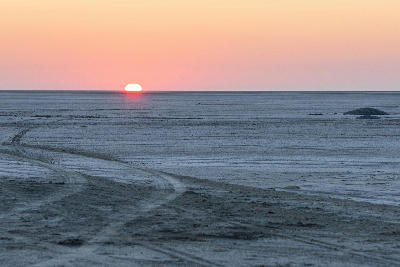
    Aerial view of the Makgadikgadi Pans showing expansive white salt flats in Botswana.

    Makgadikgadi & Nxai Pan

    Makgadikgadi & Nxai Pan are structured around the immense remains of an ancient inland lake that once dominated much of northern Botswana. Over thousands of years, changing river systems and climatic shifts caused the lake to disappear, leaving behind one of the world's largest salt pan landscapes. Today the region consists of vast open pans, fossil beaches, isolated rocky islands and surrounding grasslands that preserve the geological history of this remarkable environment. Each landscape contributes a unique element to the region's identity. The Makgadikgadi Pans provide seemingly endless white horizons and dramatic minimalist scenery, while Nxai Pan combines seasonal grasslands, abundant wildlife and the iconic Baines' Baobabs. Kubu Island rises from the surrounding salt flats as an isolated granite outcrop covered with ancient baobabs, creating one of Botswana's most recognisable landscape landmarks. The visual structure of the region is defined by immense open space, geometric horizons and isolated natural features emerging from otherwise featureless terrain. White salt surfaces stretch toward distant horizons, solitary baobabs provide striking focal points and seasonal floodwaters introduce reflections, birdlife and changing textures across the landscape. Together these elements create one of Africa's most distinctive wilderness environments.

    Aerial view of the winding river channels and floodplains of the Okavango Delta in Botswana.

    Okavango Delta

    The Okavango Delta is structured around an immense network of distributary channels that spread across the Kalahari Basin to form one of the world's largest inland wetland systems. Permanent waterways branch into countless lagoons, reed-lined channels, floodplains and islands, creating a dynamic landscape where water continuously reshapes the surrounding environment. This unique hydrological system supports one of Africa's most productive ecosystems despite being surrounded by semi-arid wilderness. Each landscape contributes a distinct character to the Delta. Moremi Game Reserve protects the eastern floodplains and permanent wetlands, Chief's Island forms the ecological heart of the Delta with exceptional wildlife concentrations, while Khwai and Xakanaxa combine seasonal floodplains, winding waterways and rich predator habitats. Together these interconnected landscapes create one of the world's most diverse wetland environments. The visual structure of the Delta is defined by winding blue channels weaving through expansive floodplains, palm-fringed islands rising above surrounding wetlands and broad grasslands extending toward distant horizons. Reflections across calm waterways, seasonal floodwaters, papyrus reed beds and abundant wildlife combine to produce an ever-changing landscape unlike anywhere else in Africa.

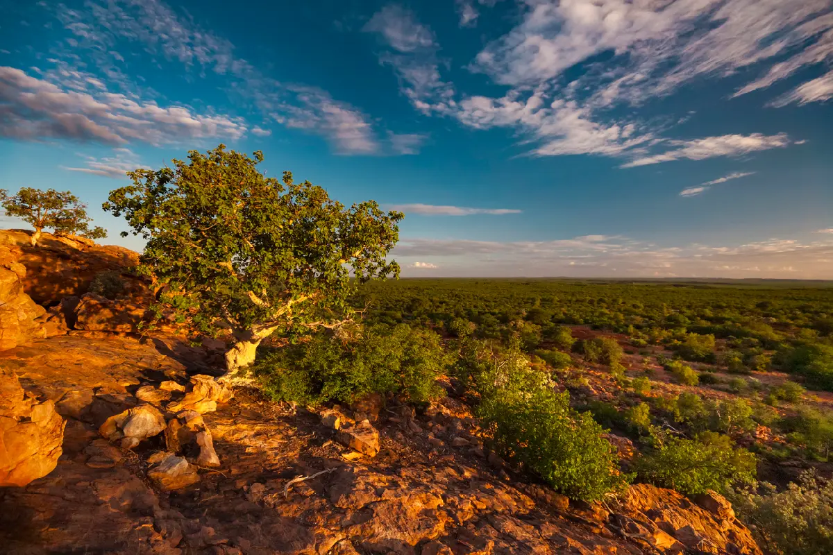
    Rock fig tree growing on sandstone cliffs above the Limpopo Valley in golden evening light near the Mapungubwe Cultural Landscape, South Africa.

    Tuli Block & Eastern Botswana

    The Tuli Block & Eastern Botswana are structured around the Limpopo River and a series of ancient sandstone ridges, granite kopjes and elevated plateaus that extend along Botswana's southeastern frontier. Unlike much of the country, where expansive plains dominate the landscape, this region is characterised by rugged relief, rocky escarpments and deeply weathered geological formations that have evolved over hundreds of millions of years. Each landscape contributes to the region's distinctive identity. Mashatu is renowned for its remarkable wildlife and giant baobabs set among sandstone hills, while the wider Tuli Block preserves extensive wilderness areas, dramatic rock formations and secluded river valleys. The Limpopo Valley links these landscapes together, creating natural corridors that support elephants, predators and a rich diversity of birdlife throughout the year. The visual structure of the region is defined by rugged topography rising above broad river valleys and semi-arid woodland. Massive baobabs stand silhouetted against expansive skies, weathered sandstone formations create elevated viewpoints and winding river channels provide strong compositional elements through the landscape. Together these features produce one of Botswana's most distinctive photographic environments.

    Photographic journey

    Botswana Photography Route

    Botswana Photographic Circuit · 21 stops

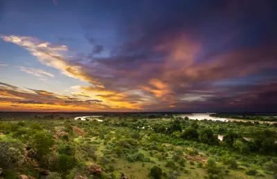
    Sunset over the Limpopo Valley at the confluence of the Limpopo and Shashe rivers on the Botswana border.01

    Limpopo Valley

    The Limpopo Valley forms Botswana's eastern frontier, where the Limpopo River winds through broad floodplains, sandstone hills and riverine forests. This diverse landscape supports abundant wildlife and links the wilderness of the Tuli Block with the neighbouring conservation areas of South Africa and Zimbabwe.

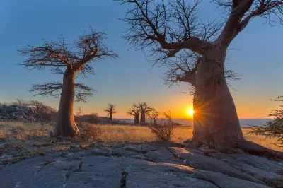
    Sunset behind ancient baobab trees on Kubu Island in the Makgadikgadi salt pans, Botswana.05

    Kubu Island

    Kubu Island is one of Botswana's most remarkable landscape destinations, where ancient granite outcrops and towering baobab trees rise from the vast Makgadikgadi salt pans. Its remote setting and distinctive scenery make it a favourite for landscape and night photography.

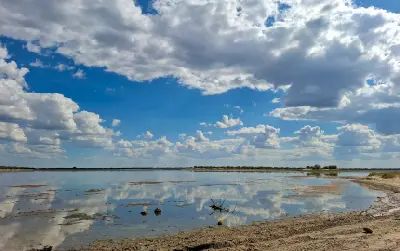
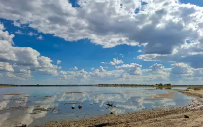
    Storm clouds reflected in the shallow waters of Nxai Pan after the rainy season in Botswana.09

    Nxai Pan

    The Makgadikgadi Pans are among the world's largest salt flats, where immense open landscapes, seasonal wetlands and dramatic skies create one of Africa's most distinctive photography destinations. Their vast scale and ever-changing conditions offer unique opportunities for landscape and wildlife photography.

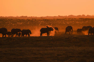
    African elephants walking through golden dust at sunset on the Linyanti floodplains in northern Botswana.13

    Linyanti

    Linyanti is one of Botswana's premier wilderness destinations, where permanent wetlands, floodplains and riverine forests support exceptional concentrations of wildlife in a remote and uncrowded setting. It is particularly renowned for elephants, African wild dogs and exclusive safari experiences.

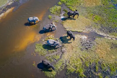
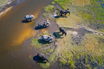
    Aerial view of African elephants crossing the Khwai River in Moremi Game Reserve, Botswana.17

    Moremi Game Reserve

    Moremi Game Reserve occupies the eastern Okavango Delta, protecting a remarkable mosaic of permanent waterways, floodplains, woodlands and savanna that supports an exceptional diversity of wildlife and birdlife.

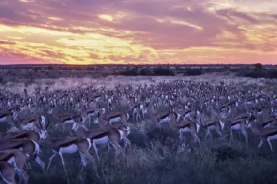
    Large herd of springbok (Antidorcas marsupialis) grazing beneath a colourful sunset in the Central Kalahari Game Reserve, Botswana.21

    Central Kalahari Game Reserve

    The Central Kalahari Game Reserve is one of Africa's largest protected wilderness areas, where vast grasslands, fossil river valleys and open pans create an extraordinary sense of space. Its remote landscapes and exceptional predator sightings make it one of Botswana's premier safari destinations.

    Explore the Full Botswana Route21 stops across Botswana

    Overview

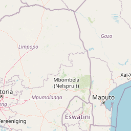
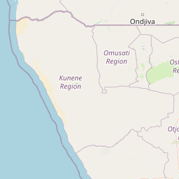
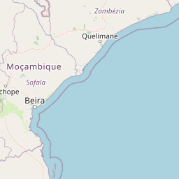
    Botswana is structured around a series of large-scale natural systems that dominate the country's geography. The Okavango Delta forms the ecological heart of northern Botswana, while surrounding regions such as Moremi Game Reserve, Chobe National Park and the Linyanti wetlands create one of Africa's most important wildlife corridors. To the south and west, the Kalahari Basin expands across immense distances, supporting desert-adapted wildlife, grasslands and remote wilderness landscapes.

    Each region possesses a distinct photographic identity. The Okavango is characterised by waterways, floodplains, islands and wildlife-rich wetlands. Chobe is known for riverfront landscapes and some of Africa's largest elephant concentrations. Makgadikgadi and Nxai Pan preserve immense salt pan environments, while the Central Kalahari represents one of the largest remaining wilderness areas on the continent. Together these ecosystems create extraordinary environmental diversity within a single country.

    The visual structure of Botswana is defined by the contrast between water and desert. Seasonal floodplains intersect with arid grasslands, isolated acacia trees punctuate open horizons and vast skies dominate much of the landscape. Wildlife frequently becomes the focal point within these environments, while changing light conditions, dust, storms and seasonal flooding continuously reshape the character of the scenery.
    Key Photography Subjects

    • Okavango Delta waterways, islands and floodplains
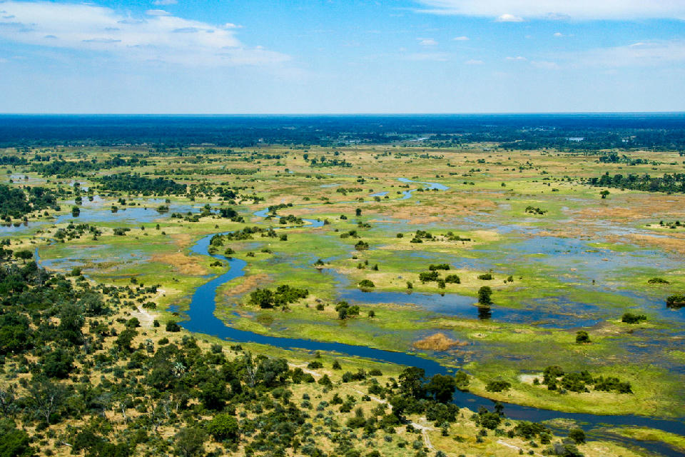
    • African wildlife and predator-prey interactions
    • Elephant herds along the Chobe River
    • Salt pans, baobabs and desert landscapes
    • Kalahari grasslands and semi-arid wilderness
    • Seasonal flood systems and wetland ecosystems
    • Dramatic skies, thunderstorms and African sunsets

    Gallery

    Workshops in Botswana