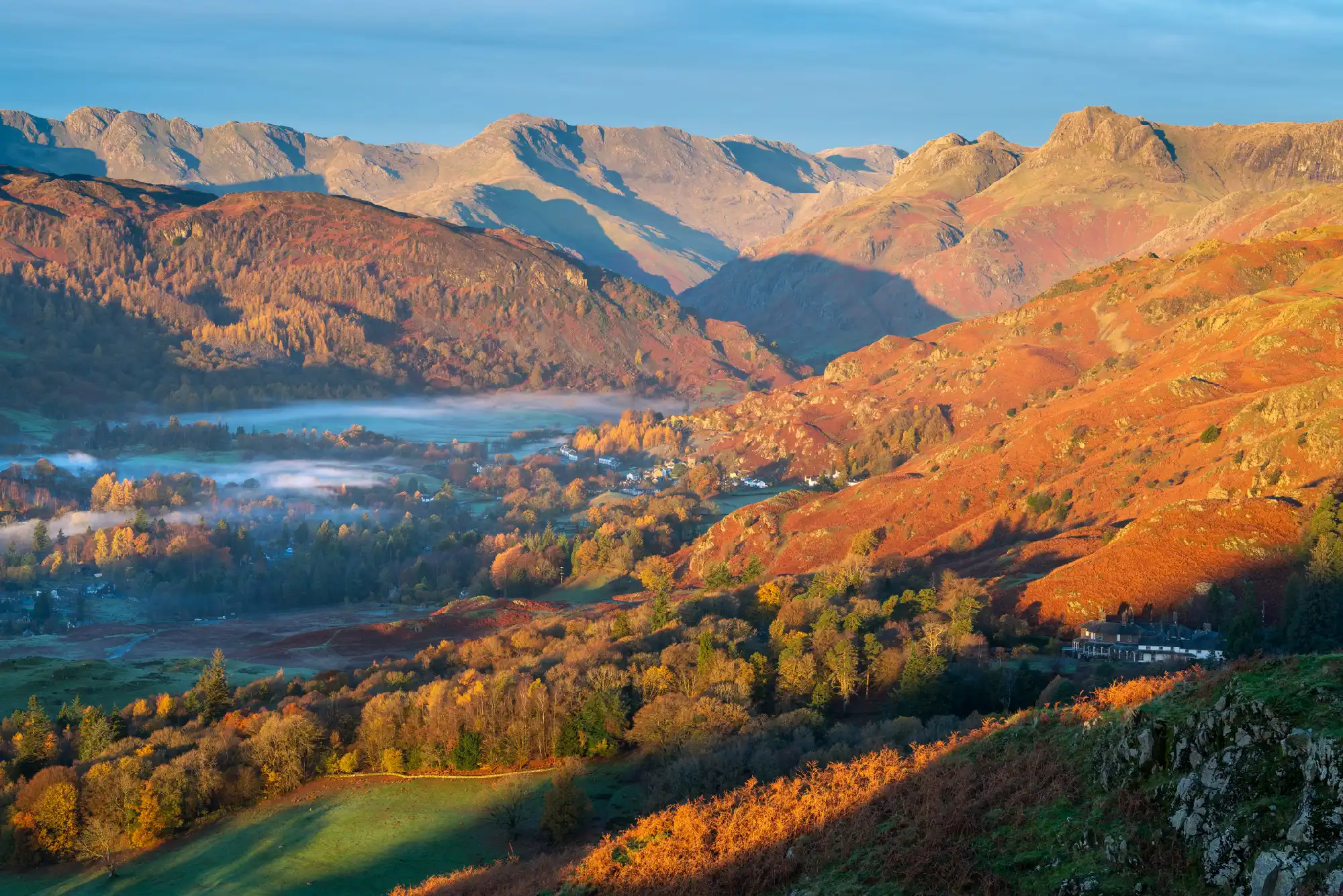
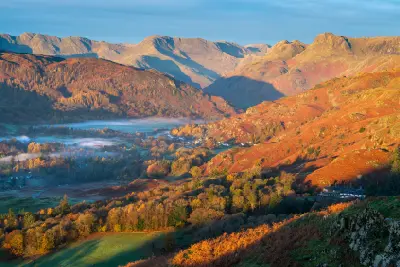
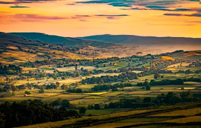
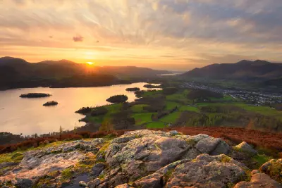
Golden autumn sunlight sweeps across the Langdale valley and surrounding fells, with morning mist lingering beneath the rugged Langdale Pikes, viewed from Loughrigg Fell in the Lake District.
Northern England forms an extensive upland and coastal landscape across the northern part of the country, defined by rugged mountains, glacial valleys, limestone hills and broad moorlands. The region includes the Lake District, Yorkshire Dales, North York Moors and Northumberland, where distinct geological formations create some of England's most varied natural landscapes. The terrain transitions between steep mountain ridges, deep lake basins, open heather moorland and rolling agricultural valleys. The Pennines form a central upland spine, while river systems cut through limestone plateaus and the eastern coastline introduces sandstone cliffs, sweeping beaches and rocky headlands. Seasonal variation influences vegetation, water levels and atmospheric conditions, creating changes in moorland colour, woodland cover and mountain visibility throughout the year.
Structured Map of Northern England
A connected view of the landscape, organised by regions, areas, and key locations.





Blea Tarn
water feature
Wastwater
water feature
Lake District — Western Lakes & Fells
area district
Honister Pass
landmark
Buttermere
water feature
Crummock Water
water feature
Catbells
landmark
Surprise View
landmark
Ashness Bridge
landmark
Derwentwater
landmark
Lake District — Central & Eastern Lakes
area district
Castlerigg Stone Circle
landmark
Aira Force
water feature
Ullswater
water feature
Lambley Viaduct
landmark
Steel Rigg & Peel Crags
landmark
Crag Lough & Highshield Crags
landmark
Housesteads Roman Fort
landmark
Hadrian’s Wall & Northumberland Interior
area district
Kielder Water & Forest
landmark
Kielder Observatory & Dark Skies
landmark
Holy Island Causeway
landmark
Lindisfarne Castle
landmark
Bamburgh Castle
landmark
Farne Islands
landmark
Northumberland Coast
area district
Embleton Bay
landmark
Dunstanburgh Castle
landmark
Staithes
landmark
Runswick Bay
landmark
Whitby Abbey
landmark
Robin Hood's Bay
landmark
North York Moors & Yorkshire Coast
area district
Roseberry Topping
landmark
Rievaulx Abbey
landmark
Aysgarth Falls
water feature
Gordale Scar
landmark
Janet's Foss
water feature
Malham Cove
landmark
Yorkshire Dales
area district
Ingleborough
landmark
Ribblehead Viaduct
landmark
Areas in Northern England
Gallery
Overview
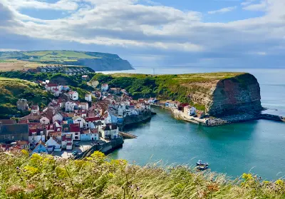
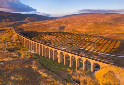
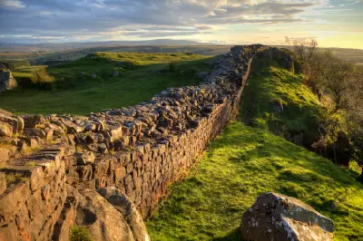
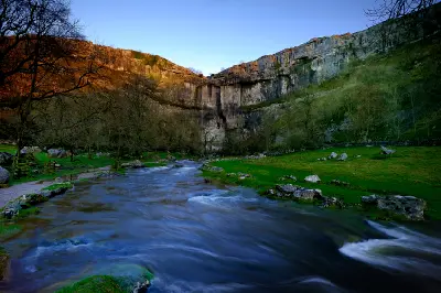
Northern England is structured around a series of upland systems extending from the Cumbrian mountains through the Pennines towards the Yorkshire moors and Northumberland hills. Glacial erosion has shaped the Lake District's deep valleys and lakes, while limestone geology produces the stepped hillsides, escarpments and river gorges characteristic of the Yorkshire Dales. Across the region, mountain landscapes give way to open moorland, enclosed agricultural valleys and extensive coastal plains. Dry-stone walls, stone villages and historic settlements form distinctive patterns across the countryside, while the Northumberland and Yorkshire coastlines introduce sandy bays, rocky headlands and exposed cliffs. The visual structure of the region is defined by contrasting elevations, repeated ridgelines and the relationship between natural terrain and rural land use. Low cloud, mist and changing directional light frequently alter the appearance of mountain slopes, lakes, moorland and coastal landscapes.
Key photography subjects
- Lake District mountains, glacial valleys and reflective lakes
- Yorkshire Dales limestone hills, valleys and dry-stone walls
- Peak District gritstone edges and open moorland landscapes
- North York Moors heather-covered hills and wooded valleys
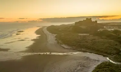
- Northumberland beaches, castles and rugged coastal headlands
- Historic stone villages, rural farms and agricultural patterns
- Mountain mist, seasonal moorland colour and atmospheric coastal light
Workshops in Northern England
No upcoming workshops scheduled for Northern England at this time.
Check back soon or explore other destinations.