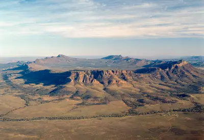
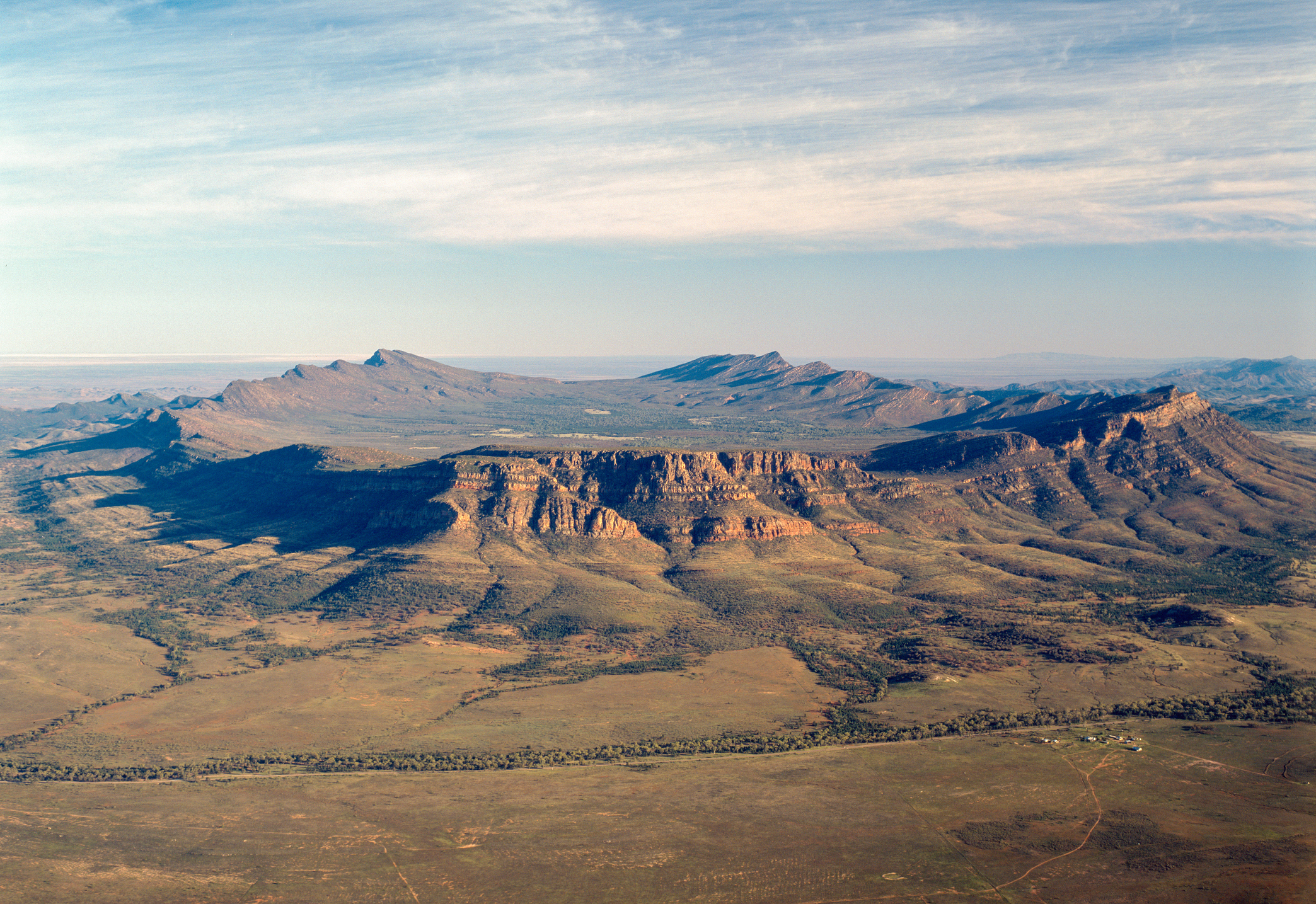
Aerial view of Wilpena Pound's sweeping mountain ridges and sandstone escarpments in the Flinders Ranges, South Australia.

    An aerial panorama of Wilpena Pound in South Australia's Flinders Ranges, revealing the vast natural amphitheatre, rugged sandstone escarpments and expansive outback landscape.

    South Australia

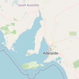
    South Australia combines ancient mountain ranges, extensive semi-arid plains and rugged Southern Ocean coastlines. The region extends from the folded sandstone ridges of the Flinders Ranges to the limestone cliffs, sheltered bays and offshore islands of the southern coast, creating a landscape of contrasting geological environments.

    The terrain transitions between rocky escarpments, dry inland valleys, open pastoral country and exposed coastal headlands. The Flinders Ranges form a prominent mountain system in the north, while Kangaroo Island and the southern coastline contain weathered rock formations, sandy beaches and coastal vegetation.

    Seasonal rainfall, dry inland conditions and changing Southern Ocean weather influence vegetation, colour and atmospheric clarity. Low-angle sunlight emphasises the structure of the ranges, while coastal winds, sea spray and shifting cloud create contrasting conditions along the southern shoreline.

    Geographic discovery

    Explore South Australia by Area

    Choose a part of South Australia to discover its landscapes, photographic character, and locations.

    Open interactive Explore

    Explore Areas in South Australia

    Open in Explore
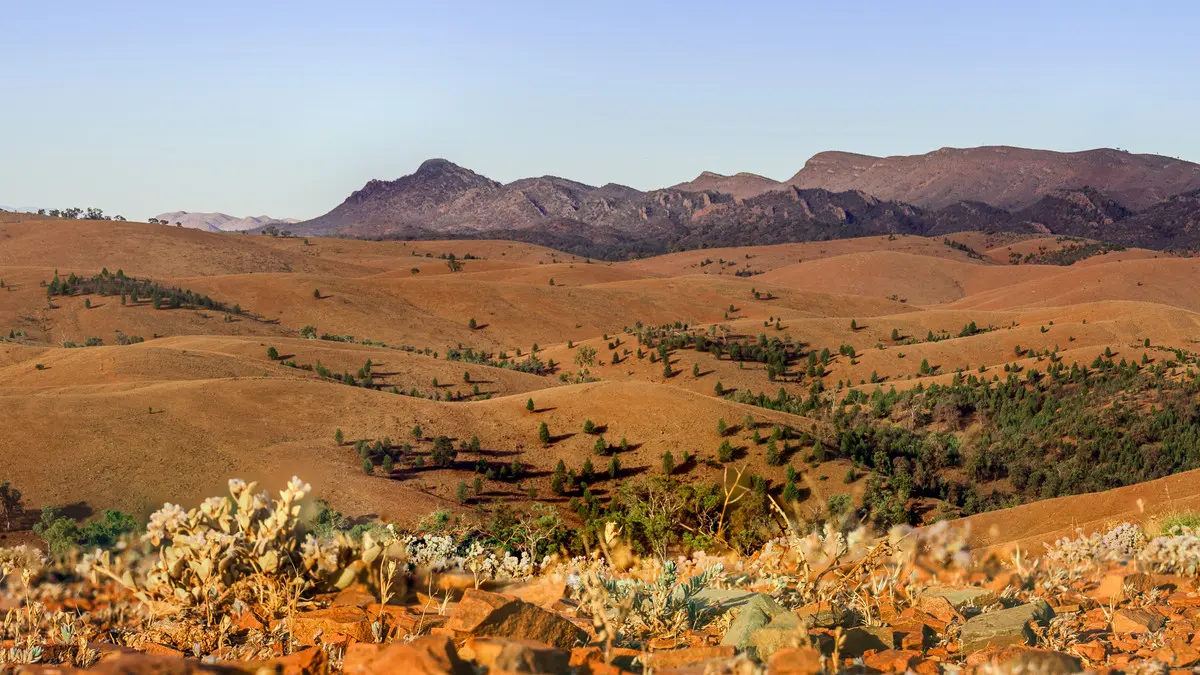
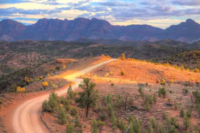
    Panoramic view of Bunyeroo Valley in the Flinders Ranges, South Australia, showing rolling ochre hills, scattered trees and rugged mountain ridges beneath a clear sky.

    Flinders Ranges

    The Flinders Ranges are structured around a series of ancient sedimentary rock formations that have been folded, uplifted and eroded into parallel ridges and broad valleys. Wilpena Pound forms a prominent natural amphitheatre enclosed by steep mountain walls, while surrounding ranges extend across the semi-arid interior of South Australia. Across the region, resistant rock layers create distinctive ridgelines, escarpments and deeply incised gorges. Brachina Gorge exposes ancient geological sequences, while the landscapes around Moralana Scenic Drive and Razorback Lookout reveal the relationship between folded mountain structures and the open valleys separating them. The visual structure of the region is defined by repeating ridges, exposed rock layers and expansive valley floors. Elevated viewpoints emphasise the geometry of the folded terrain, while low-angle sunlight reveals geological textures and creates strong contrasts between illuminated slopes and shaded gorges.

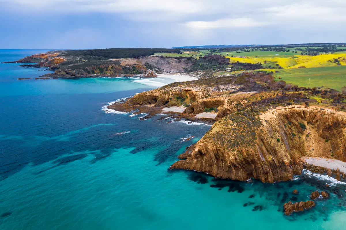
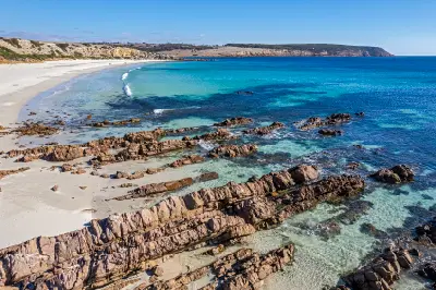
    Aerial panorama of King George Beach on Kangaroo Island, South Australia, showing rocky coastal headlands, turquoise ocean water, sandy coves and green farmland inland.

    Kangaroo Island

    Kangaroo Island lies off South Australia's Fleurieu Peninsula, where its southern and western coastlines face the full force of the Southern Ocean. Flinders Chase National Park protects some of the island's most dramatic scenery, including the weathered granite formations of Remarkable Rocks and the natural rock arch at Admirals Arch. Elsewhere, limestone cliffs, white beaches, coastal dunes and sheltered bays create a varied landscape across the island. Photographically, Kangaroo Island combines monumental coastal geology with accessible wildlife and relatively undeveloped scenery. Remarkable Rocks provides extraordinary sculptural foregrounds against the ocean, while Admirals Arch frames crashing surf and a colony of long-nosed fur seals. Seal Bay offers opportunities to photograph Australian sea lions in their natural habitat, while beaches, headlands and coastal heath extend the island's photographic appeal beyond its best-known landmarks.

    Photographic journey

    South Australia Photography Route

    South Australia Route · 12 stops

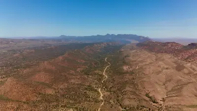
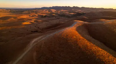
    Aerial view of Brachina Gorge showing a winding dirt road through rocky outback valleys in the Flinders Ranges, South Australia.01

    Brachina Gorge

    Brachina Gorge is a rugged sandstone and quartzite gorge within Ikara-Flinders Ranges National Park, South Australia, where an unsealed scenic road passes through ancient folded rock formations. The gorge exposes geological layers spanning hundreds of millions of years, with steep escarpments, dry creek beds and river red gums lining the valley. The colourful rock strata, weathered cliffs and distinctive outback landscape provide opportunities for geological, landscape and nature photography.

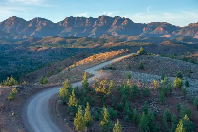
    Winding dirt road along a rocky ridge at Razorback Lookout, with sunlit native trees and rugged Flinders Ranges peaks in the background, South Australia.02

    Razorback Lookout

    Razorback Lookout is an elevated roadside viewpoint along Bunyeroo Gorge Road in the Flinders Ranges, South Australia, overlooking the folded ridgelines of Bunyeroo Valley. The lookout provides expansive views across parallel sandstone ranges, dry creek systems and rugged outback terrain, with the winding road visible through the valley below. The layered mountain formations, sweeping valley and changing light across the ridges provide opportunities for landscape, geological and panoramic photography.

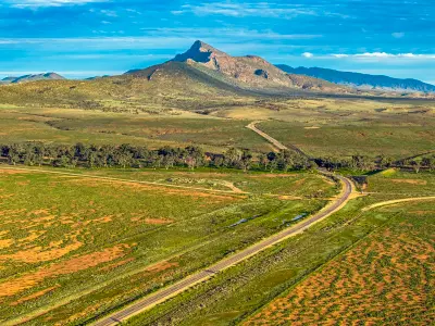
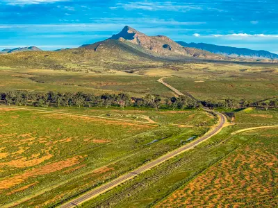
    Aerial landscape of Mount Aleck and the green Flinders Ranges plains, with winding roads and tree-lined Moralana Creek near Moralana Scenic Drive, South Australia.05

    Moralana Scenic Drive

    Moralana Scenic Drive is an unsealed scenic route through the southern Flinders Ranges, South Australia, passing between the Elder Range and the western slopes of Wilpena Pound. The road crosses open pastoral country, dry creek beds and gently undulating terrain, with rugged mountain ridges rising on either side. The winding outback road, layered escarpments and expansive valley landscapes provide opportunities for landscape, geological and panoramic photography.

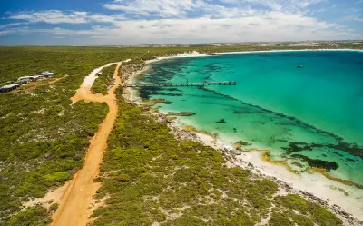
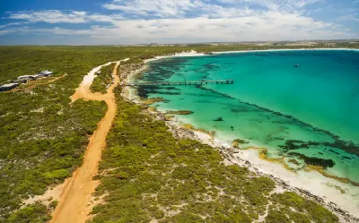
    Aerial view of Vivonne Bay jetty, turquoise ocean water, white sandy beach and coastal access road on Kangaroo Island, South Australia.08

    Vivonne Bay

    Vivonne Bay is a broad, crescent-shaped sandy bay on the southern coast of Kangaroo Island, South Australia, bordered by coastal dunes, low vegetation and the turquoise waters of the Southern Ocean. A long white-sand beach, rocky headlands and a small jetty provide varied coastal viewpoints, with the sheltered Harriet River estuary nearby. The sweeping shoreline, clear water and contrasting coastal formations provide opportunities for landscape, aerial and coastal photography.

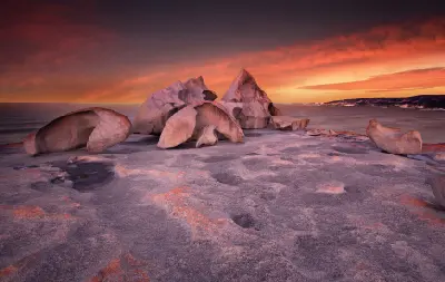
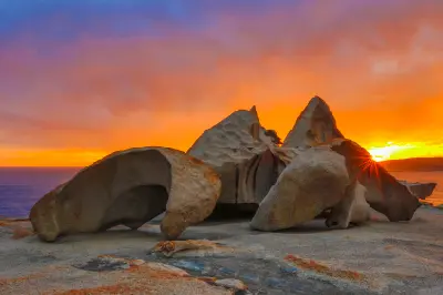
    Remarkable Rocks' sculpted granite boulders overlooking the Southern Ocean at sunset, with pink-lit rock surfaces and a glowing orange sky on Kangaroo Island, South Australia.10

    Remarkable Rocks

    Remarkable Rocks is a group of large, weathered granite boulders perched on a coastal headland within Flinders Chase National Park on Kangaroo Island, South Australia. Erosion has shaped the rocks into unusual arches, overhangs and sculptural forms, with orange lichen covering many of their surfaces above the Southern Ocean. The distinctive granite formations, coastal setting and contrasting rock textures provide opportunities for landscape, geological and abstract photography.

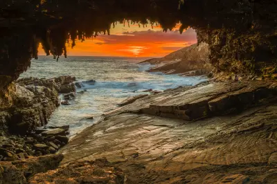
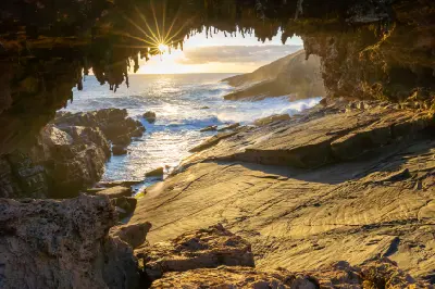
    Orange sunset over the Southern Ocean framed by Admirals Arch, showing hanging limestone formations and waves breaking against the rocky Kangaroo Island coastline.12

    Admirals Arch

    Admirals Arch is a naturally eroded rock arch at Cape du Couedic in Flinders Chase National Park on Kangaroo Island, South Australia. The arch frames the Southern Ocean through a weathered limestone opening, with a boardwalk descending towards the formation and a colony of long-nosed fur seals occupying the surrounding rocks. The sculptural arch, rugged coastline and resident seals provide opportunities for coastal landscape, wildlife and geological photography.

    Explore the Full South Australia Route12 stops across South Australia

    Overview

    South Australia is structured around a transition from ancient folded mountain systems and arid interior basins to low coastal plains and the Southern Ocean. The Flinders Ranges rise from surrounding semi-arid country as a series of parallel ridges, broad valleys and eroded escarpments, with Wilpena Pound forming one of the region's most recognisable geological features.

    Farther south, the landscape changes towards coastal plains, limestone cliffs and exposed ocean environments. Kangaroo Island contains rugged headlands, sheltered beaches and sculpted granite formations, while the mainland coast includes broad bays, rocky shorelines and extensive stretches of dune and coastal vegetation.

    The visual structure of the region is defined by contrasts between inland relief and open coastal landscapes. Elevated viewpoints reveal layered ridges and immense dry valleys, while the southern coastline introduces cliffs, offshore rocks and breaking surf. Seasonal vegetation, atmospheric haze and directional light create distinct photographic conditions across both environments.
    Key Photography Subjects

    • Flinders Ranges ridges and ancient folded landscapes
    • Wilpena Pound and broad semi-arid mountain valleys
    • Brachina Gorge and exposed geological formations
    • Razorback Lookout and layered sandstone escarpments
    • Kangaroo Island granite formations and coastal headlands
    • Remarkable Rocks, Admirals Arch and Southern Ocean cliffs
    • Seasonal inland colour, coastal weather and low-angle light

    Gallery

    Workshops in South Australia

    No upcoming workshops scheduled for South Australia at this time.

    Check back soon or explore other destinations.