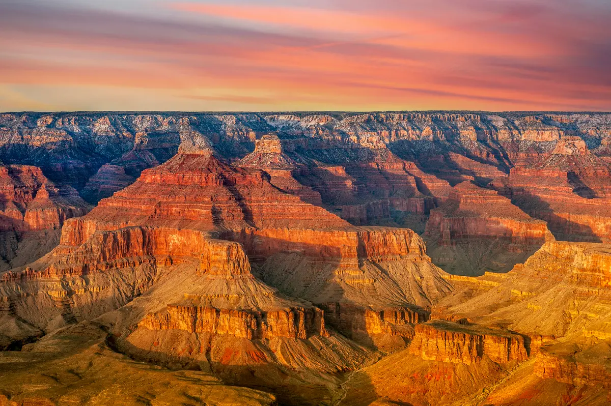
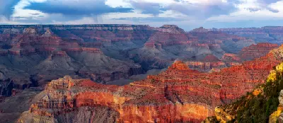
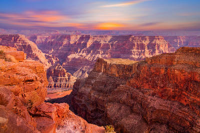
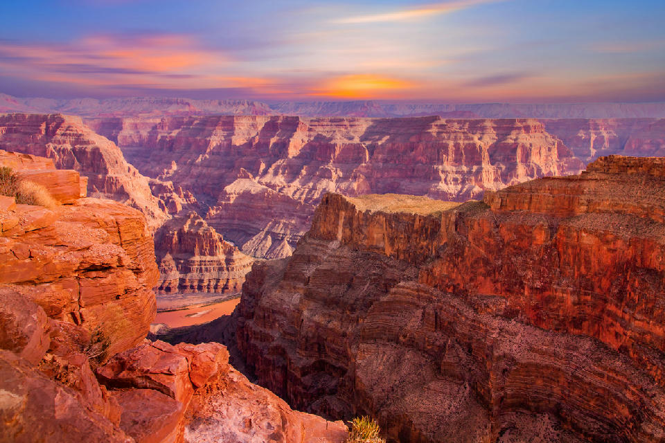
Grand Canyon layered canyon walls at sunset with Colorado River below, Arizona, USA

    Grand Canyon (South Rim) at sunset, showing layered rock formations and the Colorado River below

    Arizona

    Arizona is a desert and plateau landscape in the southwestern United States defined by canyon systems, sandstone formations, and elevated plateaus shaped by erosion and geological uplift. The state is structured across distinct terrain systems, where open desert basins, carved canyon networks, and rock formations create varied but interconnected landscapes. Its spatial identity is defined by contrast between horizontal expanses and deeply incised terrain.

    The terrain transitions between desert plains, sandstone buttes, canyon systems, and elevated plateau regions. Elevation varies across the state, with higher plateaus supporting forested terrain and lower basins forming open desert environments.

    Seasonal conditions influence visibility, atmospheric clarity, and surface contrast. Light plays a defining role across the landscape, shaping depth, shadow, and separation between rock formations and distant terrain.

    Geographic discovery

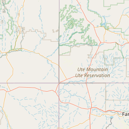
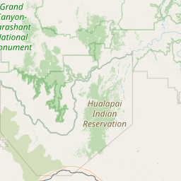
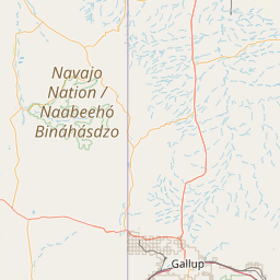
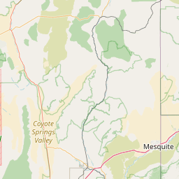
    Explore Arizona by Area

    Choose a part of Arizona to discover its landscapes, photographic character, and locations.

    Open interactive Explore

    Explore Areas in Arizona

    Open in Explore
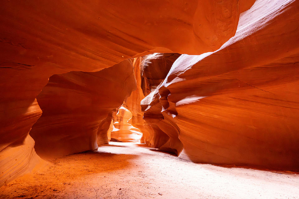
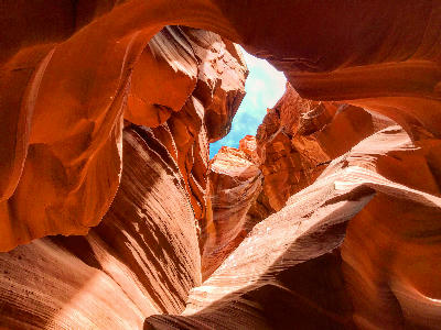
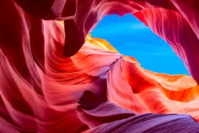
    Sandstone corridor inside Antelope Canyon with smooth curved walls and soft reflected light

    Antelope Canyon

    Antelope Canyon is structured as a series of narrow passageways carved along natural fracture lines in the sandstone. The system is divided into sections such as Upper and Lower Antelope Canyon, each with variations in width, depth, and light behaviour. Unlike open desert or canyon rim landscapes, the environment operates entirely within enclosed space. Compositions are built from within the canyon, where walls, curves, and light form the complete frame. The visual structure is defined by flow and vertical enclosure. Curved surfaces guide the eye through the space, while light entering from above creates separation, depth, and emphasis across the rock forms.

    Grand Canyon South Rim at sunset showing layered mesas and buttes with warm light across the canyon landscape

    Grand Canyon South Rim

    The South Rim is structured as a continuous edge along the canyon system, where viewpoints are positioned above deeply incised terrain. The Colorado River and its tributaries have carved through the plateau, exposing horizontal rock layers that step downward into the canyon. Unlike subject-based landscapes, the South Rim operates across scale. There is no single focal point — compositions extend across multiple layers of terrain, often spanning large distances within a single frame. The visual structure is defined by horizontal layering and vertical drop. Foreground rim edges frame the composition, while successive canyon walls recede into the distance, creating depth through repetition and atmospheric separation.

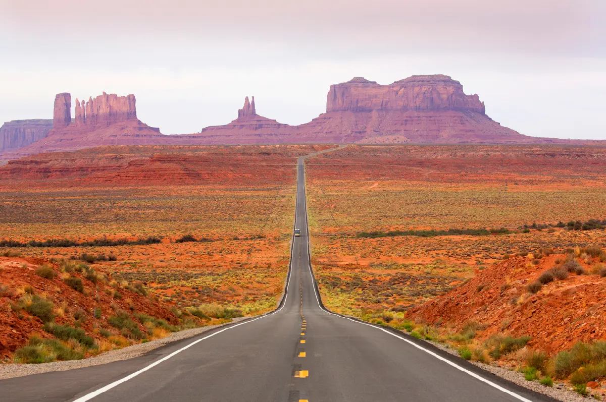
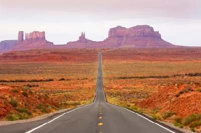
    Straight highway leading toward sandstone buttes across Monument Valley in the Southwest United States.

    Monument Valley

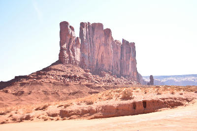
    Monument Valley is structured as a dispersed field of large rock formations positioned across open terrain. Buttes and mesas are separated by significant horizontal distance, allowing each structure to function as an individual subject within the landscape. Unlike canyon or mountain systems, there is no enclosure and minimal layering. The landscape operates through spacing, where formations are isolated against open sky and distant horizon lines. The visual structure is defined by subject isolation and scale. Compositions are built around a single dominant form, supported by simple foregrounds and distant secondary elements.

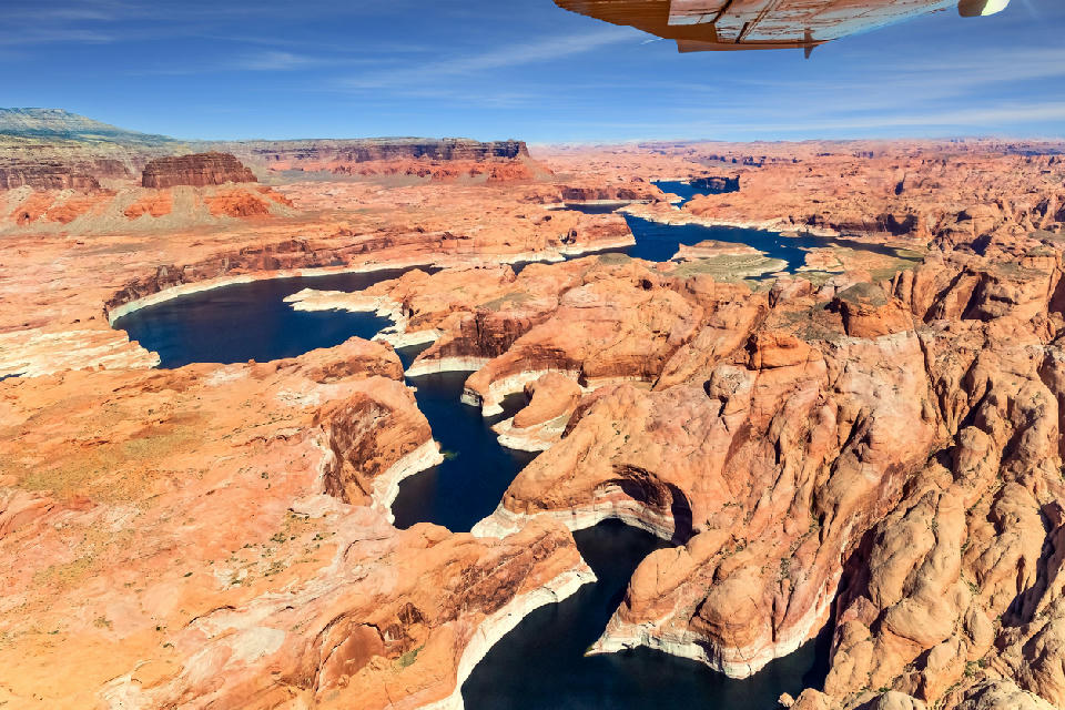
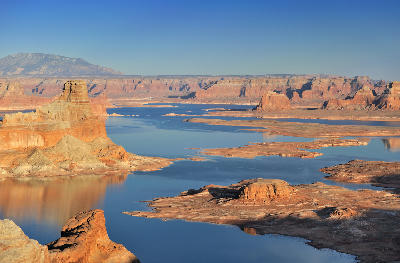
    Aerial view Lake Powell canyon system low water levels exposed sandstone reservoir Page Arizona Colorado River

    Page & Colorado River

    This region is structured around the Colorado River as it winds through sandstone terrain, forming a sequence of bends, slot canyons, and elevated viewpoints. Erosion has shaped both large-scale curves and narrow canyon passages, producing distinct but connected landscape features. Unlike the Grand Canyon’s vast scale, this system operates at a more focused level. Compositions are built around specific formations — river bends, canyon walls, and confined spaces — rather than expansive depth. The visual structure is defined by curvature and flow. The river acts as a central compositional element, guiding the eye through the landscape while surrounding rock formations frame the scene.

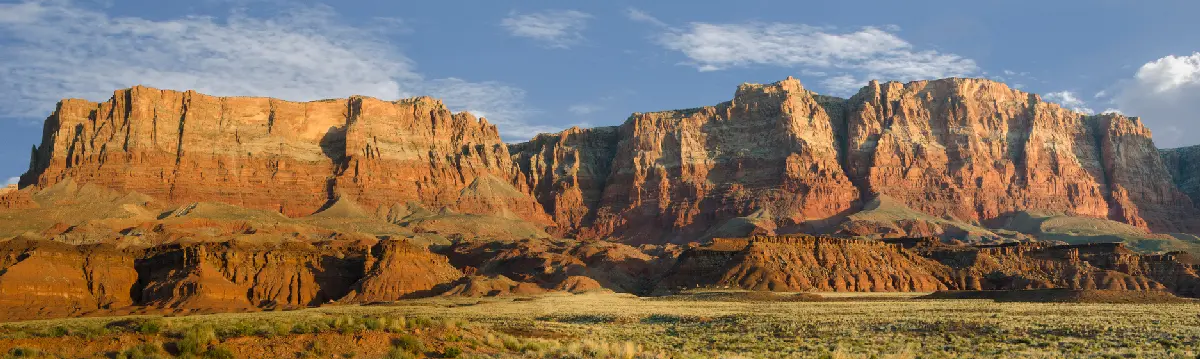
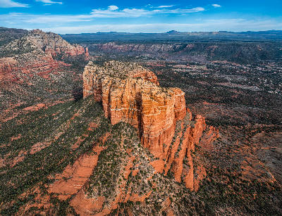
    Layered red sandstone cliffs of Vermilion Cliffs above desert landscape in northern Arizona

    Vermilion Cliffs & Paria Plateau

    This region is structured as a continuous sandstone landscape where erosion has shaped surfaces into flowing forms rather than isolated formations or canyon systems. The terrain is expansive and relatively open, with few dominant vertical features. Unlike Monument Valley or the Grand Canyon, compositions are not built around scale or subject separation. Instead, the landscape operates at a finer visual level, where patterns, textures, and surface geometry define the scene. The visual structure is defined by abstraction. Rock surfaces form continuous patterns across the terrain, allowing compositions to focus on detail, flow, and repetition rather than traditional foreground-background relationships.

    Photographic journey

    Arizona Photography Route

    Arizona Photography Route · 22 stops

    Grand Canyon stratified cliffs sunset South Rim Arizona01

    Grand Canyon South Rim Viewpoints

    Grand Canyon South Rim Viewpoints represent the continuous canyon-edge views accessible along the South Rim, where multiple overlooks provide similar wide perspectives across the layered canyon system. The composition resolves through depth, scale, and the alignment of ridgelines across the landscape.

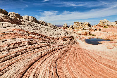
    Swirling sandstone layers at White Pocket in Vermilion Cliffs National Monument, Northern Arizona, with smooth white and red rock formations and a small desert pool.05

    White Pocket

    White Pocket is a compact sandstone formation area within the Vermilion Cliffs region, defined by smooth, pale rock surfaces and tightly folded patterns. The subject is characterised by flowing textures, shallow bowls, and continuous sculpted forms rather than a single dominant feature.

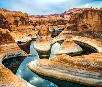
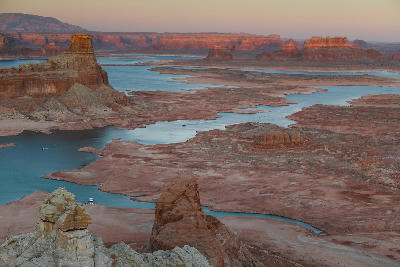
    Reflection Canyon Lake Powell sandstone towers curved basin low water levels Glen Canyon Arizona09

    Reflection Canyon

    Reflection Canyon is a remote side canyon of Lake Powell where narrow water channels curve through steep sandstone walls. The canyon forms a series of bends and inlets with elevated viewpoints looking down into the water below. The composition resolves through elevation, curvature, and the relationship between water and canyon walls.

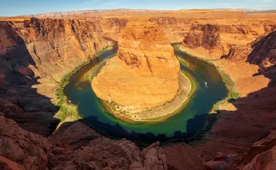
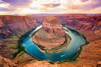
    Horseshoe Bend Colorado River midday light full curve sandstone cliffs Page Arizona aerial rim view14

    Horseshoe Bend

    Horseshoe Bend is a tight river meander where the Colorado River curves sharply around a rock formation, creating a near-complete loop. The viewpoint sits above the river with a direct downward perspective into the bend. The composition resolves through the curve of the river and the surrounding canyon walls.

    Canyon X in Page, Arizona showing upward view of narrow slot canyon with flowing sandstone walls and a small opening to blue sky above.18

    Canyon X

    Canyon X is a slot canyon near Page with narrower passages and fewer visitors than the main Antelope Canyon sections. The canyon features smooth sandstone walls with light entering from above, creating controlled illumination across the surfaces. The composition resolves through the interaction between light and the canyon walls within a quieter setting.

    West Mitten Butte in Monument Valley showing a tall isolated sandstone formation rising from a flat desert plain in Utah Arizona.22

    Monument Valley Navajo Tribal Park Scenic Drive

    The Monument Valley Scenic Drive is a loop route through the valley floor, providing access to multiple viewing locations across the butte landscape. Along the route, a series of stops and pull-offs offer similar compositions of isolated sandstone formations rising from open desert terrain. The composition resolves through scale, spacing, and the alignment of buttes across the landscape.

    Explore the Full Arizona Route22 stops across Arizona

    Overview

    Arizona is structured around a combination of plateau landscapes and erosion-driven canyon systems. The Colorado Plateau dominates the northern portion of the state, where river systems have carved deep canyon networks into layered rock.

    Desert basins and sandstone formations define much of the central and southern regions, where terrain opens into broader, less confined environments. Rock structures such as buttes, mesas, and arches are distributed across the landscape, forming distinct compositional subjects.

    The visual structure is defined by the relationship between open terrain and carved depth. Large-scale formations and canyon systems create compositions built on scale, separation, and geological layering.
    Key Photography Subjects

    • Canyon systems carved into layered plateau terrain
    • Sandstone buttes rising from open desert plains
    • Horizontal rock layers extending across wide landscapes
    • Isolated formations within expansive terrain
    • River corridors cutting through canyon systems
    • Elevated plateaus overlooking deep terrain
    • Light defining depth across rock and desert surfaces

    Gallery

    Workshops in Arizona

    No upcoming workshops scheduled for Arizona at this time.

    Check back soon or explore other destinations.