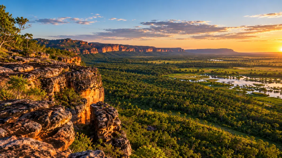
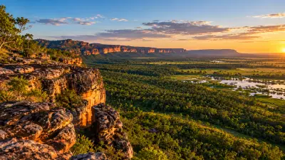
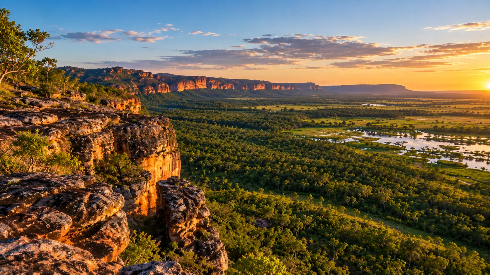
AI-generated panoramic landscape inspired by Kakadu National Park, showing golden sandstone cliffs, dense green woodland and reflective wetlands beneath a warm sunset sky in Australia's Northern Territory.

    AI-generated landscape of Kakadu National Park, depicting sunlit sandstone escarpments overlooking expansive tropical woodland and seasonal floodplain wetlands at sunset. This illustrative landscape is not a photograph of a verified location.

    Top End

    The Top End forms the tropical northern interior of Australia's Northern Territory, defined by extensive wetlands, ancient sandstone escarpments and monsoonal savanna. The region includes Kakadu and Litchfield National Parks, where broad floodplains, rugged plateaus and seasonal river systems create some of northern Australia's most distinctive landscapes.

    The terrain transitions between open savanna woodland, sandstone ranges, freshwater wetlands and deeply incised gorges. Around Kakadu, immense floodplains extend beneath rocky escarpments, while Litchfield combines elevated sandstone country with waterfalls, plunge pools and tropical vegetation.

    Seasonal monsoon rainfall transforms the landscape throughout the year, flooding wetlands, replenishing waterfalls and changing vegetation colour. The contrast between wet-season water and dry-season clarity produces strong variations in landscape texture, atmospheric conditions and light.

    Geographic discovery

    Explore Top End by Area

    Choose a part of Top End to discover its landscapes, photographic character, and locations.

    Open interactive Explore

    Explore Areas in Top End

    Open in Explore
    AI-generated panoramic landscape inspired by Kakadu National Park, showing golden sandstone cliffs, dense green woodland and reflective wetlands beneath a warm sunset sky in Australia's Northern Territory.

    Kakadu

    Kakadu is structured around the ancient Arnhem Land sandstone plateau and the extensive floodplains extending westwards towards the coast. Steep escarpments separate elevated rocky terrain from lowland wetlands, while seasonal rivers and drainage systems create a network of billabongs, channels and freshwater habitats. Ubirr and Burrungkuy occupy prominent sandstone formations along the escarpment margins, where ancient Aboriginal rock art is preserved within sheltered rock surfaces. Farther across the floodplains, Yellow Water Billabong and Mamukala support extensive wetland vegetation and wildlife, while Jim Jim Falls descends from the sandstone plateau into a deep gorge. The visual structure of the region is defined by the contrast between monumental sandstone relief and expansive tropical wetlands. Elevated viewpoints reveal layered escarpments and floodplains, while billabongs provide reflections, aquatic vegetation and wildlife. Seasonal flooding, waterfalls and changing monsoon light continually alter the landscape's appearance.

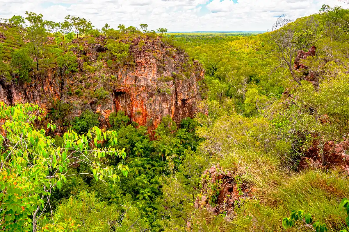
    Red sandstone cliffs overlooking a densely forested gorge in Litchfield National Park, Northern Territory, Australia.

    Litchfield

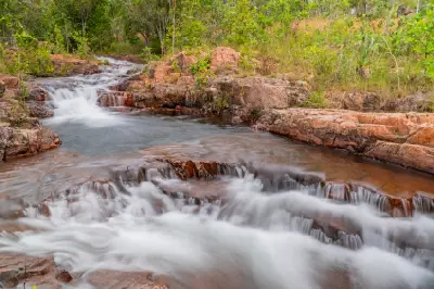
    Litchfield is structured around the sandstone plateau of the Tabletop Range, where seasonal streams have carved gorges and valleys into the surrounding escarpments. Water flowing from the elevated terrain creates a network of waterfalls, rocky channels and permanent pools, with pockets of monsoon forest occupying the wetter sheltered areas. Florence Falls and Wangi Falls descend into deep plunge pools surrounded by dense tropical vegetation, while Buley Rockhole forms a series of smaller cascades and natural pools. Tolmer Falls drops into a steep sandstone gorge, contrasting with the open savanna and distinctive magnetic termite mounds found across the lower plains. The visual structure of the region is defined by the contrast between flowing water, warm sandstone and dense green vegetation. Waterfalls provide strong vertical compositions, while rocky pools and forested streams create more enclosed landscapes. Open woodland, termite mounds and changing seasonal light introduce additional patterns and textures.

    Photographic journey

    Top End Photography Route

    Top End Route · 12 stops

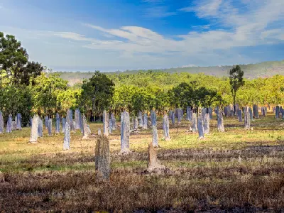
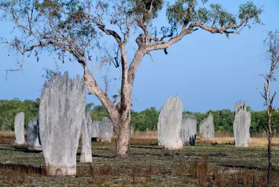
    Wide field of tall, narrow magnetic termite mounds among golden grasses and eucalyptus woodland beneath a blue sky in Australia's Northern Territory.01

    Magnetic Termite Mounds

    Magnetic Termite Mounds are distinctive, blade-shaped termite structures found in the seasonally flooded grasslands of Litchfield National Park, Northern Territory. Built by termites, the tall, narrow mounds are aligned approximately north–south, helping regulate internal temperatures by controlling exposure to the sun. Their unusual geometry, repeating forms and open tropical grassland setting provide opportunities for landscape, nature and abstract photography.

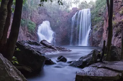
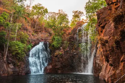
    Atmospheric early morning view of the twin waterfalls at Florence Falls, framed by dark rocks and tropical trees, with silky flowing water entering the plunge pool in Litchfield National Park, Northern Territory, Australia.02

    Florence Falls

    Florence Falls is a twin waterfall in Litchfield National Park, Northern Territory, where water cascades over a sandstone escarpment into a deep plunge pool surrounded by monsoon rainforest. An elevated lookout provides views of both waterfalls, while a stepped walking track descends to the pool and surrounding rock formations. The paired cascades, dark sandstone walls and dense tropical vegetation provide opportunities for waterfall, landscape and long-exposure photography.

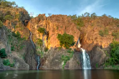
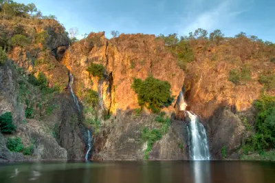
    Twin waterfalls descending sunlit rocky cliffs into a calm plunge pool at Wangi Falls in Litchfield National Park, Northern Territory, Australia.05

    Wangi Falls

    Wangi Falls is a twin waterfall in Litchfield National Park, Northern Territory, where water descends over a sandstone escarpment into a large rainforest-fringed plunge pool. A short walking path leads from the visitor area to the pool, while a longer circuit climbs through monsoon forest above the falls. The paired cascades, dark rock walls and surrounding tropical vegetation provide opportunities for waterfall, landscape and nature photography.

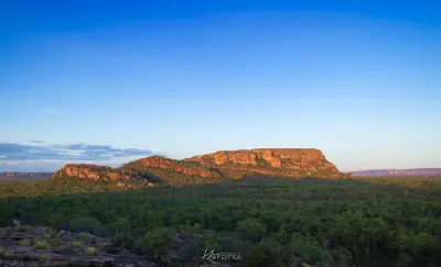
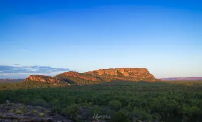
    Golden sandstone cliffs rising above dense green woodland beneath a blue evening sky in Kakadu National Park, Northern Territory, Australia.08

    Burrungkuy (Nourlangie)

    Burrungkuy (Nourlangie) is a sandstone outcrop and Aboriginal rock art site in Kakadu National Park, Northern Territory. Walking tracks lead past rock shelters and galleries containing Aboriginal paintings, with elevated viewpoints overlooking the surrounding woodland and Arnhem Land escarpment. The ancient rock art, layered sandstone formations and broad escarpment views provide opportunities for cultural, documentary and landscape photography.

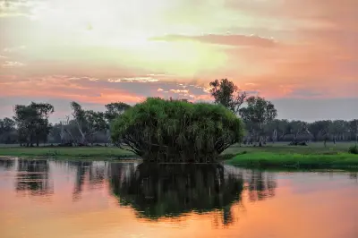
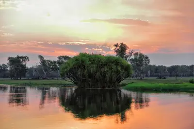
    Pandanus vegetation reflected in the calm waters of Yellow Water Billabong at sunset, with pink and orange clouds above the wetlands of Kakadu National Park, Northern Territory, Australia.10

    Yellow Water Billabong

    Yellow Water Billabong, also known as Ngurrungurrudjba, is a freshwater wetland within the South Alligator River floodplain in Kakadu National Park, Northern Territory. The billabong contains open water, paperbark woodland, aquatic vegetation and extensive bird habitat, with boat cruises providing access to its waterways and wildlife. The reflective wetlands, abundant birdlife, crocodiles and seasonal floodplain landscapes provide opportunities for wildlife, landscape and nature photography.

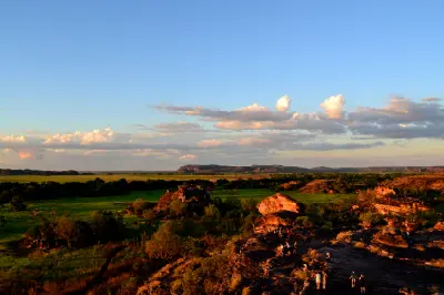
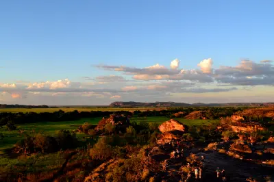
    Visitors standing on sandstone outcrops at Ubirr overlooking green floodplains and distant escarpments in Kakadu National Park, Northern Territory, Australia.12

    Ubirr

    Ubirr is a sandstone outcrop and Aboriginal rock art site in Kakadu National Park, overlooking the Nadab floodplain in Australia's Northern Territory. Walking tracks lead past ancient rock art galleries and weathered sandstone shelters to an elevated lookout with broad views across wetlands, escarpments and distant floodplains. The rock formations, cultural heritage and expansive landscape provide opportunities for documentary, landscape and sunset photography.

    Explore the Full Top End Route12 stops across Top End

    Overview

    The Top End is structured around ancient sandstone plateaus and extensive lowland floodplains shaped by tropical monsoon systems. In Kakadu, the Arnhem Land Escarpment rises above broad wetlands and river corridors, creating a distinct boundary between elevated sandstone country and the seasonally flooded plains below.

    Across Kakadu, Yellow Water Billabong and the surrounding wetlands support extensive aquatic vegetation and wildlife, while Ubirr and Nourlangie occupy rocky escarpment landscapes overlooking the plains. Farther west, Litchfield National Park contains sandstone plateaus, waterfalls and sheltered plunge pools, with termite mounds forming distinctive patterns across the surrounding savanna.

    The visual structure of the region is defined by contrasts between horizontal wetlands, vertical escarpments and flowing water. Seasonal flooding creates broad reflective surfaces, while waterfalls, weathered sandstone and tropical vegetation introduce stronger relief and texture. Changing monsoon cloud and low-angle sunlight further emphasise the scale of the landscape.
    Key Photography Subjects

    • Kakadu wetlands, billabongs and seasonal floodplains
    • Arnhem Land Escarpment and ancient sandstone formations
    • Ubirr and Nourlangie rock landscapes
    • Yellow Water Billabong, reflections and wetland wildlife
    • Litchfield waterfalls, plunge pools and tropical gorges
    • Magnetic termite mounds and open savanna woodland
    • Monsoon clouds, seasonal flooding and atmospheric light

    Gallery

    Workshops in Top End

    No upcoming workshops scheduled for Top End at this time.

    Check back soon or explore other destinations.